Pasir Mas District
| Pasir Mas District | ||
|---|---|---|
|
| ||
| Jajahan Pasir Mas | ||
| Other transcription(s) | ||
| • Jawi | ڤاسير مس | |
| ||
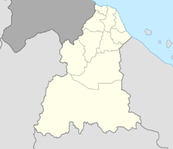 Pasir Mas District Location of Pasir Mas District in Kelantan  Pasir Mas District Pasir Mas District (Malaysia) | ||
| Coordinates: 6°2′N 102°8′E / 6.033°N 102.133°ECoordinates: 6°2′N 102°8′E / 6.033°N 102.133°E | ||
| Country |
| |
| State |
| |
| Seat | Pasir Mas | |
| Local area government(s) | Pasir Mas District Council | |
| Government | ||
| • District officer | Mohamed Nor Husin[1] | |
| Area[2] | ||
| • Total | 614.15 km2 (237.12 sq mi) | |
| Population (2010)[3] | ||
| • Total | 185,741 | |
| • Density | 300/km2 (780/sq mi) | |
| Time zone | UTC+8 (MST) | |
| • Summer (DST) | UTC+8 (Not observed) | |
| Postcode | 17xxx | |
| Calling code | +6-09 | |
| Vehicle registration plates | D | |

Pasir Mas District is a district (jajahan) in Kelantan, Malaysia. The district covers an area of 614.15 square kilometers and is bordered by the districts of Tumpat District to the north, Tanah Merah District to the south, Kota Bharu District to the east, and the Thai district of Su-ngai Kolok (Malay: Sungai Golok) to the west.[2]
Due to its geographical location, it acts as the main gateway of the East Coast of Malaysia to Thailand and is also traversed by major road transport routes from the West Coast to the state capital of Kota Bharu.
The district of Pasir Mas was originally part of the district of Kota Bharu. In 1918, the town of Pasir Mas and its surrounding areas were separated from Kota Bharu and granted its own local government.
Population
Pasir Mas as of 2010 Census, it has a population of 185,741 people.[3]
Ranking Population of Jajahan Pasir Mas.[4]
| Rank | Daerah | Population 2000 |
|---|---|---|
| 1 | Rantau Panjang | 23,714 |
| 2 | Kubang Gadong | 22,931 |
| 3 | Pasir Mas | 21,681 |
| 4 | Kangkong | 16,488 |
| 5 | Gual Periok | 15,326 |
| 6 | Bunut Susu | 15,008 |
| 7 | Kubang Sepat | 14,484 |
| 8 | Chetok | 12,576 |
| 9 | Lemal | 10,753 |
| 10 | Alor Pasir | 9,351 |
Transportation
Rail
A railway station operated by Keretapi Tanah Melayu (KTM) is located here. The station is part of KTM Intercity's Rantau Panjang Line and interchanges with the East Coast Line which ends at the Tumpat railway station.
The nightly Ekspres Timuran from Johor Bahru usually reaches here at around 9:00 am. Ekspres Wau departs at 6:30 pm for the 13-hour journey to KL Sentral, Kuala Lumpur. The Rantau Panjang Line continues towards north at Rantau Panjang railway station at the border town of Rantau Panjang and links to the Southern Line of the State Railway of Thailand.
A new railway station which replaced the original one at the same location was completed in July 2008. The reasonable fare attracts small-traders, who would board here with various goods - usually foodstuff from Rantau Panjang - to transport to the interiors. The trains' scheduled arrivals and departures often create traffic jams in the town several times daily. A carriageway connecting Lemal and Kubang Panjang over the railway track has been built to overcome this. Trains no longer stop at the hamlet station of Tok Uban along the way to Tanah Merah.
As of now, all trains service in and out of Pasir Mas had been stopped due to damaged done on the railway by the big flood in December 2014.
Bus
From Pasir Mas town, it is possible to go to any state capital in Peninsular Malaysia without having to change buses. However, buses departing from these state capitals with Kota Bharu as the final destination might not pass through Pasir Mas. But those with Rantau Panjang as the final destination, will.
The most popular inter-state bus company is Transnasional, which is majority-owned by a federal government agency. Syarikat Kenderaan Melayu Kelantan (SKMK) has a monopoly of inter-district and intra-district bus routes. There are direct buses to the main towns of Kota Bharu, Rantau Panjang and Tanah Merah and vice versa; which depart every 30 minutes from 7:00 am to 6:30 pm. The bus station is at the centre of the town; about 100 metres from the train station.
References
- ↑ "Laman Web Rasmi - Pejabat Tanah Dan Jajahan Pasir Mas - Perutusan Ketua Jajahan". www.ptjpm.kelantan.gov.my.
- 1 2 "Laman Web Rasmi - Pejabat Tanah Dan Jajahan Pasir Mas - Sejarah Jabatan". www.ptjpm.kelantan.gov.my.
- 1 2 "Population Distribution and Basic Demographic Characteristics, 2010" (PDF). Department of Statistics, Malaysia. Archived from the original (PDF) on 22 May 2014. Retrieved 19 April 2012.
- ↑ "Laman Web Rasmi - Pejabat Tanah Dan Jajahan Pasir Mas - Daerah Di Pasir Mas". www.ptjpm.kelantan.gov.my.
External links
| Wikimedia Commons has media related to Pasir Mas. |
Capital: Kota Bharu | |||||||
| Topics |
| ||||||
| Society |
| ||||||
| Administrative divisions |
| ||||||
| |||||||