Pangaio
| Pangaio Παγγαίο | |
|---|---|
 | |
 Pangaio Location within the region  | |
| Coordinates: 40°57′N 24°09′E / 40.950°N 24.150°ECoordinates: 40°57′N 24°09′E / 40.950°N 24.150°E | |
| Country | Greece |
| Administrative region | East Macedonia and Thrace |
| Regional unit | Kavala |
| Area | |
| • Municipality | 701.4 km2 (270.8 sq mi) |
| • Municipal unit | 79.6 km2 (30.7 sq mi) |
| Population (2011)[1] | |
| • Municipality | 32,085 |
| • Municipality density | 46/km2 (120/sq mi) |
| • Municipal unit | 4,251 |
| • Municipal unit density | 53/km2 (140/sq mi) |
| Time zone | UTC+2 (EET) |
| • Summer (DST) | UTC+3 (EEST) |
| Vehicle registration | ΚΒ |
Pangaio (Greek: Παγγαίο) is a municipality in the Kavala regional unit, Greece, named after the Pangaion hills. The seat of the municipality is in Eleftheroupoli.[2]
Municipality
The municipality Pangaio was formed at the 2011 local government reform by the merger of the following 5 former municipalities, that became municipal units:[2]
- Eleftheres
- Eleftheroupoli
- Orfano[3]
- Pangaio
- Piereis
The municipality has an area of 701.427 km2, the municipal unit 79.634 km2.[4]
Province
The province of Pangaio (Greek: Επαρχία Παγγαίου) was one of the provinces of the Kavala Prefecture. It had the same territory as the present municipality, except a part of the municipal unit Eleftheroupoli.[5] It was abolished in 2006.
References
- ↑ "Απογραφή Πληθυσμού - Κατοικιών 2011. ΜΟΝΙΜΟΣ Πληθυσμός" (in Greek). Hellenic Statistical Authority.
- 1 2 Kallikratis law Greece Ministry of Interior (in Greek)
- ↑ De Jure Hellenic Statistical Authority
- ↑ "Population & housing census 2001 (incl. area and average elevation)" (PDF) (in Greek). National Statistical Service of Greece.
- ↑ "Detailed census results 1991" (PDF). (39 MB) (in Greek) (in French)
Administrative division of the Eastern Macedonia and Thrace Region | ||
|---|---|---|
| Regional unit of Drama | 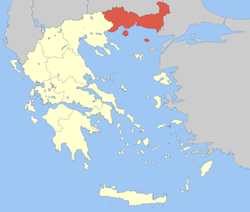 | |
| Regional unit of Evros | ||
| Regional unit of Kavala | ||
| Regional unit of Rhodope | ||
| Regional unit of Thasos | ||
| Regional unit of Xanthi | ||
| ||
This article is issued from
Wikipedia.
The text is licensed under Creative Commons - Attribution - Sharealike.
Additional terms may apply for the media files.