Sapes
| Sapes Σάπες | |
|---|---|
 Sapes Location within the regional unit 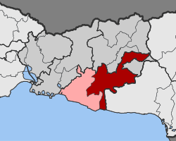 | |
| Coordinates: 41°02′N 25°42′E / 41.033°N 25.700°ECoordinates: 41°02′N 25°42′E / 41.033°N 25.700°E | |
| Country | Greece |
| Administrative region | East Macedonia and Thrace |
| Regional unit | Rhodope |
| Municipality | Maroneia-Sapes |
| • Municipal unit | 354.6 km2 (136.9 sq mi) |
| Population (2011)[1] | |
| • Municipal unit | 8,383 |
| • Municipal unit density | 24/km2 (61/sq mi) |
| Community[1] | |
| • Population | 4,988 (2011) |
| Time zone | UTC+2 (EET) |
| • Summer (DST) | UTC+3 (EEST) |
| Vehicle registration | ΚΟ |
Sapes (Greek: Σάπες) is a town and a former municipality in the Rhodope regional unit, East Macedonia and Thrace, Greece. Since the 2011 local government reform it is part of the municipality Maroneia-Sapes, of which it is the seat and a municipal unit.[2] The municipal unit has an area of 354.596 km2.[3] The population is 8,383 (2011).
Province
The province of Sapes (Greek: Επαρχία Σαπών) was one of the provinces of the Rhodope Prefecture. Its territory corresponded with that of the current municipal unit Sapes and the municipality Arriana, except the municipal unit Organi.[4] It was abolished in 2006.
References
- 1 2 "Απογραφή Πληθυσμού - Κατοικιών 2011. ΜΟΝΙΜΟΣ Πληθυσμός" (in Greek). Hellenic Statistical Authority.
- ↑ Kallikratis law Greece Ministry of Interior (in Greek)
- ↑ "Population & housing census 2001 (incl. area and average elevation)" (PDF) (in Greek). National Statistical Service of Greece.
- ↑ "Detailed census results 1991" (PDF). (39 MB) (in Greek) (in French)
This article is issued from
Wikipedia.
The text is licensed under Creative Commons - Attribution - Sharealike.
Additional terms may apply for the media files.