Chania (regional unit)
| Chania Περιφερειακή ενότητα Χανίων | |
|---|---|
| Regional unit | |
 Municipalities of Chania regional unit | |
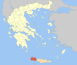 Chania regional unit within Greece | |
| Coordinates: 35°25′N 23°55′E / 35.417°N 23.917°ECoordinates: 35°25′N 23°55′E / 35.417°N 23.917°E | |
| Country | Greece |
| Region | Crete |
| Capital | Chania |
| Area | |
| • Total | 2,376 km2 (917 sq mi) |
| Population (2011) | |
| • Total | 156,585 |
| • Density | 66/km2 (170/sq mi) |
| Time zone | UTC+2 |
| • Summer (DST) | UTC+3 (EEST) |
| Postal codes | 73x xx, 740 55 |
| Area codes | 282x0, 28310 |
| ISO 3166 code | GR-94 |
| Car plates | ΧΝ |
| Website |
www |
Chania (Greek: Περιφερειακή ενότητα Χανίων) is one of the four regional units of Crete; it covers the westernmost quarter of the island. Its capital is the city of Chania. Chania borders only one other regional unit: that of Rethymno to the east. The western part of Crete is bounded to the north by the Cretan Sea, and to the west and south by the Mediterranean Sea. The regional unit also includes the southernmost island of Europe, Gavdos.
Geography
Chania regional unit, often informally termed 'Western Crete', is a beautiful and in many parts unspoilt part of the island. Districts include verdant Apokoronas, mountainous Sfakia, and Selino in the far South West corner. Some other notable towns in the Chania prefecture are Hora Sfakion, Kastelli-Kissamos, Palaiochora, Maleme, Vryses, Vamos, Georgioupolis and Kalives.
The natural park of Samariá Gorge, a major tourist attraction and a refuge for the rare Cretan wild goat or kri-kri, is in the South of the regional unit. The White Mountains or Lefka Ori, through which the Samaria, Aradena, Imbros and other gorges run, are the limestone peaks topped by snow until May that occupy much of Chania regional unit. They contain more than 40 peaks over 2,000 meters high. The highest peak in this area is Pachnes, at 2,453 meters above sea level.
The regional unit also includes three headlands, known as the "three heads" of Crete. From east to west, they are: Akrotiri, Rodopos (also called Spatha) and Gramvousa.[1]
Western Crete is popular with tourists for its spring flowers that linger on into early May in the mountains. Birdwatching is also popular, with the lammergeier and golden eagle especially sought for. As an island, Crete has many endemic species of plant and animal.
Crete's only freshwater lake, Lake Kournas, is in the regional unit close to the border with Rethymno regional unit, 47 km from Chania. It is relatively large, with a perimeter of 3.5 km. The lake used to be called 'Korisia' after ancient 'Korion', a city thought to be in the area with a temple to Athena. The lake used to be reportedly full of eels but now is better known for its terrapins and tourists. Tavernas and pedalo rental shops line part of the shore. Overall, however, the lake retains its beauty, the White Mountains reflected in the mirror-like waters. Chania is the regional unit of Crete that receives the most precipitation. The Exkursionsflora von Kreta by Jahn & Schoenfelder has a precipitation map and text confirming that in general, western Crete, in casu Chania prefecture, has more precipitation than any other region on an average basis.
Administration
The regional unit Chania is subdivided into 7 municipalities. These are (number as in the map in the infobox):[2]
- Apokoronas (2)
- Chania (1)
- Gavdos (3)
- Kantanos-Selino (4)
- Kissamos (5)
- Platanias (6)
- Sfakia (7)
Prefecture
The Chania prefecture (Greek: Νομός Χανίων) was created while Crete was still an autonomous state, and was preserved after the island joined Greece in 1913. As a part of the 2011 Kallikratis government reform, the Chania regional unit was created out of the former prefecture. The prefecture had the same territory as the present regional unit. At the same time, the municipalities were reorganised, according to the table below.[2]
| New municipality | Old municipalities | Seat |
|---|---|---|
| Apokoronas | Armenoi | Vryses |
| Asi Gonia | ||
| Vamos | ||
| Georgioupoli | ||
| Kryonerida | ||
| Fres | ||
| Chania | Chania | Chania |
| Akrotiri | ||
| Eleftherios Venizelos | ||
| Keramia | ||
| Nea Kydonia | ||
| Souda | ||
| Theriso | ||
| Gavdos | Gavdos | Gavdos |
| Kantanos-Selino | Kantanos | Palaiochora |
| East Selino | ||
| Pelekanos | ||
| Kissamos | Kissamos | Kissamos |
| Innachori | ||
| Mythimna | ||
| Platanias | Platanias | Gerani |
| Voukolies | ||
| Kolymvari | ||
| Mousouroi | ||
| Sfakia | Sfakia | Sfakia |
Provinces
The provinces were:
- Apokoronas Province - Vamos
- Kissamos Province - Kissamos
- Kydonia Province - Chania
- Selino Province - Kandanos
- Sfakia Province - Chora Sfakion
Communications
- Kydon TV
Notable people
- Eleftherios Venizelos (1864–1936), prime minister of Greece
- Michael Bletsas, Director of Computing at the MIT Media Lab
- Angelos Bletsas, MIT alumnus
- Constantinos Daskalakis, Assistant Professor at MIT
See also
References
- ↑ Facaros, Dana (1986). Cadogan Guides - Greek Islands. Cadogan Books. pp. 74-77
- 1 2 "Kallikratis reform law text" (PDF).
External links
| Wikimedia Commons has media related to Chania prefecture. |
Maps
Administrative division of the Crete Region | ||
|---|---|---|
| Regional unit of Chania | 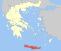 | |
| Regional unit of Heraklion | ||
| Regional unit of Lasithi | ||
| Regional unit of Rethymno | ||
| ||