Eleftheroupoli
| Eleftheroupoli Ελευθερούπολη | |
|---|---|
 Eleftheroupoli Location within the regional unit 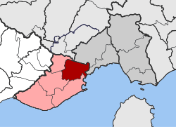 | |
| Coordinates: 40°55′N 24°15′E / 40.917°N 24.250°ECoordinates: 40°55′N 24°15′E / 40.917°N 24.250°E | |
| Country | Greece |
| Administrative region | East Macedonia and Thrace |
| Regional unit | Kavala |
| Municipality | Pangaio |
| • Municipal unit | 127.0 km2 (49.0 sq mi) |
| Elevation | 86 m (282 ft) |
| Population (2011)[1] | |
| • Municipal unit | 9,492 |
| • Municipal unit density | 75/km2 (190/sq mi) |
| Community[1] | |
| • Population | 5,555 (2011) |
| Time zone | UTC+2 (EET) |
| • Summer (DST) | UTC+3 (EEST) |
| Vehicle registration | ΚΒ |
Eleftheroupoli (Greek: Ελευθερούπολη, katharevousa: Ελευθερούπολις - Eleftheroupolis, until 1929 Πράβι - Pravi,[2] Turkish: Pravişte) is a town and a former municipality in the Kavala regional unit, East Macedonia and Thrace, Greece. Since the 2011 local government reform it is part of the municipality Pangaio, of which it is the seat and a municipal unit.[3] The municipal unit has an area of 126.974 km2.[4] At the 2011 census, the municipal unit's population was 9,492, the town's population was 4,360.[1]
Sister cities
References
- 1 2 3 "Απογραφή Πληθυσμού - Κατοικιών 2011. ΜΟΝΙΜΟΣ Πληθυσμός" (in Greek). Hellenic Statistical Authority.
- ↑ "Πανδέκτης: Pravi -- Eleftheroupolis". Retrieved 2016-11-30. Pandektis: Name Changes of Settlements in Greece, compiled by the Institute for Neohellenic Research
- ↑ Kallikratis law Greece Ministry of Interior (in Greek)
- ↑ "Population & housing census 2001 (incl. area and average elevation)" (PDF) (in Greek). National Statistical Service of Greece. Archived from the original (PDF) on 2015-09-21.
External links
- pravi.gr (in Greek)
This article is issued from
Wikipedia.
The text is licensed under Creative Commons - Attribution - Sharealike.
Additional terms may apply for the media files.