Eleftheres
| Eleftheres Ελευθερές | |
|---|---|
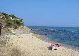 Beach in the Eleftheres Municipality | |
 Eleftheres Location within the regional unit  | |
| Coordinates: 40°50′N 24°18′E / 40.833°N 24.300°ECoordinates: 40°50′N 24°18′E / 40.833°N 24.300°E | |
| Country | Greece |
| Administrative region | East Macedonia and Thrace |
| Regional unit | Kavala |
| Municipality | Pangaio |
| • Municipal unit | 150.6 km2 (58.1 sq mi) |
| Population (2011)[1] | |
| • Municipal unit | 9,082 |
| • Municipal unit density | 60/km2 (160/sq mi) |
| Community[1] | |
| • Population | 1,303 (2011) |
| Time zone | UTC+2 (EET) |
| • Summer (DST) | UTC+3 (EEST) |
| Postal code | 64007 |
| Area code(s) | 25940 |
| Vehicle registration | ΚΒ |
Eleftheres (Greek: Ελευθερές) is a village and a former municipality in the Kavala regional unit, East Macedonia and Thrace, Greece. Since the 2011 local government reform it is part of the municipality Pangaio, of which it is a municipal unit.[2] The municipal unit has an area of 150.555 km2.[3] The seat of the municipality was Nea Peramos. The other villages in this municipal unit are Agios Andreas, Eleftheres, Elaiochori, Folia, Myrtofyto and Nea Iraklitsa.
References
- 1 2 "Απογραφή Πληθυσμού - Κατοικιών 2011. ΜΟΝΙΜΟΣ Πληθυσμός" (in Greek). Hellenic Statistical Authority.
- ↑ Kallikratis law Greece Ministry of Interior (in Greek)
- ↑ "Population & housing census 2001 (incl. area and average elevation)" (PDF) (in Greek). National Statistical Service of Greece. Archived from the original (PDF) on 2015-09-21.
- Φώτης Ο.Ε., ΕΛΛΑΣ οδικοί-τουριστικοί χάρτες, 33rd edition, 2005.
This article is issued from
Wikipedia.
The text is licensed under Creative Commons - Attribution - Sharealike.
Additional terms may apply for the media files.