Temenos, Greece
| Temenos Τέμενος | |
|---|---|
 Temenos Location within the regional unit 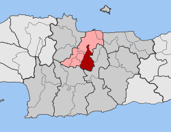 | |
| Coordinates: 35°11′N 25°06′E / 35.183°N 25.100°ECoordinates: 35°11′N 25°06′E / 35.183°N 25.100°E | |
| Country | Greece |
| Administrative region | Crete |
| Regional unit | Heraklion |
| Municipality | Heraklion |
| • Municipal unit | 56.6 km2 (21.9 sq mi) |
| Elevation | 298 m (978 ft) |
| Population (2011)[1] | |
| • Municipal unit | 3,260 |
| • Municipal unit density | 58/km2 (150/sq mi) |
| Time zone | UTC+2 (EET) |
| • Summer (DST) | UTC+3 (EEST) |
Temenos (Greek: Τέμενος) is a former municipality in the Heraklion Regional Unit, Crete, Greece. Since the 2011 local government reform it is part of the municipality Heraklion, of which it is a municipal unit.[2] The municipal unit has an area of 56.608 km2.[3] Population 3,260 (2011). The seat of the municipality was in Profitis Ilias.
Province
The province of Temenos (Greek: Επαρχία Τεμένους) was one of the provinces of the Heraklion Prefecture. Its territory corresponded with that of the current municipality Heraklion (except the municipal unit Gorgolainis and a few other villages) and the municipal unit Archanes.[4] It was abolished in 2006.
References
- ↑ "Απογραφή Πληθυσμού - Κατοικιών 2011. ΜΟΝΙΜΟΣ Πληθυσμός" (in Greek). Hellenic Statistical Authority.
- ↑ Kallikratis law Greece Ministry of Interior (in Greek)
- ↑ "Population & housing census 2001 (incl. area and average elevation)" (PDF) (in Greek). National Statistical Service of Greece.
- ↑ "Detailed census results 1991" (PDF). (39 MB) (in Greek) (in French)
This article is issued from
Wikipedia.
The text is licensed under Creative Commons - Attribution - Sharealike.
Additional terms may apply for the media files.