Pagué District
| Pagué | |
|---|---|
| District | |
 Location within São Tomé and Príncipe | |
| Coordinates: 1°37′N 7°24′E / 1.617°N 7.400°ECoordinates: 1°37′N 7°24′E / 1.617°N 7.400°E | |
| Country | São Tomé and Príncipe |
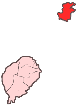
| Province/Island | Príncipe |
| Seat | Santo António |
| Area | |
| • Total | 142 km2 (55 sq mi) |
| Highest elevation | 948 m (3,110 ft) |
| Population (2012) | |
| • Total | 7,542 |
| • Density | 53/km2 (140/sq mi) |
| Time zone | UTC+0 (UTC) |
Pagué is the single district of Príncipe Province. Out of the seven districts that make up the equatorial Atlantic islands of São Tomé and Príncipe, its population is one of the smallest: 7,542 (2012).[1] Its capital, Santo António, is also the provincial capital of Príncipe. This district as well as the province includes several small islands around the island of Príncipe. The Obo National Park covers the southern part of the island and since 2012, Island of Príncipe Biosphere Reserve which covers the area of parts of the island and the islets.
Population
- 1940 3,124 (5.2% of the national population)
- 1950 4,402 (7.3% of the national population)
- 1960 4,544 (7.1% of the national population)
- 1970 4,593 (6.2% of the national population)
- 1981 5,255 (5.4% of the national population)
- 1991 5,471 (4.7% of the national population)[1]
- 2001 5,966 (4.3% of the national population)[1]
- 2008: 6,801(est.)
- 2012: 7,542[1]
Settlements
The main settlement is the town Santo António. Other settlements are:
- Aeroporto
- Belo Monte
- Ilhéu Bom Bom
- Bom Viver
- Hospital Velho
- Neves Ferreira (or Terreiro Novo)
- Novo Estrela
- Picão
- Portinho
- Porto Real
- Praia Inhame
- Praia de Seabra
- Santa Rita
- São Joaquim
- Sundy (or Sundi)
- Terreiro Velho
Persons
References
Autonomous Region of Príncipe/Pagué District | ||
|---|---|---|
| Communities |
| |
| Geographical features | ||
| Buildings | ||
| Football | ||
| São Tomé Island | ||
|---|---|---|
| Autonomous Region of Príncipe |
| |
This article is issued from
Wikipedia.
The text is licensed under Creative Commons - Attribution - Sharealike.
Additional terms may apply for the media files.