Outwell
| Outwell | |
|---|---|
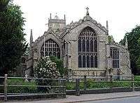 Saint Clements, Outwell | |
 Outwell Outwell shown within Norfolk | |
| Area | 12.21 km2 (4.71 sq mi) |
| Population | 2,083 (2011) |
| • Density | 171/km2 (440/sq mi) |
| OS grid reference | TF5103 |
| • London | 97 miles (156 km) SSW |
| Civil parish |
|
| District | |
| Shire county | |
| Region | |
| Country | England |
| Sovereign state | United Kingdom |
| Post town | WISBECH |
| Postcode district | PE14 |
| Dialling code | 01945 |
| Police | Norfolk |
| Fire | Norfolk |
| Ambulance | East of England |
| EU Parliament | East of England |
| UK Parliament | |
Outwell is a village and civil parish in the borough of King's Lynn and West Norfolk, in the English county of Norfolk.[1] The village is located 53.4 miles (85.9 km) west of Norwich, 18.3 miles (29.5 km) south-west of King's Lynn and 97 miles (156 km) north of London; the nearest town is Wisbech, which is 5.1 miles (8.2 km) north-west of the village.
Outwell is on the route of the A1101 road, close to the A47.[2] The nearest railway station is Downham Market on the Fen Line between King's Lynn and Cambridge, and the nearest airport is Norwich Airport.
At the 2011 Census, the parish had a population of 2,083,[3] an increase from 1,880 at the 2001 Census.[4]
Description
The village and parish of Outwell is located on the western edge of the county of Norfolk which borders Cambridgeshire. Up until 1990 Outwell parish was split with half in Norfolk and half in Cambridgeshire with the boundary falling along the old course of the River Nene. The boundary also cut straight through the middle of the village. In 1935 the part of Outwell which was in Cambridgeshire was reduced in size to enlarge the nearby village of Emneth. Outwell parish today is part of the King's Lynn and West Norfolk local government district.
Drains
The village and parish is traversed with many drainage channels which characterize this part of Fenland Norfolk. The eastern corner of the parish is cut north to south by the Middle Level main Drain. Crossing the parish from east to west is the drain called Well Creek. The north and eastern parts of the parish consist of arable and pasture fields, the eastern area referred to as Walsingham Fens and the north area as Well Moors. On the edges of the village there is a small amount of woodland near Birdbeck Field and to the south and at Church Field to the east of the village.
Name
It is thought that the name Outwell[5] is derived from old English and derives from the fact that it is a later settlement or extension of nearby village of Upwell, and suggests that the village of Outwell was established during the Saxon period.
History
Outwell has an entry in the Domesday Book of 1086.[6] In the great book Outwell is recorded by the name of Utuuella and Wella. The parish was in the custody William de Warenne. The survey also records 16 bordars with lands worth 5s. as belonging to Saint Benedict's Abbey in Ramsey.
Drainage and Flooding
In the Middle Ages the River Nene determined the layout of Outwell. Since that time, the landscape of the whole district has consequently been much altered by the construction of several large drains which run through the parish. In the 17th century Popham's Eau was cut to provide a conduit for the waters of the old River Nene into the River Great Ouse at Salter's Lode. This was followed by many alterations and new drains being dug. In May 1862 one sixth of the Parish of Outwell was inundated with water when the Middle Level Drain burst through its banks. It took three years before the area had fully recovered from the flood. Also constructed across the parish was the Wisbech Canal, now disused, which followed the course of the Well Stream as far as Outwell church and then struck across in a southeasterly direction to join Popham's Eau at Nordelph.
One consequence of all the drains and watercourse around this part of the Fens is the sport of Fen skating. During the cold winters of the 1820s and 1830s there were a number of fenmen who made a name for themselves as skaters. They included James May of Upwell[7]
Beaupré Hall
Beaupré Hall was a large 16th-century manor house on the outskirts of Outwell, built by the Beaupre family, who also financed the many catholic chapels on the church at Outwell. It was later lived in by Robert Bell during the reign of Elizabeth I. In decline since the Victorian era, during World War II, the hall was commandeered by the RAF and later used for holiday housing. From this point the Hall fell into a state of further disrepair until its demolition in 1966.[8][9]
References
- ↑ Ordnance Survey (2006). OS Explorer Map 228 – March & Ely. ISBN 0-319-23802-4
- ↑ County A to Z Atlas, Street & Road maps Norfolk, page 230 ISBN 978-1-84348-614-5
- ↑ "Outwell (Parish): Key Figures for 2011 Census". Neighbourhood Statistics. Office for National Statistics. Retrieved 29 August 2015.
- ↑ "Outwell (Parish): Key Figures for 2001 Census". Neighbourhood Statistics. Office for National Statistics. Retrieved 6 May 2017.
- ↑ A Popular Guide to Norfolk Place-names: by James Rye: Published by Larks press, Dereham, Norfolk, 2000 ; ISBN 0-948400-15-3
- ↑ The Domesday Book, England's Heritage, Then and Now, (Editor: Thomas Hinde), Norfolk, page 192, Outwell, ISBN 1-85833-440-3
- ↑ N & A Goodman 1882 Handbook of fen skating. London.
- ↑ A History of the County of Cambridge and the Isle of Ely: Volume IV
- ↑ Worsley, G., England's Lost Houses, Aurum Press Limited, 2002
External links
![]()