Nyeri County
| Nyeri County | ||
|---|---|---|
| County | ||
 | ||
| ||
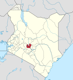 Location in Kenya | ||
| Country |
| |
| Formed | March 4th 2013 | |
| Capital | Nyeri | |
| Government | ||
| • Governor | Mutahi Kahiga | |
| Area | ||
| • Total | 2,361.0 km2 (911.6 sq mi) | |
| Population (2009) | ||
| • Total | 693,558 [1] | |
| Time zone | UTC+3 (EAT) | |
| Website | nyeri.go.ke | |

Nyeri County is located in the central region of Kenya. Its capital and largest town is Nyeri.[2] It has a population of 661,156 and an area of 3,356 km².
People
The county is located on the southwest flank of Mount Kenya. Local people are predominantly of the Kikuyu ethnicity.
Local authorities
| Authority | Type | Population* | Urban pop.* |
|---|---|---|---|
| Nyeri | Municipality | 98,908 | 46,969 |
| Karatina | Municipality | 6,852 | 6,852 |
| Othaya | Town | 21,427 | 4,108 |
| Nyeri county | County | 533,969 | 10,047 |
| * 1999 census. Source: | |||
Administrative divisions
| Division | Population* | Urban pop.* | Headquarters |
|---|---|---|---|
| Kieni east | 83,635 | 2,643 | Naro Moru |
| Kieni west | 68,461 | 5,017 | Mweiga |
| Mathira | 150,998 | 6,275 | Karatina |
| Mukurwe-ini | 87,447 | 1,525 | Kiahungu |
| Nyeri municipality | 101,238 | 40,497 | Nyeri |
| Othaya | 88,291 | 3,846 | Othaya |
| Tetu | 80,100 | 0 | [Wamagana] |
| * 1999 census. Sources: , , | |||
Sub-Counties/Constituencies
The county has six Sub-Counties/Constituencies):
Central Kenya Region
Urbanisation
| County | Urbanisation in Central Kenya (Percent) | ||||||||
|---|---|---|---|---|---|---|---|---|---|
| Kiambu County | 60.8 | ||||||||
| Nyeri County | 24.5 | ||||||||
| Nyandarua County | 18.5 | ||||||||
| Muranga County | 16.3 | ||||||||
| Kirinyaga County | 15.8 | ||||||||
32.3 | |||||||||
|
Urbanisation by County in Central Kenya | |||||||||
Source: OpenDataKenya
Wealth/Poverty Level
| County | Poverty Level in Central Kenya (Percent) | ||||||||
|---|---|---|---|---|---|---|---|---|---|
| Kirinyaga County | 25.2 | ||||||||
| Muranga County | 28.5 | ||||||||
| Kiambu County | 28.9 | ||||||||
| Nyeri County | 32.7 | ||||||||
| Nyandarua County | 46.6 | ||||||||
45.9 | |||||||||
|
Poverty level by County | |||||||||
Source: OpenDataKenya Worldbank
See also
References
- ↑ https://www.scribd.com/doc/36672705/Kenya-Census-2009
- ↑ "Archived copy" (PDF). Archived from the original (PDF) on 24 February 2013. Retrieved 27 July 2013.
External links
This article is issued from
Wikipedia.
The text is licensed under Creative Commons - Attribution - Sharealike.
Additional terms may apply for the media files.