Mandera County
| Mandera County | |||
|---|---|---|---|
| County | |||
| |||
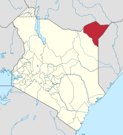 Location of Mandera County in Kenya | |||
| Coordinates: 3°25′00″N 40°40′00″E / 3.41667°N 40.6667°ECoordinates: 3°25′00″N 40°40′00″E / 3.41667°N 40.6667°E | |||
| Country |
| ||
| Formed | March 4, 2013 | ||
| Capital and largest town | Mandera | ||
| Other towns | El Wak | ||
| Government | |||
| • Governor | Ali Roba | ||
| Area | |||
| • Total | 25,797.7 km2 (9,960.5 sq mi) | ||
| Population (2009)[1] | |||
| • Total | 1,025,756 | ||
| • Density | 40/km2 (100/sq mi) | ||
| Time zone | UTC+3 (EAT) | ||
| Website |
www | ||


Mandera County is a county in the former North Eastern Province of Kenya. Its capital and largest town is Mandera. The county has a population of 1,025,756 (2009 census)[1] and an area of 25,797.7 km².
| Authority | Type | Population* | Urban pop.* | |
|---|---|---|---|---|
| Mandera | Town | 39,697 | 30,433 | |
| Mandera County | County | 210,675 | 22,505 | |
| Total | - | 250,372 | 52,938 | |
| * 1999 census. Source:[2] | ||||
| Division | Population* | Pop. density* | Area (km²) | Headquarters |
|---|---|---|---|---|
| Ashabito | 33,034 | 7 | x | Rhamu |
| Banisa | 38,411 | 27 | x | Banissa |
| Central | 43,916 | 437 | x | Mandera |
| Dandu | 16,534 | 8 | x | Takaba |
| El Wak | 26,391 | 26 | x | El Wak |
| Fino | 7,910 | 4 | x | Lafey |
| Hareri | 5,468 | 5 | x | Mandera |
| Khalalio | 7,948 | 16 | x | Mandera |
| Kotulo | 12,955 | 5 | x | Elwak |
| Lafey | 7,865 | 9 | x | Lafey |
| Libehia | 2,992 | 4 | x | Mandera |
| Malkamari | 12,498 | 7 | x | Mandera |
| Rahamu Dimtu | 7,371 | 8 | x | Rhamu |
| Rhamu | 10,818 | 75 | x | Rhamu |
| Shimbir Fatuma | 5,179 | 3 | x | Elwak |
| Takaba | 9,668 | 3 | x | Takaba |
| Warankara | 3,042 | 3 | x | Lafey |
| Wargadud | 8,372 | 8 | x | Elwak |
| Sala | 4,322 | 5 | x | Lafey |
| Kiliweri | 7,572 | 9 | x | Banisa |
| Total | 250,372 | 9 (average) | x | - |
| * 1999 census. Sources:[3] | ||||
Electoral constituencies
The county has six constituencies:
Villages and settlements
References
- 1 2 "Kenya Census 2009 - Census - Kenya". Scribd.
- ↑ http://treasury.go.ke/cbs.go.ke/pdf/authority.pdf%5Bpermanent+dead+link%5D
- ↑ "Archived copy" (PDF). Archived from the original (PDF) on 16 June 2007. Retrieved 2007-03-23.
External links
- http://softkenya.com/county/mandera-county/ Mandela County
- Map of the District
- http://www.reliefweb.int/rw/RWB.NSF/db900SID/VBOL-6UEDLF?OpenDocument
- http://www.aridland.go.ke/districts.asp?DistrictID=9%5Bpermanent+dead+link%5D
This article is issued from
Wikipedia.
The text is licensed under Creative Commons - Attribution - Sharealike.
Additional terms may apply for the media files.