Makueni County
| Makueni County | |||
|---|---|---|---|
| County | |||
| |||
| Motto(s): Haven of Opportunities | |||
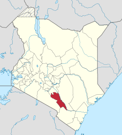 Location of Makueni County in Kenya | |||
| Coordinates: 1°48′S 37°37′E / 1.800°S 37.617°ECoordinates: 1°48′S 37°37′E / 1.800°S 37.617°E | |||
| Country |
| ||
| Formed | March 4, 2013 | ||
| Other towns | Makindu, Emali, Sultan Hamud | ||
| Government | |||
| • Governor | Kivutha Kibwana | ||
| Area | |||
| • Total | 8,008.9 km2 (3,092.3 sq mi) | ||
| Population (2009)[1] | |||
| • Total | 884,527 | ||
| • Density | 110/km2 (290/sq mi) | ||
| Time zone | UTC+3 (EAT) | ||
| Website |
makueni | ||


Makueni County (formerly Makueni District) is a county in the former Eastern Province of Kenya. Its capital and largest town is Wote. The county has a population of 884,527 (2009 census) and an area of 8,008.9 km².
Administration
Sub-Counties
The county has six sub-counties:
- Makueni
- Kaiti
- Kilome
- Kibwezi East
- Kibwezi West
- Mbooni
Constituencies
Since 2010, county has six constituencies:
Other Divisions
| Authority | Type | Population* | Urban pop.* | |
|---|---|---|---|---|
| Wote | Town | 56,419 | 5,542 | |
| Mtito Andei | Town | 24,435 | 4,304 | |
| Makueni | County | 690,691 | 18,689 | |
| Total | - | 771,545 | 28,535 | |
| * 1999 census. Source:[2] | ||||
| Division | Population* | Urban pop.* | Headquarters |
|---|---|---|---|
| Kaiti | 46,107 | 501 | Kilala |
| Kalawa | 14,039 | 0 | Kalawa |
| Kasikeu | 35,719 | 1,848 | Kasikeu |
| Kathonzweni | 65,738 | 0 | Kathonzweni |
| Kibwezi | 80,236 | 4,695 | Kibwezi |
| Kilome | 46,204 | 0 | Mukaa |
| Kilungu | 67,741 | 0 | Mukaa |
| Kisau | 50,510 | 1,905 | |
| Makindu | 50,299 | 2,482 | Makindu |
| Matiliku | 38,867 | 0 | Matiliku |
| Mbitini | 48,729 | 3,266 | Emali |
| Mbooni | 55,984 | 1,786 | Mbooni |
| Mtito Andei | 66,663 | 3,966 | Mtito Andei |
| Ilima | 32,717 | 0 | |
| Wote | 40,353 | 4,708 | Wote |
| Total | 771,545 | 25,157 | - |
| * 1999 census. Sources:,,[3][4] | |||
South Eastern Kenya Region
Urbanisation
| County | Urbanisation in South Eastern Kenya (Percent) | ||||||||
|---|---|---|---|---|---|---|---|---|---|
| Machakos County | 52 | ||||||||
| Kitui County | 13.8 | ||||||||
| Makueni County | 11.8 | ||||||||
32.3 | |||||||||
|
Urbanisation by County in South Eastern Kenya | |||||||||
Source: OpenDataKenya
Wealth/Poverty Level
| County | Poverty Level in South Eastern Kenya (Percent) | ||||||||
|---|---|---|---|---|---|---|---|---|---|
| Machakos County | 59.6 | ||||||||
| Kitui County | 63.1 | ||||||||
| Makueni County | 64.1 | ||||||||
45.9 | |||||||||
|
Poverty level by County | |||||||||
Source: OpenDataKenya Worldbank
Villages and settlements
See also
References
- ↑ https://www.scribd.com/doc/36672705/Kenya-Census-2009
- ↑ http://treasury.go.ke/cbs.go.ke/pdf/authority.pdf%5Bpermanent+dead+link%5D
- ↑ "Archived copy" (PDF). Archived from the original (PDF) on 16 June 2007. Retrieved 2007-03-23.
- ↑ "Archived copy". Archived from the original on 28 September 2006. Retrieved 2007-11-27.
External links
- Makueni County Council
- http://www.aridland.go.ke/districts.asp?DistrictID=15%5Bpermanent+dead+link%5D
- https://web.archive.org/web/20070628140851/http://www.drylandsresearch.org.uk/dr_kenya.html
This article is issued from
Wikipedia.
The text is licensed under Creative Commons - Attribution - Sharealike.
Additional terms may apply for the media files.