Nelson, Lancashire
| Nelson | |
|---|---|
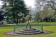 Marsden Park, Nelson | |
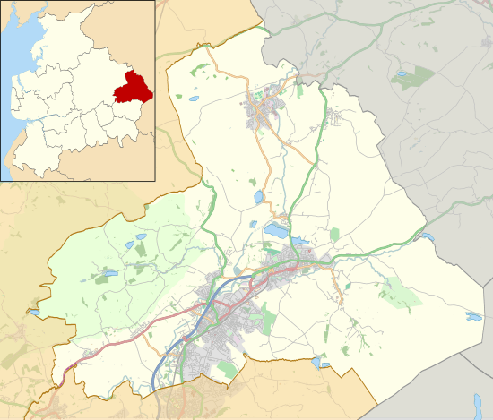 Nelson Shown within Pendle Borough  Nelson Nelson shown within Lancashire | |
| Area | 4.64 km2 (1.79 sq mi) [1] |
| Population | 29,135 (2011 Census) |
| • Density | 16,187/sq mi (6,250/km2) |
| OS grid reference | SD856376 |
| • London | 184 miles (296 km) SSE |
| District | |
| Shire county | |
| Region | |
| Country | England |
| Sovereign state | United Kingdom |
| Post town | NELSON |
| Postcode district | BB9 |
| Dialling code | 01282 |
| Police | Lancashire |
| Fire | Lancashire |
| Ambulance | North West |
| EU Parliament | North West England |
| UK Parliament | |
| Website | Pendle Borough Council |
Nelson is a town and civil parish in the Borough of Pendle in Lancashire, England, with a population of 29,135 in 2011. It is 4 miles (6.4 km) north of Burnley on the Leeds and Liverpool Canal.
It developed as a mill town during the Industrial Revolution, but has today lost much of its industry and is characterised by pockets of severe deprivation and some of the lowest house prices in the country.[2][3]
History
An Iron Age hillfort called Castercliff is on a hill to the east of the town.[4] The area was historically known as Marsden. The modern town spans two townships of the ancient parish of Whalley.[5][6] Little Marsden was on the southwest of Walverden Water, its lands considered part of the manor of Ightenhill and Great Marsden to the northeast, part of the manor of Colne.[7][4] Great Marsden included the southern parts of Colne,[lower-alpha 1] and Little Marsden included all of modern-day Brierfield.[7][4] Walverden Water joins Pendle Water next to Nelson & Colne College, that river formed the boundary of the Forest of Pendle. Both the manors and forest where parts of the Honour of Clitheroe. The forest of Pendle was made famous by the Pendle witch trials of 1612. One of the accused in the less well-known witch trails of 1634, Margaret Johnson, confessed that she first met her familiar in Marsden.[4]
A small mill had been established by the Ecroyd family at Edge End as early as 1740,[8] and there were two coal mines nearby,[8] but it was the coming of the Leeds and Liverpool Canal in 1796, followed by the East Lancashire Railway Line in 1849,[9] that spurred its development as an industrial town, with an economy based mainly upon cotton weaving. The first Ordnance Survey map of the area, published in 1848 shows three small villages; Marsden (around St Paul's Church), and Hebson and Bradley, both on Walverden Water in the modern-day centre of town. Also apparent are the estates of Marsden Hall to the east and Carr Hall across Pendle Water to the northwest.[7] And the turnpike roads of the Marsden, Gisburn and Long Preston trust (Scotland Road) heading north and the Blackburn, Addingham and Cocking End trust (Manchester Road) heading east.[7] Brierfield railway station was originally called Marsden and Nelson railway station became known as the Nelson Inn, Great Marsden, after the adjacent public house, the Lord Nelson Inn (named after Admiral Lord Nelson). As the villages developed into a town, the name Nelson was chosen to differentiate it from Marsden across the Pennines in the neighbouring county of Yorkshire (West Riding).[10]
There was a worsted mill at Lomeshaye close to a "cotton factory" and another cotton mill along the canal at Reedyford by 1848.[7] Walverden Mill in Leeds Road was built in 1850,[11] and was soon followed by others. The cotton industry was the most important in the town, and by 1910, more than 12,000 local workers were members of the Nelson and District Power-Loom Weavers' Association.[12]
From 1862, Phoenix Foundry, the steam engine factory of William Roberts stood at the site of the shopping centre's car park, and has been called "Nelson's most significant engineering site". The town became associated in the 20th century with the production of confectionery as well, including Jelly Babies and Victory V and was where the package holiday company Airtours (formerly Pendle Travel and now part of Thomas Cook) began life as an independent travel agent. The textile industry, in particular, has now sharply declined, leaving the town with low property prices and higher than average unemployment.
Governance
Nelson was granted its charter of incorporation as a municipal borough by Queen Victoria in 1890.[9] Radical left wing politics in the early 20th century led to it being labelled "Little Moscow" by both the local and national press; indeed, the Nelson Leader ran the headline "Moscow calling" during the lock-out of 1928. There was significant Communist Party influence in the town between the wars. When the Labour Party came to power in the town, they responded to local political feeling by placing utilities such as gas and water under the control of the municipal council, anticipating by decades the nationalisation of such utilities after World War II. The council refused, moreover, to participate in celebrations for King George V's silver jubilee in 1935, saying that they would rather spend public money on free dinners for school children and the jobless.
Under the Local Government Act 1972, the town became part of the non-metropolitan district of Pendle on 1 April 1974.[13] It currently has three tiers of local government, Lancashire County Council, Pendle Borough Council and a town council, with 24 councillors, which was elected for the first time on 1 May 2008.[14]
The borough comprises a total of 20 wards, six of which – Bradley, Clover Hill, Marsden, Southfield, Walverden and Whitefield are in Nelson. After several years under 'No Overall Control' Pendle Borough Council is currently governed by the Labour, led by Councillor Mohammed Iqbal. The mayor is a ceremonial post, rotated annually.
Lancashire County Council has been governed since 1994 by Labour. The town is represented on the council in three divisions: Brierfield & Nelson North, Nelson South, and Pendle Central.[15]
The Member of Parliament for Pendle, the constituency into which the town falls, is Andrew Stephenson (Conservative), who was first elected in 2010.
Nelson lies within the North West England European Parliament constituency, which elects eight MEPs by proportional representation – currently three Conservative (ECR), two Labour (PASD), one Liberal Democrat (ALDE), one UKIP (EFD), and one BNP (NI).[16]
Demography
| Year | 1911 | 1921 | 1931 | 1939 | 1951 | 1961 | 1971 | 2001 | 2011 | ||||||||||||
|---|---|---|---|---|---|---|---|---|---|---|---|---|---|---|---|---|---|---|---|---|---|
| Population | 39,479 | 39,841 | 38,304 | 34,803 | 34,384 | 32,292 | 31,286 | 28,998 | 29,135 | ||||||||||||
| [13] | |||||||||||||||||||||
The United Kingdom Census 2011 showed a total resident population for Nelson of 29,135. The town forms part of the Burnley-Nelson urban area, which has an estimated population of 149,796; for comparison purposes, this is about the same size as Huddersfield or Oxford.[17]
The racial composition of the town in 2011 was 57.8% White (53.4% White British), 40.4% Asian, 0.1% Black, 1.5% Mixed and 0.2% Other. The largest religious groups are Christian (39.0%) and Muslim (37.6%). 59.9% of adults between the ages of 16 and 74 are classed as economically active and in work.[18]
Economy
The town centre contains the largest number of high street multiples of any town in the Borough of Pendle. Stores currently include: Boots, Wilko, Specsavers, Home Bargains, Peacocks, Costa Coffee, Greggs, Post Office, Martin McColl and Poundworld.
The Pendle Rise Shopping Centre has been the focal point of the town centre for over 50 years. It opened as the Arndale Centre in June 1967[19] and was rebranded as the Admiral Shopping Centre before taking its current name. Nelson Market (previously Admiral's Market) is a covered market below the Pendle Rise Shopping Centre. The Victory Centre opened on the site of the former Salem Chapel in 1993. Of the 12 units only one remained occupied in 2017, by a branch of William Hill.
The main road through the town centre, pedestrianised in the early 1990s, was reopened to traffic in August 2011, to help boost trade.[20] In 2012, Nelson twelve English towns chosen to participate in the Portas Pilot Areas initiative, receiving £100,000 to help rejuvenate the shopping area.[21]
On the edge of the town centre, there is a large Morrisons, which, was the company's 100th supermarket when it opened in September 1999. Other edge of centre stores are occupied by Lidl (opened in February 2001) and Home Bargains, which will relocate into the unit formerly occupied by Tesco Metro in 2018. There is also a B&Q DIY centre adjacent to junction 12 on the M65.
As well as motor dealerships from Citroën, Peugeot (both Perry's), SsangYong (Steve Durkin) and Land Rover (Hillendale), the town also has a branch of We Buy Any Car. Shell (which includes a Subway), Esso, BP and Morrisons operate petrol stations in the town.
The largest business park in the town is located at junction 12 on the M65 at Lomeshaye. The original 15 hectare site was designated as an Enterprise Zone on 7 December 1983. The estate currently occupies 53 hectares and is home to over 80 businesses. Between them they employ approximately 4,000 people on the estate. A 31 hectare site was taken out of the Green Belt when the Council's new Local Plan was adopted in December 2015, in order to facilitate a further extension to the west and north. The Lomeshaye Business Village, a refurbished former cotton mill to the east of the estate contains a further 151 units, principally occupied by small and medium sized enterprises engaged in office and light industrial uses.
Transport
Nelson is served by Junction 13 of the M65 motorway, which runs west to Burnley, Accrington, Blackburn and Preston, and northeast to Colne. From the town centre, the A56 runs southwest to the M65 at Brierfield and northeast to Colne and beyond, while the A682 – Britain's most dangerous road[22] – heads north into the Yorkshire Dales.
In November 1969, a multi-storey car park with space for 350 cars was opened in Nelson.[23]
In December 2008, the town's new bus and rail interchange was opened at a site which used the existing railway station.[24] The new interchange facility cost £4.5 million and included enhancements such as cycle stands, taxi and car drop off facilities, electronic information displays, a direct link to the railway station including a passenger lift and an enclosed passenger concourse with 10 bus stands.[25]
Rail services to and from Nelson are provided by Northern. The Interchange has an hourly stopping service 7 days a week west to Blackpool South via Blackburn and Preston, and east to Colne.
The main bus operator in Nelson is Burnley Bus Company, although Tyrer Bus, Boomerang and Holmeswood operate some services. National Express operates one coach service to London Victoria Coach Station each day from the Interchange. The town has good bus links into Burnley with peak hour services on to Manchester: X43 Witch Way service (operated by Burnley Bus Company) runs from Skipton via Colne, M65 (avoiding Nelson), Burnley and Rawtenstall to Manchester city centre, using a fleet of specially-branded double-decker buses with leather seats and WiFi. Some peak time X43 journeys to/from Manchester start and end at Nelson instead of serving Colne and Skipton.
Sports
The town is home to Nelson F.C., who were Football League members from 1921 until 1931 and played in the lower semi-professional leagues until resigning from the North West Counties League in 2010 (returning in 2011), and to Nelson Cricket Club. Cricket was particularly popular in the town during the inter-war period, when the club enjoyed the services of Learie Constantine, the West Indian cricketer; when in 1969 Constantine became the first person of African descent to be given a life peerage, he chose to be gazetted as Baron Constantine, of Maraval in Trinidad and Tobago and of Nelson in the County Palatine of Lancaster.[26]
Speedway racing was staged at Seedhill Stadium from 1967 to 1970. The Nelson Admirals were founder members of the British League Division Two.) The team later moved embloc to Odsal Stadium, Bradford. The track was also used for stock car racing.
The town also has two golf clubs, a municipal at Marsden Park and a private club in Kings Causeway known simply as Nelson Golf Club.
Recreation
The town is home to several parks the most notable of which are Victoria Park and Marsden Park. The recently opened Arts, Culture and Enterprise Centre (The ACE Centre) provides the residents with a new multi-purpose venue and incorporates a cinema, theatre and bistro. The Heritage Trust for the North West have numerous campaigns and projects in the area. One of which has seen the restoration and conservation of a whole street of Victorian workers housing, a former primary school and cotton mill, as it was feared that the Industrial Heritage of the town was at risk.[27] St Mary's Church is also another major project in the town, which is planned to open as an exhibition centre in Summer 2012.[28]
Media
Local radio for Nelson is currently provided by 2BR and BBC Radio Lancashire, and – since September 2007 – by community radio service Pendle Community Radio, aimed primarily at the local Asian community. There are two local newspapers: the Nelson Leader, published on Fridays, and the daily Lancashire Telegraph, which publishes a local edition for Burnley and Pendle.
Notable people
- Bernie Calvert, musician, The Hollies, born Nelson, 1944
- Tony Hicks, musician, The Hollies, born Nelson, 1945
- Learie Constantine, a West Indian cricketer, lawyer and politician who played for Nelson cricket club with great distinction between 1929 and 1938
- Footballer and manager Jimmy Hogan,
- Footballer Mike Phelan[29]
- Actor John Simm[30]
- Sir Frank Hartley CBE, (pharmacist) born 1911, Vice-Chancellor, University of London 1976–78
- C.L.R. James, author, intellectual and writer on cricket, lived in Nelson before moving to London
- Ted Koppel, American broadcast journalist, was born in Nelson
- Eric Knowles, (19 February 1953–) is a British antiques expert whose main interest is in ceramics
- John Pickles, distinguished professor of geography, University of North Carolina, USA
- Kevin Smith, entrepreneur, born Nelson, 1954
- Nicola Wheeler, Actress currently starring in Emmerdale lived in Nelson and went to Walton High School.
See also
References
Notes
- ↑ Colne Water formed the border between Great Marsden and Colne townships.[7]
Citations
- ↑ Office for National Statistics. Accessed 15 April 2008.
- ↑ www.communities.gov.uk Archived 28 June 2008 at the Wayback Machine.. Accessed 4 August 2008. The most deprived Lower Layer SOA ranks 262nd out of 32482, placing it in the 1% most deprived areas in the country.
- ↑ Sold House Prices. Nelson appears in 10th place in the list of towns with the lowest property prices (averaging £97,307); Oxford Street in Brierfield, Nelson appears in 4th place in the list of streets with the lowest property prices (averaging £19,943).
- 1 2 3 4 Farrer and Brownbill 1911, pp. 536–541
- ↑ "Great and Little Marsden CP/Tn through time". visionofbritain.org.uk. GB Historical GIS / University of Portsmouth. Retrieved 25 February 2015.
- ↑ An Early History of Burnley, Pendle and West Craven Clayton 2006, p.118
- 1 2 3 4 5 6 Lancashire and Furness (Map) (1st ed.). 1 : 10,560. County Series. Ordnance Survey. 1848.
- 1 2 Metcalfe 2005, p.7.
- 1 2 Metcalfe 2005, p.8.
- ↑ Nicolaisen 1970, p.140
- ↑ Metcalfe 2005, p.8
- ↑ Marsh, Arthur; Ryan, Victoria; Smethurst, John B. (1994). Historical Directory of Trade Unions. 4. Farnham: Ashgate. pp. 112–113. ISBN 9780859679008.
- 1 2 www.visionofbritain.org.uk. Accessed 23 April 2008.
- ↑ Pendle Borough Council. Accessed 15 April 2008.
- ↑ Lancashire County Council. Accessed 24 April 2008.
- ↑ European Parliament official site. Accessed 24 April 2008.
- ↑ Office for National Statistics. Accessed 6 September 2007.
- ↑ UK Census (2011). "Local Area Report – Nelson Parish (1170215083)". Nomis. Office for National Statistics. Retrieved 11 February 2018.
- ↑ Copestake, Peter. "1967 opening of Nelson's Arndale Centre". Pendle Today. Johnston Press. Retrieved 3 January 2018.
- ↑ Magill, Peter. "High hopes for Nelson as new high street opens". Lancashire Telegraph. Newsquest. Retrieved 3 January 2018.
- ↑ Marshall, Tyrone. "Nelson shopping centre gets cash boost from Mary Portas". Lancashire Telegraph. Newsquest. Retrieved 3 January 2018.
- ↑ www.bbc.co.uk, 24 June 2007. Accessed 6 September 2007.
- ↑ "News: Multi-storey car park". Motor. Vol. nbr 3518. 22 November 1969. p. 57.
- ↑ "Interchanges". Lancashire County Council. Retrieved 23 October 2011.
- ↑ "Nelson Interchange". Lancashire County Council. Retrieved 23 October 2011.
- ↑ "No. 18759". The Edinburgh Gazette. 28 March 1969. p. 235.
- ↑ HTNW (2010) "Lomeshaye Mill, School and Bridge Cottage", "Archived copy". Archived from the original on 6 October 2011. Retrieved 20 March 2011.
- ↑ HTNW (2010) "St Marys Church, Nelson", "Archived copy". Archived from the original on 6 October 2011. Retrieved 20 March 2011.
- ↑ El Bombín: Tales of British Football Coaches Around The World. Accessed 24 April 2008.
- ↑ "John Simm: The time of his life", The Independent, 11 February 2007. Accessed 24 April 2008
Bibliography
- Farrer and Brownbill (1911), The Victoria History of the County of Lancaster Vol 6], Victoria County History – Constable & Co, OCLC 270761418
- Clayton John A. (2006). The Valley of the Drawn Sword – The Early History of Burnley, Pendle and West Craven. Barrowford Press. ISBN 978-0-9553821-0-9.
- Metcalf M. (2005). Nelson (Images of England). Tempus Publishing Ltd. ISBN 978-0-7524-3630-2.
- Nicolaisen W. F. H.; Gelling M. & Richards M. (1970). The Names of Towns and Cities in Britain. B. T. Batsford Ltd. ISBN 0-7134-0113-3.
External links
| Wikivoyage has a travel guide for Nelson, Lancashire. |
