Roughlee
| Roughlee | |
|---|---|
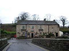 The Bay Horse public house | |
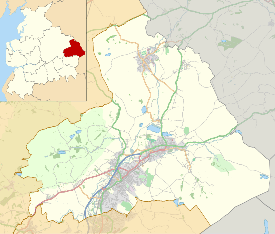 Roughlee Location in Pendle Borough 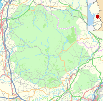 Roughlee Location in the Forest of Bowland AONB  Roughlee Roughlee shown within Lancashire | |
| Population | 318 (2011) |
| OS grid reference | SD843403 |
| Civil parish |
|
| District | |
| Shire county | |
| Region | |
| Country | England |
| Sovereign state | United Kingdom |
| Post town | NELSON |
| Postcode district | BB9 |
| Dialling code | 01282 |
| Police | Lancashire |
| Fire | Lancashire |
| Ambulance | North West |
| EU Parliament | North West England |
| UK Parliament | |
Roughlee /rʌfˈliː/ is a village in Pendle, Lancashire, England, in the civil parish of Roughlee Booth. It is close to Nelson, Barrowford and Blacko. The village lies at the foot of Pendle Hill, well known for the Pendle Witches, and includes the hamlet of Crowtrees. The parish adjoins the Pendle parishes of Blacko, Barrowford, Old Laund Booth, Goldshaw Booth and Barley-with-Wheatley Booth. It is part of the Forest of Bowland Area of Outstanding Natural Beauty (AONB).[1]
The village has won the small village category of the Lancashire Best Kept Village competition in 2006, and the champion village category in 2007.[2] It was also runner-up in the champion category in 2009.[3]
The village is featured in Joseph Delaney's 2008 novel The Spook's Battle.
According to the United Kingdom Census 2011, the parish has a population of 318,[4] a decrease from 328 in the 2001 census.[5]
Roughlee Booth was once a township in the ancient parish of Whalley. This became a civil parish in 1866, forming part of the Burnley Rural District from 1894 until 1974. The village of Newchurch in Pendle used to straddle the boundary with Goldshaw Booth,[lower-alpha 1] but that part of the parish was transferred in 1935.[7]
Along with Higham-with-West Close Booth, Goldshaw Booth and Barley-with-Wheatley Booth, the parish forms the Higham with Pendleside ward of Pendle Borough Council.[8]
Notable people
- Alice Nutter (witch) was accused in Pendle and hanged as a witch in 1612 and now has a statue in the village.[9]
- Bobby Elliott who was a drummer in the Hollies lives here.[9]
See also
References
Notes
- ↑ In 1848, the boundary passed just east of St Mary's Church.[6]
Citations
- ↑ Forest of Bowland map (Map). forestofbowland.com. Lancashire County Council.
- ↑ "Towns and Villages". forestofbowland.com. Lancashire County Council. Retrieved 5 September 2015.
- ↑ "Roughlee and Barley honoured in Lancs Best-Kept Village contest". Pendle Today. Johnston Press. 13 October 2009. Retrieved 5 September 2015.
- ↑ UK Census (2011). "Local Area Report – Roughlee Booth Parish (1170215075)". Nomis. Office for National Statistics. Retrieved 11 February 2018.
- ↑ Office for National Statistics : Census 2001 : Parish Headcounts : Pendle Retrieved 2009-09-18
- ↑ Lancashire and Furness (Map) (1st ed.). 1 : 10,560. County Series. Ordnance Survey. 1848.
- ↑ "Roughlee Booth Tn/CP through time". visionofbritain.org.uk. GB Historical GIS / University of Portsmouth. Retrieved 3 September 2015.
- ↑ "Higham with Pendleside". Ordnance Survey Linked Data Platform. Ordnance Survey. Retrieved 2 September 2015.
- 1 2 "Statue to Pendle Witch unveiled". BBC News. 2012-07-28. Retrieved 2018-02-17.
External links
| Wikimedia Commons has media related to Roughlee Booth. |