Brierfield, Lancashire
| Brierfield | |
|---|---|
 Railway View | |
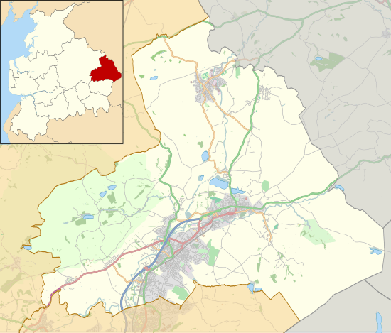 Brierfield Shown within Pendle Borough  Brierfield Brierfield shown within Lancashire | |
| Population | 8,193 (2011) [1] |
| OS grid reference | SD850361 |
| Civil parish |
|
| District | |
| Shire county | |
| Region | |
| Country | England |
| Sovereign state | United Kingdom |
| Post town | NELSON |
| Postcode district | BB9 |
| Dialling code | 01282 |
| Police | Lancashire |
| Fire | Lancashire |
| Ambulance | North West |
| EU Parliament | North West England |
| UK Parliament | |
Brierfield (/ˌbraɪ.ərˈfiːld/) is a small town and civil parish in the Borough of Pendle Lancashire, England. It is 2.5 miles (4.0 km) north east of Burnley, 1 mile (1.6 km) south west of Nelson, and 0.5 miles (0.8 km) north east of Reedley. It has a population of 8,200,[2] reducing marginally to 8,193 at the 2011 Census.[1]
History
The building of the Leeds and Liverpool Canal, the Blackburn to Addingham turnpike road and the railway from Preston to Colne led to the town developing during the early 19th century.
Before the new transport links were constructed, the town was just a scattering of farmhouses forming part of the township of Little Marsden, which also covered a large part of what was to become Nelson. The construction of the first cotton mill in 1832 off Lob Lane (now Clitheroe Road) close to the Marsden coal pit, led to the massive growth of the settlement during the mid-19th century.
New mills were established along the banks of the canal and people flocked to the area to work in the cotton industry, many coming from the lead mining areas of the North Riding of Yorkshire as the lead seams were worked out.
In July 1997, the town's small cinema, Unit Four, closed down. It was showing Batman and Robin, The Fifth Element, Con Air, and Beavis and Butt-Head Do America. It was later replaced by a branch of Dixy Chicken, as well as Maria's World Food Store.[3]
The cotton industry continued to be the main employer until well into the 1960s, and in 2006 that BSN (formerly Smith & Nephew) ceased production of woven cloth at Brierfield Mills. After years of disuse, Pendle Council purchased the mills in 2012, intending to use it as a flagship regeneration project.[4][5]
The town's war memorial features a large roaring bronze lion. The town is known for its part in the Quaker movement. A Friends meeting house is still in use on the south-eastern boundary of the town, and the bridge over Pendle Water at the foot of the town is called Quaker Bridge.
Schools
There are three primary schools, and one secondary school in Brierfield. The primary schools are Reedley Road, Pendle Primary Academy (formerly known as Walter street) and Holy Trinity. The secondary school is Marsden Heights Community College.
Facilities
The town is served by Brierfield railway station.
Pendle Community Radio commenced broadcasting on 103.1FM in September 2005. Licensed by Ofcom as a distinct community radio service, it aims to target the borough's Muslim population, a large number of which reside in Brierfield.
Notable people
- Saj Karim, European Parliament member
- Mohammed Afzal Khan, Lord Mayor of Manchester 2005–06
- Several members of the celebrated 1960s pop group The Hollies came from Brierfield, including long-time bass guitarist Bernie Calvert.
- Alan Buck, drummer with The Four Pennies of "Juliet" fame
- Lee Ingleby, actor
See also
References
- 1 2 UK Census (2011). "Local Area Report – Brierfield Parish (1170215078)". Nomis. Office for National Statistics. Retrieved 8 February 2018.
- ↑ "Parish headcount" (PDF). Lancashire County Council. Archived from the original (PDF) on 2006-12-10. Retrieved 2009-07-25.
- ↑ H J Hill (21 October 2014). "Unit Four Cinemas Burnley Road, Brierfield, BB9 5HY". Cinema Treasures. Retrieved 10 May 2016.
- ↑ Kirsty Weakley (21 March 2012). "Islamic Help sells building to local authority for £1.5m". Civil Society. Retrieved 21 March 2012.
- ↑ "Pendle Council buys Brierfield Mill for £1.5m". BBC Lancashire. 20 March 2012. Retrieved 21 March 2012.
External links
| Wikimedia Commons has media related to Brierfield, Lancashire. |