Barley-with-Wheatley Booth
| Barley with Wheatley Booth | |
|---|---|
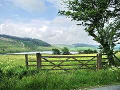 Upper Black Moss Reservoir | |
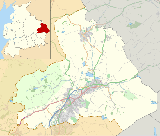 Barley with Wheatley Booth Location in Pendle Borough 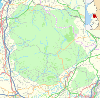 Barley with Wheatley Booth Location in the Forest of Bowland AONB  Barley with Wheatley Booth Barley with Wheatley Booth shown within Lancashire | |
| Population | 298 (2011) |
| OS grid reference | SD8240 |
| Civil parish |
|
| District | |
| Shire county | |
| Region | |
| Country | England |
| Sovereign state | United Kingdom |
| Post town | BURNLEY |
| Postcode district | BB12 |
| Dialling code | 01282 |
| Police | Lancashire |
| Fire | Lancashire |
| Ambulance | North West |
| EU Parliament | North West England |
| UK Parliament | |
Barley-with-Wheatley Booth is a civil parish in the Pendle district of Lancashire, England. It has a population of 298,[1] and contains the village of Barley and the hamlet of White Hough or Whitehough (53°51′32″N 2°15′25″W / 53.859°N 2.257°W). To the west of Barley is Pendle Hill; its summit, at 557 metres (1,827 ft), is within the parish.
The parish adjoins the Pendle parishes of Blacko, Roughlee Booth and Goldshaw Booth and the Ribble Valley parishes of Sabden, Mearley, Worston, Downham and Twiston. It is part of the Forest of Bowland Area of Outstanding Natural Beauty (AONB).[2]
Barley-with-Wheatley Booth was once a township in the ancient parish of Whalley. This became a civil parish in 1866, forming part of the Burnley Rural District from 1894.[3]
Along with Higham-with-West Close Booth, Goldshaw Booth and Roughlee Booth, the parish forms the Higham with Pendleside ward of Pendle Borough Council.[4]
According to the United Kingdom Census 2011, the parish has a population of 298,[1] an increase from 271 in the 2001 census.[5]
Media gallery
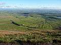 View over the parish from Pendle Hill
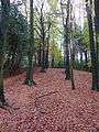 Autumn near White Hough
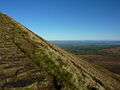 Assending Pendle on the footpath from Barley
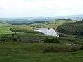 Lower Ogden Reservoir from Buttock Farm
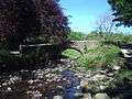 Bridge over White Hough Water
See also
References
Citations
- 1 2 UK Census (2011). "Local Area Report – Barley-with-Wheatley Booth Parish (1170215065)". Nomis. Office for National Statistics. Retrieved 11 February 2018.
- ↑ Forest of Bowland map (Map). forestofbowland.com. Lancashire County Council.
- ↑ "Barley With Wheatley Booth Tn/CP through time". visionofbritain.org.uk. GB Historical GIS / University of Portsmouth. Retrieved 27 June 2015.
- ↑ "Higham with Pendleside". Ordnance Survey Linked Data Platform. Ordnance Survey. Retrieved 2 September 2015.
- ↑ Office for National Statistics : Census 2001 : Parish Headcounts : Pendle Retrieved 2009-09-18
External links
![]()