Ogden Reservoirs
| Upper and Lower Ogden Reservoirs | |
|---|---|
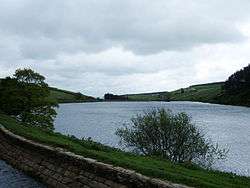 View looking east across lower reservoir | |
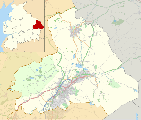 Upper and Lower Ogden Reservoirs Location in Pendle Borough  Upper and Lower Ogden Reservoirs Location in Lancashire | |
| Location | Lancashire, England |
| Coordinates | 53°51′21″N 2°16′52″W / 53.85583°N 2.28111°WCoordinates: 53°51′21″N 2°16′52″W / 53.85583°N 2.28111°W |
| Built | 1906 and 1914 |
| Surface area | 2.84 and 8.55 ha (7.0 and 21.1 acres) |
| Max. depth | 17.9 and 18 m (59 and 59 ft) |
| Water volume | 247,755 and 715,989 m3 (200.858 and 580.462 acre⋅ft) |
| References | [1] |
Upper and Lower Ogden Reservoirs are half a mile to the west of the village of Barley, in the Borough of Pendle, England.[2] They supply drinking water to the town of Nelson.[1]
Three forests covering more than 23 hectares (57 acres) can be found close to the reservoirs. Fell Wood, which is the largest, was planted in 1931 and contains Norway Spruce (Picea abies), Sitka Spruce (Picea sitchensis), Scots Pine (Pinus sylvestris) and European Larch (Larix decidua). Blue Wood, which was originally planted in 1935 with Scots Pine, Sitka Spruce and Larch was felled and replanted in 1981. The third forest: Buttock Plantation, was planted in 1935 with Sitka Spruce and Larch.[1]
References
- 1 2 3 United Utilities. "Ogden Reservoir and Fell Wood" (PDF). Retrieved August 6, 2010.
- ↑ Michael Ely. "Lower Ogden Reservoir". Retrieved August 6, 2010.
| Wikimedia Commons has media related to Ogden Reservoirs. |
This article is issued from
Wikipedia.
The text is licensed under Creative Commons - Attribution - Sharealike.
Additional terms may apply for the media files.