M65 motorway
| ||||
|---|---|---|---|---|
_map.svg.png) | ||||
| Route information | ||||
|
Maintained by Highways England Lancashire County Council | ||||
| Length | 25.8 mi (41.5 km) | |||
| Existed | 1981 – present | |||
| History |
Opened: 1981 Completed: 1997 | |||
| Major junctions | ||||
| West end | Farington | |||
|
J1 → M6 motorway J2 → M61 motorway | ||||
| East end | Colne | |||
| Location | ||||
| Counties | Lancashire | |||
| Primary destinations |
Preston Blackburn Burnley Colne | |||
| Road network | ||||
| ||||

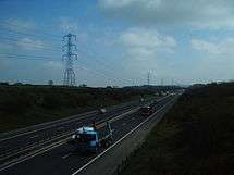
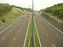
The M65 is a motorway in Lancashire, England. It runs from just south of Preston through the major junction of the M6 and M61 motorways, east past Darwen, Blackburn, Accrington, Burnley, Nelson and ends at Colne.
History
The M65 was opened in the following sections:
- Junctions 1a to 6 in 1997
- Junctions 6 to 7 in 1984
- Junctions 7 to 10 in 1983
- Junctions 10 to 12 in 1981
- Junctions 12 to 13 in 1983
- Junctions 13 to 14 in 1988
The first section of the motorway was opened in 1981, connecting Burnley to Brierfield. Over the years, several extensions were made, the largest being the link from Whitebirk to the M6 and M61 motorways in 1997. This extension was the scene of a standoff between construction security workers and protesters (often known as 'eco-warriors').
Junctions 1a to 6 were opened 18 December 1997 by Jack Straw, Home Secretary and Member of Parliament for Blackburn. The opening ceremony took place on the westbound carriageway beneath junction 5 at Guide with a heavy police presence as protesters threatened to bring a halt to the proceedings.
Much of the 1997 extension was relaid shortly after it opened with a new, quieter tarmac because the amount of road noise had been so great that it prevented birds of prey (mainly owls) from foraging effectively.
Originally, the M65 was planned to go via the town centre of Blackburn.
Features
Unusual spur road
When the M65 was extended, a slip road was built at Walton Summit, southeast of Preston, from the roundabout linking junction 9 of the M61 with junction 2 of the M65 to the Walton Summit industrial estate. It is a single-carriageway road, with two lanes towards the junction (uphill) and one away (downhill). It is around 500 m long and replaced an A-road spur of the A6 that was built in the 1980s.
According to the statutory instrument that authorised its construction, the road is officially classified as a 'special link road to connect the [M65/M61 roundabout] with the all-purpose road known as Tramway Lane'.[1] According to Lancashire County Council, it is the 'M61 Link Tramway Lane to Junction 9' and is part of the M61.[2] In 2007, the approach signs from Walton Summit were modified to read 'M61', but the signs still mark the roundabout at the eastern end.
Management of junctions 10–14
Highways England is responsible only for the 32.4 km section from junction 1a at Farington to junction 10 at Burnley.
The 9.2 km section from junction 10, Burnley, to the M65's eastern terminus at junction 14, Colne, is operated and maintained by Lancashire County Council.
Legislation
Each motorway in England requires that a Statutory Instrument be published, detailing the route of the road, before it can be built. The dates given on these Statutory Instruments relate to when the document was published, and not when the road was built. Provided below is an incomplete list of the Statutory Instruments relating to the route of the M65.
- Statutory Instrument 1991 No. 722: The M65 Motorway (Bamber Bridge to Whitebirk Section, Blackburn Southern Bypass) and Connecting Roads Scheme 1991. S.I. 1991/722
- Statutory Instrument 1992 No. 2651: The M65 Motorway (Bamber Bridge to Whitebirk Section, Blackburn Southern Bypass) and Connecting Roads Scheme 1991 Variation Scheme 1992. S.I. 1992/2651
Junctions
Data from driver location signs are used to provide distance information.[3]
| M65 motorway | ||||
| mile | km | Eastbound exits | Junction | Westbound exits |
| 25.8 | 41.6 | Skipton, Keighley, Nelson, Colne A6068 | J14 Terminus |
Start of motorway |
| 24.4 | 39.3 | Nelson, Kendal A682 | J13 | Nelson A682 |
| 23.3 | 37.5 | Nelson, Brierfield A682 | J12 | Brierfield A682 |
| 21.0 | 33.8 | No access | J11 | Burnley, Nelson (A679, A682) B6434 |
| 19.9 | 32.1 | Burnley (Central), Padiham A671 | J10 | Burnley (Central), Padiham A671 |
| 18.5 | 29.8 | Burnley (West) A679 | J9 | No access |
| 17.3 | 27.8 | Bury, Manchester A56 Clitheroe A6068 |
J8 | Bury, Manchester A56 Clitheroe A6068 |
| 14.5 | 23.3 | Accrington, Clitheroe A6185 | J7 | Accrington A6185 |
| 12.4 | 19.9 | Blackburn (North & East) A678 | J6 | Blackburn (North & East) A678 |
| 10.1 | 16.2 | B6232, Shadsworth A6077 | J5 | B6232, Shadsworth A6077 |
| 8.5 | 13.6 | Blackburn (South), Bolton, Darwen A666, Blackburn with Darwen services | J4 Services |
Blackburn (South), Bolton, Darwen A666, Blackburn with Darwen services |
| 4.9 | 7.9 | Blackburn (West) A674 Bolton A675 |
J3 | Blackburn (West) A674 |
| 2.2 | 3.5 | Manchester, The North West, Lancaster M61 | J2 | Manchester, The North West, Lancaster M61 |
| 0.7 | 1.2 | The South, Birmingham, The North West, Lancaster M6 | J1 | The South, Birmingham, The North West, Lancaster M6 |
| 0.6 | 1.0 | Start of motorway | J1a Terminus |
Preston, Bamber Bridge A6 |
See also
- List of motorways in the United Kingdom
- Mancunian Way, another motorway with a secret number
References
- ↑ "The M65 Motorway (Bamber Bridge to Whitebirk Section, Blackburn Southern Bypass) and Connecting Roads Scheme 1991". Office of Public Sector Information. 1991. Retrieved 10 January 2009.
- ↑ "MARIO". Lancashire County Council. Retrieved 10 January 2009.
- ↑ Driver Location Signs, Highway Agency Area 10 (map) – Highway Authority, 2009
External links
Route map:
- CBRD Motorway Database – M65
- Highways Agency
- Lancashire County Council
- Pathetic Motorways – Walton Summit
- The Motorway Archive – M65
- Amateur documentary of commencement ceremony and early works at Brierfield 1976 YouTube (Pendle Movie Makers)
| Great Britain | .svg.png) | |||||
|---|---|---|---|---|---|---|
| Northern Ireland | ||||||
| Former | ||||||
| Unbuilt | ||||||
| Proposed | ||||||
| Junctions | ||||||
| Related articles | ||||||
| ||||||