South Ribble
Coordinates: 53°41′49″N 2°41′24″W / 53.697°N 2.690°W
| Borough of South Ribble | |
|---|---|
| Borough | |
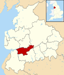 Shown within non-metropolitan Lancashire | |
| Sovereign state | United Kingdom |
| Constituent country | England |
| Region | North West England |
| Ceremonial county | Lancashire |
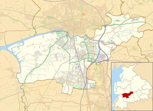
| Admin. HQ | Leyland |
| Government | |
| • Type | South Ribble Borough Council |
| • Leadership: | Leader & Cabinet |
| • Executive: | Conservative |
| • MPs: | Seema Kennedy |
| Area | |
| • Total | 43.6 sq mi (113.0 km2) |
| Area rank | 206th |
| Population (mid-2017 est.) | |
| • Total | 110,400 |
| • Rank | Ranked 216th |
| • Density | 2,500/sq mi (980/km2) |
| Time zone | UTC+0 (Greenwich Mean Time) |
| • Summer (DST) | UTC+1 (British Summer Time) |
| ONS code |
30UN (ONS) E07000126 (GSS) |
| Ethnicity |
98.0% White |
| Website | southribble.gov.uk |
South Ribble is a non-metropolitan district and borough of Lancashire, England. Its council is based in Leyland. The population, at the 2011 Census, was 109,057.[2] In May 2007, the council was officially declared "Excellent" by the Audit Commission, of the best five district councils in the country. The council is the only district council not to be part of the District Councils' Network.
Overview
On 4 October 2007, a team from South Ribble won the LGC Challenge, defeating over 40 other authorities, including larger metropolitan and unitary councils.
South Ribble Borough Council is working in partnership with Chorley Borough Council (a neighbouring authority) on Finance, Procurement, Audit and other centralised functions.
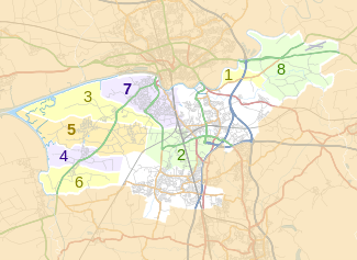
Other notable population areas within South Ribble are Penwortham, Longton, Hutton (headquarters of the Lancashire Police), Walton-le-Dale, Bamber Bridge, Lostock Hall, Moss Side, and part of Buckshaw Village.
The district was formed on 1 April 1974 under the Local Government Act 1972, from Leyland and Walton-le-Dale urban districts, along with part of Preston Rural District.
The Parliamentary Constituency of South Ribble includes the West Lancashire communities of Rufford, Tarleton, Hesketh Bank and Meols.
In February 2017 the district was named as the 'UK's best place to live' for people in their twenties on Channel 4's programme of the same name.
Council affiliation
In the 2007 local elections, South Ribble witnessed a landslide Conservative victory, gaining 24 seats to hold 44 of 55 on the borough council.[3]
After the 2015 local elections, the political make up was Conservative (29 members), Labour (19 members) and Liberal Democrat (2 members).
As of May 2017, the council stood as a Conservative majority run borough.[4] The current political make up is Conservative (29 members), Labour (18 members), Liberal Democrat (2 members) and Independent Labour (1 member).
Parishes
The former urban district areas of Leyland, Lostock Hall, Bamber Bridge and Walton-le-Dale are unparished areas. The rest of the district is divided into the following civil parishes:
Footnotes
- ↑
- ↑ "Non-Metropolitan District population 2011". Retrieved 17 January 2016.
- ↑ "South Ribble". BBC News. Retrieved 2007-05-17.
- ↑ http://www.southribble.gov.uk/Section.asp?sectiontype=listseparate&catid=200033