Goldshaw Booth
| Goldshaw Booth | |
|---|---|
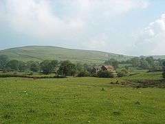 Countryside near Sabden Fold | |
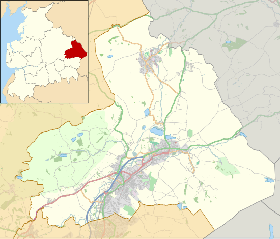 Goldshaw Booth Location in Pendle Borough 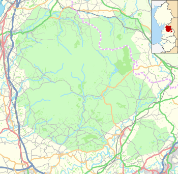 Goldshaw Booth Location in the Forest of Bowland AONB  Goldshaw Booth Goldshaw Booth shown within Lancashire | |
| Population | 248 (2011) |
| OS grid reference | SD8239 |
| Civil parish |
|
| District | |
| Shire county | |
| Region | |
| Country | England |
| Sovereign state | United Kingdom |
| Post town | BURNLEY |
| Postcode district | BB12 |
| Dialling code | 01282 |
| Police | Lancashire |
| Fire | Lancashire |
| Ambulance | North West |
| EU Parliament | North West England |
| UK Parliament | |
Goldshaw Booth is a civil parish in the Pendle district of Lancashire, England. It has a population of 248,[1] and contains the village of Newchurch in Pendle and the hamlets of Spen Brook (53°50′46″N 2°16′01″W / 53.846°N 2.267°W) and Sabden Fold (53°50′28″N 2°17′24″W / 53.841°N 2.290°W). Pendle Hill lies to the north.
The parish adjoins the Pendle parishes of Barley-with-Wheatley Booth, Roughlee Booth, Old Laund Booth and Higham-with-West Close Booth and the Ribble Valley parish of Sabden. It is part of the Forest of Bowland Area of Outstanding Natural Beauty (AONB).[2]
According to the United Kingdom Census 2011, the parish has a population of 248,[1] a decrease from 265 in the 2001 census.[3]
Goldshaw Booth was once a township in the ancient parish of Whalley. This became a civil parish in 1866, forming part of the Burnley Rural District from 1894. The township extended to cover parts of the adjoining villages of Fence and Wheatley Lane,[4] but this part transferred to Old Laund Booth in 1898. Parts of the parish also transferred to Sabden on its creation in 1904,[lower-alpha 1] and Newchurch in Pendle also used to straddle the boundary with Roughlee Booth but was brought entirely within the parish in 1935.[5]
Along with Higham-with-West Close Booth, Barley-with-Wheatley Booth and Roughlee Booth, the parish forms the Higham with Pendleside ward of Pendle Borough Council.[6]
Media gallery
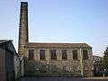 Spenbrook Mill
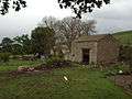 Old barn at Sabden Fold
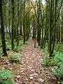 Footpath through a plantation east of Newchurch
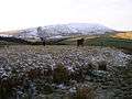 Pendle from Cross Lane in winter
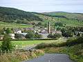 Spen Brook from the south-east
See also
References
Notes
Citations
- 1 2 UK Census (2011). "Local Area Report – Goldshaw Booth Parish (1170215071)". Nomis. Office for National Statistics. Retrieved 11 February 2018.
- ↑ Forest of Bowland map (Map). forestofbowland.com. Lancashire County Council.
- ↑ Office for National Statistics : Census 2001 : Parish Headcounts : Pendle Retrieved 2009-09-18
- 1 2 Lancashire and Furness (Map) (1st ed.). 1 : 10,560. County Series. Ordnance Survey. 1848.
- ↑ "Goldshaw Booth Tn/CP through time". visionofbritain.org.uk. GB Historical GIS / University of Portsmouth. Retrieved 27 June 2015.
- ↑ "Higham with Pendleside". Ordnance Survey Linked Data Platform. Ordnance Survey. Retrieved 2 September 2015.
External links
![]()
- Map of modern parish boundary at Lancashire County Council website
- Goldshaw Booth township - British History Online