Black Moss Reservoirs
| Upper and Lower Black Moss Reservoirs | |
|---|---|
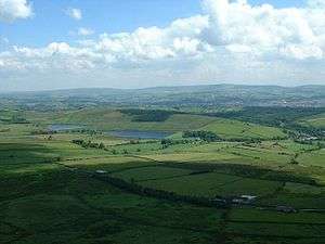 Upper and Lower Black Moss Reservoir viewed from half way up Pendle Hill. | |
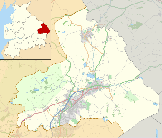 Upper and Lower Black Moss Reservoirs Location in Pendle Borough  Upper and Lower Black Moss Reservoirs Location in Lancashire | |
| Location | Pendle, England |
| Coordinates | 53°52′05″N 2°15′55″W / 53.86806°N 2.26528°WCoordinates: 53°52′05″N 2°15′55″W / 53.86806°N 2.26528°W |
| Built | 1894 and 1903 |
| Surface area | 5.17 and 7.23 ha (12.8 and 17.9 acres) |
| Average depth | 9.45 and 11.8 m (31.0 and 38.7 ft) |
| Water volume | 204,568 and 295,487 m3 (165.846 and 239.555 acre⋅ft) |
| References | [1] |
Upper and Lower Black Moss Reservoirs are reservoirs close to the village of Barley, in the Borough of Pendle, close to the market town of Burnley, England.[2] The reservoirs provide drinking water to Nelson when needed.[1]
Ornithology
During the winter different species of wildfowl can be seen. These include:[1]
- Mallard (Anas platyrhynchos)
- Tufted duck (Aythya fuligula)
- Common goldeneye (Bucephala clangula)
- Goosander (Mergus merganser)
- Common pochard (Aythya ferina)
- Common teal (Anas crecca).
During the summer the number of ducks declines. These are largely replaced by wading birds such as:[1]
- Northern lapwing (Vanellus vanellus)
- Eurasian curlew (Numenius arquata)
- Common redshank (Tringa totanus)
Other birds seen at the reservoir include:[1]
- Linnet (Carduelis cannabina)
- Common stonechat (Saxicola torquatus)
- Skylark (Alauda arvensis)
- Common sandpiper (Actitis hypoleucos)
- Reed bunting (Emberiza schoeniclus)
References
- 1 2 3 4 5 United Utilities. "Black Moss Reservoirs" (PDF). Retrieved August 4, 2010.
- ↑ Walks in Yorkshire. "Circular from Barley via Pendle Hill and Ogden Clough Reservoirs". Retrieved August 4, 2010.
| Wikimedia Commons has media related to Black Moss Reservoirs. |
This article is issued from
Wikipedia.
The text is licensed under Creative Commons - Attribution - Sharealike.
Additional terms may apply for the media files.