| [2] |
Name on the Register |
Image |
Date listed[3] |
Location |
City or town |
Description |
|---|
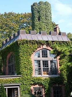
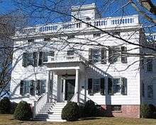
| 1 |
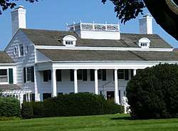
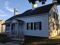
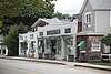
Balcastle |
|
October 2, 1986
(#86002722) |
NW corner of Herrick and Little Plains Roads
40°53′02″N 72°23′04″W / 40.883889°N 72.384444°W / 40.883889; -72.384444 (Balcastle) |
Southampton |
|
| 2 |
Beach Road Historic District |
|
October 2, 1986
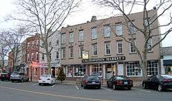
(#86002723) |
Between Shinnecock and Halsely Neck Roads on Beach Road at Barrier Beach
40°51′44″N 72°25′03″W / 40.862222°N 72.4175°W / 40.862222; -72.4175 (Beach Road Historic District) |
Southampton |
|
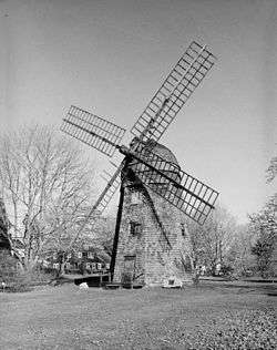
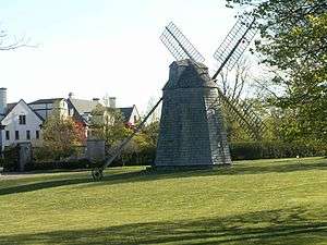
| 3 |
Beebe Windmill |
|
December 27, 1978
(#78001918) |
SE corner of Ocean Road and Hildreth Avenue
40°56′03″N 72°18′05″W / 40.934167°N 72.301389°W / 40.934167; -72.301389 (Beebe Windmill) |
Bridgehampton |
|
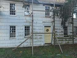
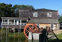
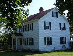
| 4 |
James Benjamin Homestead |
|
August 13, 1986
(#86001510) |
1182 Flanders Road
40°54′11″N 72°37′04″W / 40.903056°N 72.617778°W / 40.903056; -72.617778 (James Benjamin Homestead) |
Flanders |
|
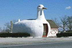
| 5 |
The Big Duck |
|
April 28, 1997
(#97000164) |
NY 24, NW of jct. with Bellows Pond Road, Town of Southampton
40°54′25″N 72°37′20″W / 40.906944°N 72.622222°W / 40.906944; -72.622222 (The Big Duck) |
Flanders |
Moved two miles northwest of previous location in 2007 |
| 6 |
Big Duck Ranch |
|
September 12, 2008
(#08000866) |
1012 NY 24
40°54′27″N 72°37′23″W / 40.907614°N 72.622947°W / 40.907614; -72.622947 (Big Duck Ranch) |
Flanders |
Also called the Maurer Duck Farm; Used for The Big Duck (see above), after nearly several moves along Flanders Road |
| 7 |
Dr. Wesley Bowers House |
|
October 2, 1986
(#86002699) |
Beach Road (just west of "Road C")
40°51′19″N 72°26′01″W / 40.855278°N 72.433611°W / 40.855278; -72.433611 (Dr. Wesley Bowers House) |
Southampton |
|
| 8 |
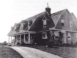
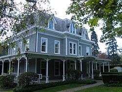
James L. Breese House |
|
April 18, 1980
(#80002778) |
155 Hill Street
40°53′06″N 72°23′56″W / 40.885°N 72.398889°W / 40.885; -72.398889 (James L. Breese House) |
Southampton |
|
| 9 |
Bridgehampton Presbyterian Church |
|
February 14, 2017
(#100000649) |
2429 Montauk Hwy.
40°56′10″N 72°18′12″W / 40.936049°N 72.303237°W / 40.936049; -72.303237 (Bridgehampton Presbyterian Church) |
Bridgehampton |
|
| 10 |
William Cauldwell House |
|
May 4, 2009
(#09000305) |
51 Peconic Avenue
40°59′24″N 72°22′21″W / 40.989886°N 72.372592°W / 40.989886; -72.372592 (William Cauldwell House) |
Noyack |
|
| 11 |
William Merritt Chase Homestead |
|
June 16, 1983
(#83001808) |
Canoe Place Road and Bathing Beach Road (east of Peconic Road)
40°53′15″N 72°28′38″W / 40.887475°N 72.477184°W / 40.887475; -72.477184 (William Merritt Chase Homestead) |
Shinnecock Hills |
|
| 12 |
COIMBRA (shipwreck and remains) |
|
September 25, 2013
(#13000779) |
Address Restricted
|
Westhampton |
From World War II Shipwrecks along the East Coast and Gulf of Mexico MPS |
| 13 |
William Corwith House |
|
July 13, 2013
(#13000463) |
2368 Montauk Hwy.
40°56′10″N 72°18′21″W / 40.935994°N 72.305757°W / 40.935994; -72.305757 (William Corwith House) |
Bridgehampton |
Currently the headquarters of the Bridgehampton Historical Society |
| 14 |
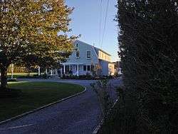
Crowther House |
|
March 21, 1985
(#85000630) |
97 Beach Lane
40°48′16″N 72°38′03″W / 40.804444°N 72.634167°W / 40.804444; -72.634167 (Crowther House) |
Westhampton Beach |
|
| 15 |
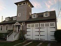
William A. Farnum Boathouse |
|
November 9, 2017
(#100001809) |
52 Actor's Colony Rd.
41°02′08″N 72°18′26″W / 41.03565°N 72.30721°W / 41.03565; -72.30721 (William A. Farnum Boathouse) |
Sag Harbor |
1915 boathouse is sole surviving intact structure associated with the life of early 20th century movie star William Farnum |
| 16 |
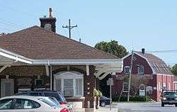
First Presbyterian Church |
|
April 19, 1994
(#94001194) |
44 Union Street
40°59′50″N 72°17′39″W / 40.997222°N 72.294167°W / 40.997222; -72.294167 (First Presbyterian Church) |
Sag Harbor |
Egyptian revival church designed by Minard Lafever; steeple lost in 1938 hurricane |
| 17 |
Foster-Meeker House |
|
August 26, 2009
(#09000656) |
101 Mill Road
40°48′44″N 72°38′36″W / 40.812342°N 72.643447°W / 40.812342; -72.643447 (Foster-Meeker House) |
Westhampton Beach |
|
| 18 |
Capt. C. Goodale House |
|
October 2, 1986
(#86002725) |
300 Hampton Road
40°53′29″N 72°22′51″W / 40.891389°N 72.380833°W / 40.891389; -72.380833 (Capt. C. Goodale House) |
Southampton |
|
| 19 |
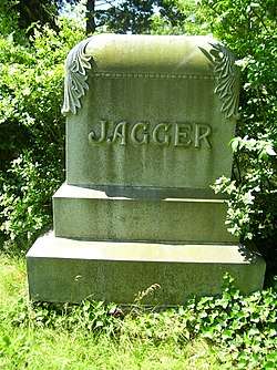
Jagger House |
|
December 12, 1978
(#78001920) |
Old Montauk Highway
40°49′00″N 72°40′38″W / 40.816667°N 72.677222°W / 40.816667; -72.677222 (Jagger House) |
Westhampton |
|
| 20 |
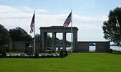
Maycroft |
|
February 24, 1995
(#95000158) |
Ferry Road (NY 114)
41°00′33″N 72°18′35″W / 41.009167°N 72.309722°W / 41.009167; -72.309722 (Maycroft) |
North Haven |
|
| 21 |
North Main Street Historic District |
|
October 2, 1986
(#86002730) |
North Main Street near CR 39 and Railroad Station Plaza
40°53′45″N 72°23′27″W / 40.895833°N 72.390833°W / 40.895833; -72.390833 (North Main Street Historic District) |
Southampton |
|
| 22 |
Quogue Cemetery |
|
December 11, 2013
(#13000914) |
58 Lamb Ave
40°49′01″N 72°36′18″W / 40.816932°N 72.604906°W / 40.816932; -72.604906 (Quogue Cemetery) |
Quogue |
Graves of early settlers date to mid-18th century, with distinctive period funerary art. |
| 23 |
Quogue Historic District |
|
February 2, 2016
(#15001028) |
Quogue Historic District
40°49′07″N 72°36′15″W / 40.818596°N 72.604122°W / 40.818596; -72.604122 (Quogue Historic District) |
Quogue |
District covering most of village shows slow transition from agricultural town to seaside vacation destination. |
| 24 |
Quogue Life-Saving Station |
|
May 27, 1999
(#99000640) |
78 Dune Road
40°48′26″N 72°36′00″W / 40.807222°N 72.6°W / 40.807222; -72.6 (Quogue Life-Saving Station) |
Quogue |
|
| 25 |
Rev. Paul Cuffee Gravesite |
|
October 8, 2010
(#10000852) |
North side of Montauk Highway opposite 216 East Montauk Highway
40°53′45″N 72°23′27″W / 40.895833°N 72.390833°W / 40.895833; -72.390833 (Rev. Paul Cuffee Gravesite) |
Hampton Bays |
Cemeteries of the Town of Southampton, 1640-1930 MPS |
| 26 |
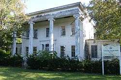
Rogers Mansion Museum Complex |
|
January 10, 2012
(#11001010) |
17 Meetinghouse Ln.
40°58′37″N 72°08′10″W / 40.976828°N 72.136236°W / 40.976828; -72.136236 (Rogers Mansion Museum Complex) |
Southampton |
1843 Greek Revival mansion built for whaling captain; now used as the Southampton Historical Museums |
| 27 |
Nathaniel Rogers House |
|
March 15, 2005
(#05000170) |
2539 Montauk Highway
40°56′15″N 72°18′04″W / 40.9375°N 72.301111°W / 40.9375; -72.301111 (Nathaniel Rogers House) |
Bridgehampton |
|
| 28 |
Rosemary Lodge |
|
January 14, 2000
(#99001681) |
322 Rose Hill Road
40°54′39″N 72°20′19″W / 40.910833°N 72.338611°W / 40.910833; -72.338611 (Rosemary Lodge) |
Water Mill |
|
| 29 |
Sag Harbor Village District |
|
July 20, 1973
(#73001274) |
Roughly bounded by Sag Harbor, Rysam, Hamilton, Marsden, Main and Long Island Avenues
40°59′50″N 72°17′44″W / 40.997222°N 72.295556°W / 40.997222; -72.295556 (Sag Harbor Village District) |
Sag Harbor |
|
| 30 |
Sagaponack Historic District |
|
June 2, 2000
(#00000582) |
Roughly along Main Street
40°55′29″N 72°16′40″W / 40.924722°N 72.277778°W / 40.924722; -72.277778 (Sagaponack Historic District) |
Sagaponack |
|
| 31 |
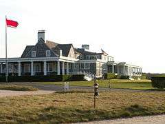
Shinnecock Hills Golf Club |
|
September 29, 2000
(#00001211) |
Between County Road and Sebonac Road
40°53′46″N 72°26′28″W / 40.896111°N 72.441111°W / 40.896111; -72.441111 (Shinnecock Hills Golf Club) |
Southampton |
|
| 32 |
Southampton Village Historic District |
|
April 25, 1988
(#86002726) |
Roughly bounded by Hill and Main Streets, Old Town Road, Atlantic Ocean, Coopers Neck and Halsey Neck Lanes
40°52′37″N 72°23′35″W / 40.876944°N 72.393056°W / 40.876944; -72.393056 (Southampton Village Historic District) |
Southampton |
|
| 33 |
Ellis Squires Jr. House |
|
November 9, 2017
(#100001811) |
186 and 190 Newtown Rd.
40°53′48″N 72°31′35″W / 40.89676°N 72.52632°W / 40.89676; -72.52632 (Ellis Squires Jr. House) |
Hampton Bays |
1785 Federal style building is oldest surviving house in Hampton Bays |
| 34 |
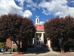
US Post Office-Westhampton Beach |
|
May 11, 1989
(#88002446) |
170 Main Street[4]
40°48′36″N 72°38′28″W / 40.81°N 72.641111°W / 40.81; -72.641111 (US Post Office-Westhampton Beach) |
Westhampton Beach |
|
| 35 |
Water Mill |
|
October 13, 1983
(#83004175) |
Old Mill Road
40°54′33″N 72°21′24″W / 40.909167°N 72.356667°W / 40.909167; -72.356667 (Water Mill) |
Water Mill |
|
| 36 |
Wickapogue Road Historic District |
|
October 2, 1986
(#86002697) |
Wickapogue Road between Narrow Lane and Cobb Road
40°53′01″N 72°22′03″W / 40.883611°N 72.3675°W / 40.883611; -72.3675 (Wickapogue Road Historic District) |
Southampton |
|
| 37 |
Windmill at Water Mill |
|
December 27, 1978
(#78001919) |
NY 27 and Halsey Lane
40°54′34″N 72°21′15″W / 40.909444°N 72.354167°W / 40.909444; -72.354167 (Windmill at Water Mill) |
Water Mill |
|