Le Ray, New York
| Le Ray, New York | |
|---|---|
| Town | |
 Le Ray  Le Ray | |
| Coordinates: 44°4′34″N 75°48′32″W / 44.07611°N 75.80889°WCoordinates: 44°4′34″N 75°48′32″W / 44.07611°N 75.80889°W | |
| Country | United States |
| State | New York |
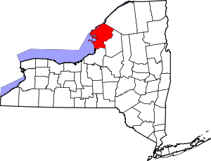
| County | Jefferson |
| Named for | Jacques-Donatien Le Ray, Comte de Chaumont |
| Government | |
| • Type | Town Council |
| • Town Supervisor | Ronald C. Taylor (R) |
| • Town Council |
Members' List
|
| Area[1] | |
| • Total | 73.98 sq mi (191.61 km2) |
| • Land | 73.61 sq mi (190.64 km2) |
| • Water | 0.37 sq mi (0.97 km2) |
| Elevation | 459 ft (140 m) |
| Population (2010) | |
| • Total | 21,782 |
| • Estimate (2016)[2] | 21,693 |
| • Density | 294.71/sq mi (113.79/km2) |
| Time zone | UTC-5 (Eastern (EST)) |
| • Summer (DST) | UTC-4 (EDT) |
| ZIP code | 13637 |
| Area code(s) | 315 |
| FIPS code | 36-045-42015 |
| GNIS feature ID | 0979141 |
| Website |
www |
Le Ray is a town in Jefferson County, New York, United States. The population was 21,782 at the 2010 census,[3] up from 19,840 at the 2000 census. The town is named for Jacques-Donatien Le Ray, known as a French "father of the American Revolution".
The town is in the central part of the county and is northeast of Watertown.
History
Archaeological remains show the presence of aboriginal natives in the town.
The region was part of Macomb's Purchase and was acquired by Gouverneur Morris and James Le Ray in 1800. Settlement began around 1802.
The town was formed in 1806 and included a large portion of northern Jefferson County. Parts of the town were used to create the towns of Wilna, Alexandria, Theresa, Antwerp, and Philadelphia.
Many of the historic settlements of the town were abandoned due to the formation of Fort Drum, which occupies the eastern half of the town.
The LeRaysville Archeological District was listed on the National Register of Historic Places in 1995.[4]
Geography
According to the United States Census Bureau, the town has a total area of 74.0 square miles (191.7 km2), of which 190.7 square miles (494 km2) are land and 0.3 square miles (0.9 km2), or 0.49%, are water.[3] The Black River marks the south town border.
U.S. Route 11 is a northeast-southwest highway through Le Ray. New York State Route 3 passes across the southeast part of Le Ray. New York State Route 26 is a north-south highway. New York State Route 37 is a north-south highway in the western part of Le Ray. New York State Route 342 crosses the south part of the town.
Demographics
| Historical population | |||
|---|---|---|---|
| Census | Pop. | %± | |
| 1820 | 2,944 | — | |
| 1830 | 3,430 | 16.5% | |
| 1840 | 3,721 | 8.5% | |
| 1850 | 3,654 | −1.8% | |
| 1860 | 3,159 | −13.5% | |
| 1870 | 2,862 | −9.4% | |
| 1880 | 2,660 | −7.1% | |
| 1890 | 2,565 | −3.6% | |
| 1900 | 2,576 | 0.4% | |
| 1910 | 2,555 | −0.8% | |
| 1920 | 2,366 | −7.4% | |
| 1930 | 2,422 | 2.4% | |
| 1940 | 2,551 | 5.3% | |
| 1950 | 2,821 | 10.6% | |
| 1960 | 3,627 | 28.6% | |
| 1970 | 3,973 | 9.5% | |
| 1980 | 5,039 | 26.8% | |
| 1990 | 17,973 | 256.7% | |
| 2000 | 19,840 | 10.4% | |
| 2010 | 21,782 | 9.8% | |
| Est. 2016 | 21,693 | [2] | −0.4% |
| U.S. Decennial Census[5] | |||
As of the census[6] of 2000, there were 19,836 people, 4,998 households, and 4,303 families residing in the town. The population density was 269.1 people per square mile (103.9/km²). There were 5,245 housing units at an average density of 71.2 per square mile (27.5/km²). The racial makeup of the town was 70.48% White, 16.36% African American, 0.79% Native American, 2.06% Asian, 0.49% Pacific Islander, 6.09% from other races, and 3.73% from two or more races. Hispanic or Latino of any race were 10.94% of the population.
There were 4,998 households out of which 58.9% had children under the age of 18 living with them, 76.0% were married couples living together, 7.3% had a female householder with no husband present, and 13.9% were non-families. 10.9% of all households were made up of individuals and 3.2% had someone living alone who was 65 years of age or older. The average household size was 3.04 and the average family size was 3.28.
In the town, the population was spread out with 27.8% under the age of 18, 27.9% from 18 to 24, 34.7% from 25 to 44, 6.8% from 45 to 64, and 2.7% who were 65 years of age or older. The median age was 23 years. For every 100 females, there were 145.9 males. For every 100 females age 18 and over, there were 167.5 males.
The median income for a household in the town was $33,359, and the median income for a family was $33,806. Males had a median income of $21,541 versus $21,074 for females. The per capita income for the town was $14,140. About 7.8% of families and 9.1% of the population were below the poverty line, including 10.1% of those under age 18 and 8.8% of those age 65 or over.
Communities and locations in Le Ray
- Black River – A village on the south town line along the Black River.
- Calcium – A hamlet and census-designated place west of Fort Drum.
- Doolins Crossing – A location by the eastern corner of the town.
- Dutch Settlement – A hamlet in the north part of the town on County Road 18.
- Evans Mills – A village in the center of the town on the west side of Fort Drum, north of US-11.
- Five Corners – A location in the southwest part of Le Ray.
- Fort Drum – Part of the military reservation occupies the eastern half of the town.
- Gould Corners – A location southeast of Evans Mills, located on US-11.
- Gracey Corners – A location in the southwest of Le Ray.
- Hall Corners – A location near the northeast town line.
- Pine Plains – A location near the eastern corner of the town.
- Westwood Corners – A location on US-11 near the northeast town line.
References
- ↑ "2016 U.S. Gazetteer Files". United States Census Bureau. Retrieved Jul 5, 2017.
- 1 2 "Population and Housing Unit Estimates". Retrieved June 9, 2017.
- 1 2 "Geographic Identifiers: 2010 Census Summary File 1 (G001): Le Ray town, Jefferson County, New York". American Factfinder. U.S. Census Bureau. Retrieved August 30, 2018.
- ↑ National Park Service (2010-07-09). "National Register Information System". National Register of Historic Places. National Park Service.
- ↑ "Census of Population and Housing". Census.gov. Retrieved June 4, 2015.
- ↑ "American FactFinder". United States Census Bureau. Retrieved 2008-01-31.