Oxbow, New York
| Oxbow, New York | |
|---|---|
| Census-designated place | |
 Oxbow  Oxbow | |
| Coordinates: 44°17′14″N 75°37′24″W / 44.28722°N 75.62333°WCoordinates: 44°17′14″N 75°37′24″W / 44.28722°N 75.62333°W | |
| Country | United States |
| State | New York |
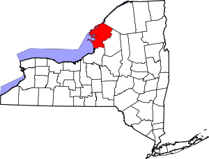
| County | Jefferson |
| Town | Antwerp |
| Area | |
| • Total | 0.20 sq mi (0.52 km2) |
| • Land | 0.20 sq mi (0.52 km2) |
| • Water | 0.0 sq mi (0.0 km2) |
| Elevation | 351 ft (107 m) |
| Population (2010) | |
| • Total | 108 |
| • Density | 534/sq mi (206.1/km2) |
| Time zone | UTC-5 (Eastern (EST)) |
| • Summer (DST) | UTC-4 (EDT) |
| Area code(s) | 315 |
| FIPS code | 36-55937 |
| GNIS feature ID | 0959708 |
Oxbow is a hamlet and census-designated place (CDP) in the town of Antwerp, Jefferson County, New York, United States. As of the 2010 census it had a population of 108.[1]
History
It was founded in 1817 by Abraham Cooper, an ancestor of Ambassador Charles W. Yost. Located at Oxbow is the Dr. Abner Benton House (1819), listed on the National Register of Historic Places in 1984.[2]
Geography
Oxbow is in northern Jefferson County, in the northern part of the town of Antwerp. It sits at the south end of a sharp bend in the Oswegatchie River at an altitude of 351 feet (107 m). According to the United States Census Bureau, the CDP has a total area of 0.20 square miles (0.52 km2), all of it recorded as land.[1]
Oxbow is 29 miles (47 km) northeast of Watertown, the Jefferson county seat, and 9 miles (14 km) southwest of Gouverneur.
References
- 1 2 "Geographic Identifiers: 2010 Census Summary File 1 (G001): Oxbow CDP, New York". American Factfinder. U.S. Census Bureau. Retrieved October 4, 2018.
- ↑ National Park Service (2009-03-13). "National Register Information System". National Register of Historic Places. National Park Service.