Interstate 78
| |
|---|---|
|
I-78 highlighted in red | |
| Route information | |
| Maintained by PENNDOT, DRJTBC, NJDOT, NJTA, and PANYNJ | |
| Length | 143.56 mi[1] (231.04 km) |
| Existed | 1957 – present |
| Major junctions | |
| West end |
|
| |
| East end | Canal Street in New York, NY |
| Location | |
| States | Pennsylvania, New Jersey, New York |
| Highway system | |

Interstate 78 (I-78) is an Interstate Highway in the Northeast United States, running 144 miles (231 km) from Interstate 81 northeast of Harrisburg, Pennsylvania, through Allentown, Pennsylvania, and western and northern New Jersey to the Holland Tunnel and Lower Manhattan in New York City.
I-78 is a major road linking ports in the New York City and New Jersey area to points west, and sees over 4 million trucks annually, with trucks representing 24% of all traffic. It also is a major connection point toward airports in the New York area, including Newark Airport, John F. Kennedy Airport, and LaGuardia Airport. I-78 serves as a major connecting route from New York City to New Jersey via the Holland Tunnel.
Route description
Pennsylvania

I-78 begins at a directional-T interchange with I-81 in Union Township, Lebanon County, Pennsylvania, about 25 miles (40 km) northeast of Harrisburg. Near the east end of the county, at exit 8, U.S. Route 22 (US 22) merges with I-78, running concurrently for the next 43 miles (69 km).[2]
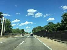
At exit 51, in Upper Macungie Township, US 22 leaves the highway. Passengers traveling on I-78 eastbound must use this exit to access I-476 (Northeast Extension of the Pennsylvania Turnpike), and westbound travelers must use exit 53 (northbound Pennsylvania Route 309 (PA 309)) and then westbound US 22. From exits 53 to 60, I-78 runs concurrently with PA 309. The six-lane overlap bypasses the City of Allentown to the south and crosses South Mountain.[3][4]
At exit 60 (A-B going westbound), PA 309 south leaves for Quakertown.[5] 6 miles (9.7 km) later, there is an interchange between PA 412 and I-78 in Hellertown. PA 412 also goes to Bethlehem and Lehigh University. At mile marker 71, PA 33 intersects with I-78 at a trumpet interchange. PA 33 traverses the Pocono Mountains and goes to Bangor and I-80. The final exit on I-78 in Pennsylvania is for Morgan Hill Road, which goes to PA 611 and Easton. I-78 then crosses the Interstate 78 Toll Bridge and enters New Jersey.
New Jersey
After the Interstate 78 Toll Bridge, I-78 enters New Jersey as the Phillipsburg–Newark Expressway.[6] The road begins by running parallel with County Route 642 (CR 642) in the town of Alpha. At 3.94 miles (6.34 km), Exit 3, a partial cloverleaf interchange brings together US 22, NJ 122, and NJ 173 with Interstate 78 in Phillipsburg.[7] US 22 now runs concurrently with I-78 for the next 15 miles (24 km). Going westbound, exit 4 leaves to the right for CR 637 and Warren Glen. The next exit, Exit 6, is for CR 632 in Bloomsbury. However the route number is not signed on I-78. Exit 7 is the first of several eastbound exits for NJ 173. This one is located in Bloomsbury as NJ 173 begins to parallel the interstate. 4 miles (6.4 km) later, Exit 11 leaves to the right as another exit for NJ 173. CR 614 also is located off the exit. Exit 12, westbound is for NJ 173 again. However, Exit 12 eastbound is for a frontage road parallelling I-78.

Exit 13 is only westbound and is another exit for NJ 173. Nearby the exit, going eastbound, the frontage road merges in.[7] Exit 15 is for NJ 173 and CR 513 in Franklin Township. Exit 17 is for NJ 31 in Clinton. In the town of Annandale, US 22 leaves I-78 at exit 18. US 22 continues towards Bound Brook and Union County. At exit 20, CR 639 intersects. CR 639 heads towards the Round Valley Recreational Area. Exit 24 is for CR 523 towards Oldwick. At exit 29, I-287, US 202, and US 206 interchange with I-78 in Bedminster. At this point, in Somerset County, Exits 33, 36 and 40 are for county routes in Warren Township. At exit 41, I-78 enters Union County.[7] At exit 45, CR 527 intersects after paralleling for some time. West of exit 48, I-78 splits into express and local highways. Exit 48 is for NJ 24 in Springfield. Exit 49A is for one of Route 24's spur routes, NJ 124. Exit 52 is for the Garden State Parkway in Union. At Exits 57 and 58, NJ 21, US 1, US 9, and US 22 intersect I-78. The exit provides access to Newark Liberty International Airport.
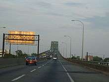
East of exit 58 at the eastern tip of Newark, I-78 becomes the Newark Bay Extension of the New Jersey Turnpike. Past the first toll plaza, I-78 has an interchange with I-95 (The New Jersey Turnpike) and crosses Newark Bay via the Newark Bay Bridge.[7] The first exit, 14A, is for NJ 440 in Bayonne. The Liberty State Park can be reached by taking Exit 14B. Exit 14C is the final numbered exit, providing access to the Liberty Science Center. NJ 139 runs concurrently with I-78 as it approaches the Holland Tunnel and enters New York.
New York City
I-78's length in New York is only 0.5 miles (0.80 km)—half of the Holland Tunnel and the egress-only roundabout immediately beyond the end of the tunnel. The route was planned to run east and north through New York City to end at I-95 in the Bronx, but sections of the planned route, including the Lower Manhattan Expressway, were cancelled.
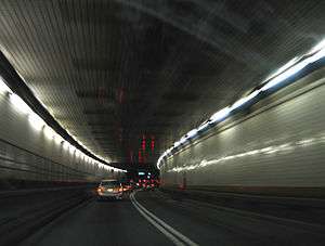
In New York City, I-78 continues through the limited access egress-only roundabout known as the Saint John's Rotary. The five separate exits from the Rotary are assigned numbers—exits 1 to 5—in counterclockwise order. The last one—and the logical continuation east—is Exit 5, Canal Street. Under the original plans, I-78 was to continue across Manhattan as the Lower Manhattan Expressway onto the Williamsburg Bridge, and then beyond I-278 on the never-built Bushwick Expressway through Brooklyn into Queens near the John F. Kennedy Airport. A section of I-78 at the airport was built as the Nassau Expressway, later I-878 and now NY 878, though most of the westbound side was never built. East of the airport, I-78 would have turned north on the Clearview Expressway (built north of Hillside Avenue in Queens and now I-295), run across the Throgs Neck Bridge, and forked into two spurs, ending at I-95 via the Throgs Neck Expressway (now I-695) and the Bruckner Interchange via the Cross Bronx Expressway (now part of I-295).[8]
Junction list
- Pennsylvania


- New Jersey


- New York
- Canal Street in Lower Manhattan
Auxiliary routes

All of I-78's auxiliary routes serve New York City; however, none of these routes actually intersect I-78, following the route's truncation at the eastern end of the Holland Tunnel.


- A former I-878 existed from 1959 to 1972 along present I-278 east of I-895. (I-895 was part of I-278.)
| |
|---|---|
| Location | Bethlehem, Pennsylvania |
| Existed | 1968–1971 |
In eastern Pennsylvania, PA 378 into downtown Bethlehem was once I-378, but was redesignated as a state route after I-78 was rerouted to a new southerly alignment.
| |
|---|---|
| Location | Allentown, Pennsylvania |
| Existed | 1950s–1971 |
I-178 was initially planned as an extension into downtown Allentown, but was canceled due to local opposition.
References
- ↑ Federal Highway Administration (October 31, 2002). "Table 1". Route Log and Finder List. Retrieved March 28, 2007.
- ↑ Google (August 31, 2007). "Overview Map of I-78 in Lebanon, Berks, and Lehigh Counties" (Map). Google Maps. Google. Retrieved August 31, 2007.
- ↑ Google (August 31, 2007). "Overview Map of I-78 Southeast of Allentown" (Map). Google Maps. Google. Retrieved August 31, 2007.
- ↑ Google (August 31, 2007). "Overview Satellite Image of I-78 with Six Lanes" (Map). Google Maps. Google. Retrieved August 31, 2007.
- ↑ Google (August 31, 2007). "Interstate 78 in Pennsylvania" (Map). Google Maps. Google. Retrieved August 31, 2007.
- ↑ New Jersey Department of Transportation. "Interstate 78 Straight Line Diagram" (PDF). Retrieved August 31, 2007.
- 1 2 3 4 Google (August 31, 2007). "I-78, New Jersey, United States" (Map). Google Maps. Google. Retrieved August 31, 2007.
- ↑ NYSDOT - Traffic Count Information
External links
Route map:

| ||
| Signed | |
|---|---|
| Unsigned | |
| Lists | |
| Other | |
Major Interstates highlighted | |