National Register of Historic Places listings in Doña Ana County, New Mexico
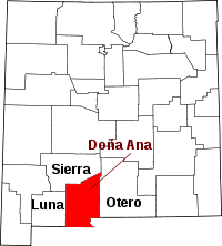
Location of Doña Ana County in New Mexico
This is a list of the National Register of Historic Places listings in Doña Ana County, New Mexico.
This is intended to be a complete list of the properties and districts on the National Register of Historic Places in Doña Ana County, New Mexico, United States. Latitude and longitude coordinates are provided for many National Register properties and districts; these locations may be seen together in a map.[1]
There are 34 properties and districts listed on the National Register in the county, including 2 National Historic Landmarks. All of the places within the county on the National Register are also listed on the State Register of Cultural Properties.
- This National Park Service list is complete through NPS recent listings posted October 11, 2018.[2]
| Bernalillo – Catron – Chaves – Cibola – Colfax – Curry – De Baca – Doña Ana – Eddy – Grant – Guadalupe – Harding – Hidalgo – Lea – Lincoln – Los Alamos – Luna – McKinley – Mora – Otero – Quay – Rio Arriba – Roosevelt – San Juan – San Miguel – Sandoval – Santa Fe – Sierra – Socorro – Taos – Torrance – Union – Valencia |
Current listings
| [3] | Name on the Register[4] | Image | Date listed[5] | Location | City or town | Description |
|---|---|---|---|---|---|---|
| 1 | Air Science | 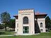 |
May 16, 1989 (#88001546) |
Northeastern corner of N. Horseshoe and Espina St. on the New Mexico State University campus 32°17′00″N 106°45′19″W / 32.283333°N 106.755278°W |
Las Cruces | Today the William Conroy Honors Center |
| 2 | Alameda-Depot Historic District | 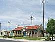 |
April 11, 1985 (#85000786) |
Includes properties centered around Pioneer Park and extending up Alameda Boulevard 32°18′45″N 106°47′01″W / 32.3125°N 106.783611°W |
Las Cruces | |
| 3 | Nestor Armijo House | 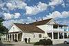 |
December 12, 1976 (#76001195) |
Lohman Ave. and Church St. 32°18′20″N 106°46′35″W / 32.305556°N 106.776389°W |
Las Cruces | |
| 4 | Barela-Reynolds House | 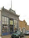 |
January 20, 1978 (#78001815) |
Off State Road 292 32°16′27″N 106°47′43″W / 32.274167°N 106.795278°W |
Mesilla | State Historic Site |
| 5 | L.B. Bentley General Merchandise | 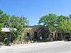 |
March 22, 2006 (#06000155) |
16125 Old Organ Main St. 32°25′40″N 106°35′55″W / 32.427778°N 106.598611°W |
Organ | |
| 6 | Thomas Branigan Memorial Library | 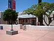 |
September 15, 2004 (#04000981) |
106 W. Hadley St. 32°18′52″N 106°46′48″W / 32.314444°N 106.78°W |
Las Cruces | Original library building; replaced by newer facility in 1979 |
| 7 | Camino Real-Rincon Arroyo-Perrillo Section |  |
April 8, 2011 (#11000172) |
Address Restricted |
Rincon vicinity | part of the Camino Real in New Mexico, AD 1598-1881 Multiple Property Submission |
| 8 | Camino Real-San Diego South | |
April 8, 2011 (#11000165) |
Address Restricted |
Rincon vicinity | part of the Camino Real in New Mexico, AD 1598-1881 Multiple Property Submission |
| 9 | Camino Real-San Diego North South Section | |
April 8, 2011 (#11000166) |
Address Restricted |
Radium Springs vicinity | part of the Camino Real in New Mexico, AD 1598-1881 Multiple Property Submission |
| 10 | Chope's Town Cafe and Bar |  |
May 26, 2015 (#15000262) |
16145 NM 28 32°07′10″N 106°42′22″W / 32.1195°N 106.7062°W |
La Mesa | |
| 11 | Dona Ana Village Historic District | September 27, 1996 (#96001042) |
Roughly bounded by the Dona Ana lateral irrigation ditch, Interstate 25, State Road 320, and Dona Ana School Rd. 32°23′17″N 106°48′56″W / 32.388056°N 106.815556°W |
Doña Ana | ||
| 12 | Paul Laurence Dunbar Elementary School | 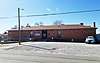 |
February 7, 2017 (#100000630) |
325 Holguin Rd. 32°07′06″N 106°39′46″W / 32.118213°N 106.662733°W |
Vado | |
| 13 | Elephant Butte Irrigation District | August 8, 1997 (#97000822) |
Roughly along U.S. Route 85 between its junction with State Road 90 and the El Paso city limits 32°12′58″N 106°57′31″W / 32.216111°N 106.958611°W |
Las Cruces | Extends into Sierra County and El Paso County, Texas | |
| 14 | Fort Fillmore | |
July 30, 1974 (#74001196) |
Address Restricted |
Las Cruces | |
| 15 | Fort Selden | 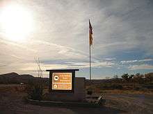 |
July 9, 1970 (#70000401) |
18 miles north of Las Cruces 32°29′45″N 106°55′30″W / 32.495833°N 106.925°W |
Las Cruces | State Historic Site |
| 16 | Foster Hall | 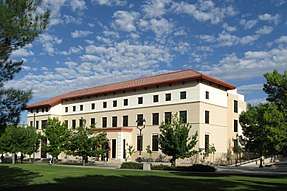 |
May 16, 1989 (#88001547) |
Southeastern corner of the junction of S. Horseshoe and Sweet on the New Mexico State University campus 32°16′53″N 106°45′09″W / 32.281389°N 106.7525°W |
Las Cruces | |
| 17 | Goddard Hall | 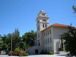 |
September 22, 1988 (#88001548) |
S. Horseshoe between Espina and Sweet on the New Mexico State University campus 32°16′53″N 106°45′13″W / 32.281389°N 106.753611°W |
Las Cruces | |
| 18 | Green Bridge | 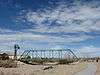 |
August 21, 2008 (#08000791) |
4100 Dripping Springs Rd. 32°17′56″N 106°43′13″W / 32.29885°N 106.72015°W |
Las Cruces | |
| 19 | Hadley-Ludwick House | 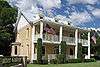 |
April 3, 1991 (#91000352) |
2640 El Paseo 32°16′59″N 106°45′42″W / 32.283056°N 106.761667°W |
Las Cruces | |
| 20 | International Boundary Marker No. 1, U.S. and Mexico | 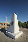 |
September 10, 1974 (#74001195) |
West of El Paso off Interstate 10 31°47′03″N 106°31′45″W / 31.784167°N 106.529167°W |
Sunland Park | |
| 21 | Frank and Amelia Jones House | 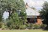 |
July 25, 2014 (#14000444) |
18000 Castillo Rd. 32°08′42″N 106°43′02″W / 32.1449°N 106.7171°W |
La Mesa | |
| 22 | La Mesilla Historic District | 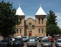 |
July 20, 1982 (#82003323) |
Roughly bounded by Calle del Norte, Calle del El Paso, Calle del Cura and Calleion Guerro 32°16′49″N 106°47′39″W / 32.280278°N 106.794167°W |
Mesilla | |
| 23 | Launch Complex 33 | .jpg) |
October 3, 1985 (#85003541) |
White Sands Missile Range 32°24′04″N 106°22′40″W / 32.401111°N 106.377778°W |
White Sands Missile Range | |
| 24 | Mesilla Park Elementary School | 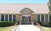 |
February 23, 2015 (#15000039) |
304 Bell Ave. 32°16′30″N 106°46′10″W / 32.275128°N 106.769487°W |
Las Cruces | |
| 25 | Mesilla Park Historic District | April 12, 2016 (#16000161) |
Bounded by Bowman St., Union and University Aves., and Park Drain 32°16′38″N 106°46′08″W / 32.277159°N 106.769024°W |
Las Cruces | ||
| 26 | Mesilla Plaza | 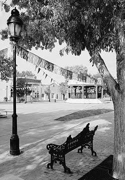 |
October 15, 1966 (#66000475) |
2 miles south of Las Cruces on State Road 28 32°16′25″N 106°48′16″W / 32.273611°N 106.804444°W |
Mesilla | |
| 27 | Mesquite Street Original Townsite Historic District | 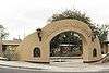 |
August 1, 1985 (#85001669) |
Roughly bounded by E. Texas, Campo, Tornillo, and E. Court 32°18′31″N 106°46′26″W / 32.308611°N 106.773889°W |
Las Cruces | |
| 28 | Our Lady of Purification Catholic Church | 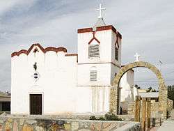 |
June 27, 1985 (#85001386) |
Camino Real and 2nd St. 32°23′14″N 106°48′59″W / 32.387222°N 106.816389°W |
Dona Ana | |
| 29 | Phillips Chapel CME Church | 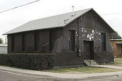 |
August 4, 2003 (#03000735) |
638 N. Tornillo St. 32°18′54″N 106°46′25″W / 32.315°N 106.773611°W |
Las Cruces | |
| 30 | Rio Grande Bridge at Radium Springs | 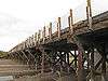 |
July 15, 1997 (#97000734) |
State Road 185 over the Rio Grande 32°29′09″N 106°55′28″W / 32.485833°N 106.924444°W |
Radium Springs | |
| 31 | Rio Grande Theatre | 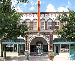 |
January 2, 2004 (#03001352) |
211 N. Downtown Mall 32°18′38″N 106°46′42″W / 32.310556°N 106.778333°W |
Las Cruces | |
| 32 | San Jose Church | 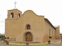 |
January 21, 1993 (#92001817) |
317 Josephine St. 32°07′23″N 106°42′16″W / 32.123056°N 106.704444°W |
La Mesa | |
| 33 | Summerford Mountain Archeological District | January 22, 2007 (#06001302) |
Address Restricted |
Radium Springs vicinity | ||
| 34 | Tortugas Pueblo Fiesta of Our Lady of Guadalupe | January 22, 2007 (#100001437) |
Bounded by Emilia Rd., E. Guadalupe St., Juan Diego Ave. & Stern Dr. 32°16′11″N 106°45′10″W / 32.269696°N 106.752897°W |
Tortugas | ||
| 35 | University President's House | 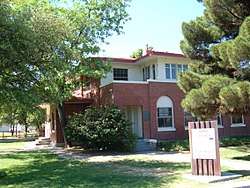 |
May 16, 1989 (#88001549) |
South of University Ave. between Espina and Solano on the New Mexico State University campus 32°17′02″N 106°45′16″W / 32.283889°N 106.754444°W |
Las Cruces | Now the Nason House |
See also
| Wikimedia Commons has media related to National Register of Historic Places in Doña Ana County, New Mexico. |
References
- ↑ The latitude and longitude information provided in this table was derived originally from the National Register Information System, which has been found to be fairly accurate for about 99% of listings. For about 1% of NRIS original coordinates, experience has shown that one or both coordinates are typos or otherwise extremely far off; some corrections may have been made. A more subtle problem causes many locations to be off by up to 150 yards, depending on location in the country: most NRIS coordinates were derived from tracing out latitude and longitudes from USGS topographical quadrant maps created under the North American Datum of 1927, which differs from the current, highly accurate WGS84 GPS system used by most on-line maps. Chicago is about right, but NRIS longitudes in Washington are higher by about 4.5 seconds, and are lower by about 2.0 seconds in Maine. Latitudes differ by about 1.0 second in Florida. Some locations in this table may have been corrected to current GPS standards.
- ↑ "National Register of Historic Places: Weekly List Actions". National Park Service, United States Department of the Interior. Retrieved on October 11, 2018.
- ↑ Numbers represent an ordering by significant words. Various colorings, defined here, differentiate National Historic Landmarks and historic districts from other NRHP buildings, structures, sites or objects.
- ↑ National Park Service (2010-07-09). "National Register Information System". National Register of Historic Places. National Park Service.
- ↑ The eight-digit number below each date is the number assigned to each location in the National Register Information System database, which can be viewed by clicking the number.
| Topics | |
|---|---|
| Lists by states |
|
| Lists by insular areas | |
| Lists by associated states | |
| Other areas | |
| |
Municipalities and communities of Doña Ana County, New Mexico, United States | ||
|---|---|---|
| Cities | | |
| Town | ||
| Village | ||
| CDPs | ||
| Other unincorporated place | ||
| Ghost towns | ||
This article is issued from
Wikipedia.
The text is licensed under Creative Commons - Attribution - Sharealike.
Additional terms may apply for the media files.