La Mesa, New Mexico
| La Mesa, New Mexico | |
|---|---|
| Census-designated place | |
 La Mesa | |
| Coordinates: 32°07′19″N 106°42′28″W / 32.12194°N 106.70778°WCoordinates: 32°07′19″N 106°42′28″W / 32.12194°N 106.70778°W | |
| Country | United States |
| State | New Mexico |
| County | Doña Ana |
| Area[1] | |
| • Total | 2.366 sq mi (6.13 km2) |
| • Land | 2.366 sq mi (6.13 km2) |
| • Water | 0 sq mi (0 km2) |
| Elevation | 3,825 ft (1,166 m) |
| Population (2010)[2] | |
| • Total | 728 |
| • Density | 310/sq mi (120/km2) |
| Time zone | UTC-7 (Mountain (MST)) |
| • Summer (DST) | UTC-6 (MDT) |
| ZIP code | 88044 |
| Area code(s) | 575 |
| GNIS feature ID | 899706[3] |
La Mesa is a census-designated place and unincorporated community in Doña Ana County, New Mexico, United States. Its population was 728 as of the 2010 census. La Mesa has a post office with ZIP code 88044.[4][5] NM 28 passes through the community.
References
- ↑ "US Gazetteer files: 2010, 2000, and 1990". United States Census Bureau. 2011-02-12. Retrieved 2011-04-23.
- ↑ "American FactFinder". United States Census Bureau. Retrieved 2011-05-14.
- ↑ "La Mesa". Geographic Names Information System. United States Geological Survey.
- ↑ United States Postal Service (2012). "USPS - Look Up a ZIP Code". Retrieved 2012-02-15.
- ↑ "Postmaster Finder - Post Offices by ZIP Code". United States Postal Service. Retrieved March 4, 2014.
Municipalities and communities of Doña Ana County, New Mexico, United States | ||
|---|---|---|
| Cities | 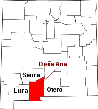 | |
| Town | ||
| Village | ||
| CDPs | ||
| Other unincorporated place | ||
| Ghost towns | ||
This article is issued from
Wikipedia.
The text is licensed under Creative Commons - Attribution - Sharealike.
Additional terms may apply for the media files.