Chamberino, New Mexico
| Chamberino, New Mexico | |
|---|---|
| Census-designated place | |
 Chamberino | |
| Coordinates: 32°02′24″N 106°41′08″W / 32.04000°N 106.68556°WCoordinates: 32°02′24″N 106°41′08″W / 32.04000°N 106.68556°W | |
| Country | United States |
| State | New Mexico |
| County | Doña Ana |
| Area[1] | |
| • Total | 3.057 sq mi (7.92 km2) |
| • Land | 3.057 sq mi (7.92 km2) |
| • Water | 0 sq mi (0 km2) |
| Elevation | 3,822 ft (1,165 m) |
| Population (2010)[1] | |
| • Total | 919 |
| • Density | 300/sq mi (120/km2) |
| Time zone | UTC-7 (Mountain (MST)) |
| • Summer (DST) | UTC-6 (MDT) |
| ZIP code | 88027 |
| Area code(s) | 575 |
| GNIS feature ID | 899577[2] |
Chamberino is an unincorporated community and census-designated place (CDP) in Doña Ana County, New Mexico, United States.[2] As of the 2010 census it had a population of 919.[3] A post office was established at Chamberino in 1880; although it was suppressed two years later, it was reëstablished in 1893 and continues to the present day.[4] The ZIP code is 88027.
Notable people
- J. Paul Taylor, New Mexico legislator and educator, was born in Chamberino.[5]
References
- 1 2 "2010 Census Gazetteer Files - Places: New Mexico". U.S. Census Bureau. Archived from the original on July 14, 2014. Retrieved October 22, 2014.
- 1 2 U.S. Geological Survey Geographic Names Information System: Chamberino, New Mexico
- ↑ "Geographic Identifiers: 2010 Demographic Profile Data (G001): Chamberino CDP, New Mexico". U.S. Census Bureau, American Factfinder. Retrieved November 3, 2015.
- ↑ U.S. Geological Survey Geographic Names Information System: Chamberino Post Office
- ↑ J. Paul Taylor and family
Municipalities and communities of Doña Ana County, New Mexico, United States | ||
|---|---|---|
| Cities | 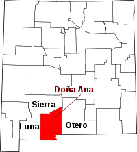 | |
| Town | ||
| Village | ||
| CDPs | ||
| Other unincorporated place | ||
| Ghost towns | ||
This article is issued from
Wikipedia.
The text is licensed under Creative Commons - Attribution - Sharealike.
Additional terms may apply for the media files.