Mortagne-sur-Sèvre
| Mortagne-sur-Sèvre | ||
|---|---|---|
| Commune | ||
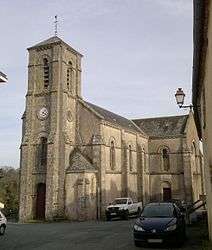 The church in the village of Evrunes, in Mortagne-sur-Sèvre | ||
| ||
 Mortagne-sur-Sèvre Location within Pays de la Loire region  Mortagne-sur-Sèvre | ||
| Coordinates: 46°59′33″N 0°57′09″W / 46.9925°N 0.9525°WCoordinates: 46°59′33″N 0°57′09″W / 46.9925°N 0.9525°W | ||
| Country | France | |
| Region | Pays de la Loire | |
| Department | Vendée | |
| Arrondissement | La Roche-sur-Yon | |
| Canton | Mortagne-sur-Sèvre | |
| Intercommunality | Canton de Mortagne-sur-Sèvre | |
| Government | ||
| • Mayor (2008–2014) | Alain Pauvert | |
| Area1 | 21.94 km2 (8.47 sq mi) | |
| Population (2006)2 | 6,315 | |
| • Density | 290/km2 (750/sq mi) | |
| Time zone | UTC+1 (CET) | |
| • Summer (DST) | UTC+2 (CEST) | |
| INSEE/Postal code | 85151 /85290 | |
| Elevation | 57–151 m (187–495 ft) | |
|
1 French Land Register data, which excludes lakes, ponds, glaciers > 1 km2 (0.386 sq mi or 247 acres) and river estuaries. 2 Population without double counting: residents of multiple communes (e.g., students and military personnel) only counted once. | ||
Mortagne-sur-Sèvre is a commune in the Vendée department in the Pays de la Loire region in western France. The commune was formed by the consolidation Mortagne-sur-Sèvre, Évrunes and Saint-Hilaire-de-Mortagne in 1964.
See also
References
| Wikimedia Commons has media related to Mortagne-sur-Sèvre. |
This article is issued from
Wikipedia.
The text is licensed under Creative Commons - Attribution - Sharealike.
Additional terms may apply for the media files.