La Rabatelière
| La Rabatelière | ||
|---|---|---|
| Commune | ||
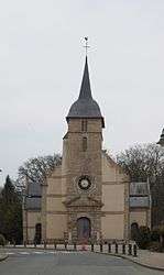 The church in La Rabatelière | ||
| ||
 La Rabatelière Location within Pays de la Loire region  La Rabatelière | ||
| Coordinates: 46°51′44″N 1°15′33″W / 46.8622°N 1.2592°WCoordinates: 46°51′44″N 1°15′33″W / 46.8622°N 1.2592°W | ||
| Country | France | |
| Region | Pays de la Loire | |
| Department | Vendée | |
| Arrondissement | La Roche-sur-Yon | |
| Canton | Montaigu | |
| Intercommunality | Canton de Saint-Fulgent | |
| Government | ||
| • Mayor (2008–2014) | Wilfrid Montassier | |
| Area1 | 8.26 km2 (3.19 sq mi) | |
| Population (2006)2 | 804 | |
| • Density | 97/km2 (250/sq mi) | |
| Time zone | UTC+1 (CET) | |
| • Summer (DST) | UTC+2 (CEST) | |
| INSEE/Postal code | 85186 /85250 | |
| Elevation | 42–77 m (138–253 ft) | |
|
1 French Land Register data, which excludes lakes, ponds, glaciers > 1 km2 (0.386 sq mi or 247 acres) and river estuaries. 2 Population without double counting: residents of multiple communes (e.g., students and military personnel) only counted once. | ||
.svg.png)
La Rabatelière is a commune in the Vendée department in the Pays de la Loire region in western France.
See also
References
| Wikimedia Commons has media related to La Rabatelière. |
This article is issued from
Wikipedia.
The text is licensed under Creative Commons - Attribution - Sharealike.
Additional terms may apply for the media files.