La Boissière-de-Montaigu
| La Boissière-de-Montaigu | ||
|---|---|---|
| Commune | ||
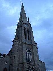 The church of Our Lady of the Assumption, in La Boissière-de-Montaigu | ||
| ||
 La Boissière-de-Montaigu Location within Pays de la Loire region  La Boissière-de-Montaigu | ||
| Coordinates: 46°57′06″N 1°11′24″W / 46.9517°N 1.19°WCoordinates: 46°57′06″N 1°11′24″W / 46.9517°N 1.19°W | ||
| Country | France | |
| Region | Pays de la Loire | |
| Department | Vendée | |
| Arrondissement | La Roche-sur-Yon | |
| Canton | Montaigu | |
| Intercommunality | Terres de Montaigu | |
| Area1 | 29.1 km2 (11.2 sq mi) | |
| Population (2006)2 | 1,945 | |
| • Density | 67/km2 (170/sq mi) | |
| Time zone | UTC+1 (CET) | |
| • Summer (DST) | UTC+2 (CEST) | |
| INSEE/Postal code | 85025 /85600 | |
| Elevation |
35–97 m (115–318 ft) (avg. 84 m or 276 ft) | |
|
1 French Land Register data, which excludes lakes, ponds, glaciers > 1 km2 (0.386 sq mi or 247 acres) and river estuaries. 2 Population without double counting: residents of multiple communes (e.g., students and military personnel) only counted once. | ||
.svg.png)
La Boissière-de-Montaigu is a commune in the Vendée department in the Pays de la Loire region in western France.
History
Within the border of the commune, axes, potteries and engraved rocks attest to the presence of man between 3500 and 2800 BC.
Places of interest
Château d' Asson: 15th and 18th centuries. Devastated during the War of Vendée.
Démographie
| Year | 1789 | 1802 | 1962 | 1968 | 1975 | 1982 | 1990 | 1999 | 2006 |
|---|---|---|---|---|---|---|---|---|---|
| Population | 1100 | 360 | 1313 | 1383 | 1430 | 1500 | 1584 | 1568 | 1945 |
See also
References
External links
| Wikimedia Commons has media related to La Boissière-de-Montaigu. |
- Official site
- La Boissière-de-Montaigu on the Quid site
- La Boissière-de-Montaigu on the map of France
- Ecole Privée
- Course des As
This article is issued from
Wikipedia.
The text is licensed under Creative Commons - Attribution - Sharealike.
Additional terms may apply for the media files.