Saint-Philbert-de-Bouaine
| Saint-Philbert-de-Bouaine | ||
|---|---|---|
| Commune | ||
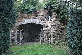 A replica of the grotto of Lourdes | ||
| ||
 Saint-Philbert-de-Bouaine Location within Pays de la Loire region  Saint-Philbert-de-Bouaine | ||
| Coordinates: 46°59′10″N 1°31′10″W / 46.9861°N 1.5194°WCoordinates: 46°59′10″N 1°31′10″W / 46.9861°N 1.5194°W | ||
| Country | France | |
| Region | Pays de la Loire | |
| Department | Vendée | |
| Arrondissement | La Roche-sur-Yon | |
| Canton | Aizenay | |
| Intercommunality | Canton de Rocheservière | |
| Government | ||
| • Mayor (2008–2014) | Charles Baty | |
| Area1 | 50.16 km2 (19.37 sq mi) | |
| Population (2006)2 | 2,604 | |
| • Density | 52/km2 (130/sq mi) | |
| Time zone | UTC+1 (CET) | |
| • Summer (DST) | UTC+2 (CEST) | |
| INSEE/Postal code | 85262 /85660 | |
| Elevation | 7–55 m (23–180 ft) | |
|
1 French Land Register data, which excludes lakes, ponds, glaciers > 1 km2 (0.386 sq mi or 247 acres) and river estuaries. 2 Population without double counting: residents of multiple communes (e.g., students and military personnel) only counted once. | ||
.svg.png)
Saint-Philbert-de-Bouaine is a commune in the Vendée department in the Pays de la Loire region in western France.
See also
External links
| Wikimedia Commons has media related to Saint-Philbert-de-Bouaine. |
This article is issued from
Wikipedia.
The text is licensed under Creative Commons - Attribution - Sharealike.
Additional terms may apply for the media files.