Le Champ-Saint-Père
| Le Champ-Saint-Père | ||
|---|---|---|
| Commune | ||
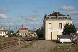 The Champ-Saint-Père railway station | ||
| ||
 Le Champ-Saint-Père Location within Pays de la Loire region  Le Champ-Saint-Père | ||
| Coordinates: 46°30′33″N 1°20′43″W / 46.5092°N 1.3453°WCoordinates: 46°30′33″N 1°20′43″W / 46.5092°N 1.3453°W | ||
| Country | France | |
| Region | Pays de la Loire | |
| Department | Vendée | |
| Arrondissement | Les Sables-d'Olonne | |
| Canton | Mareuil-sur-Lay-Dissais | |
| Intercommunality | Pays moutierrois | |
| Government | ||
| • Mayor (2008–2014) | Marcel Gauducheau | |
| Area1 | 24.67 km2 (9.53 sq mi) | |
| Population (2006)2 | 1,534 | |
| • Density | 62/km2 (160/sq mi) | |
| Time zone | UTC+1 (CET) | |
| • Summer (DST) | UTC+2 (CEST) | |
| INSEE/Postal code | 85050 /85540 | |
| Elevation | 1–75 m (3.3–246.1 ft) | |
|
1 French Land Register data, which excludes lakes, ponds, glaciers > 1 km2 (0.386 sq mi or 247 acres) and river estuaries. 2 Population without double counting: residents of multiple communes (e.g., students and military personnel) only counted once. | ||
.svg.png)
Le Champ-Saint-Père is a commune in the Vendée department in the Pays de la Loire region in western France.
Geography
The river Yon forms all of the commune's north-eastern border, then flows into the Lay, which forms all of its eastern border.
See also
References
| Wikimedia Commons has media related to Le Champ-Saint-Père. |
This article is issued from
Wikipedia.
The text is licensed under Creative Commons - Attribution - Sharealike.
Additional terms may apply for the media files.