Matong
| Matong New South Wales | |
|---|---|
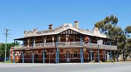 The Farmers Home Hotel being rebuilt after a fire | |
|
Matong | |
| Coordinates | 34°46′0″S 146°55′0″E / 34.76667°S 146.91667°ECoordinates: 34°46′0″S 146°55′0″E / 34.76667°S 146.91667°E |
| Population | 194 (2006 census)[1] |
| Postcode(s) | 2652 |
| Elevation | 192 m (630 ft) |
| Location |
|
| LGA(s) | Coolamon Shire |
| County | Bourke |
| State electorate(s) | Cootamundra |
| Federal Division(s) | Riverina |
Matong /məˈtɒŋ/ is a town in the central east part of the Riverina region of New South Wales, Australia. The town is 37 kilometres (23 mi) east of Narrandera and 26 kilometres (16 mi) west of Coolamon. At the 2006 census, Matong had a population of 194 people.[1]
Gallery
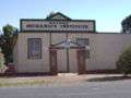 Mechanics Institute
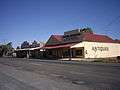
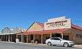 Shop
Shop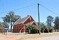
- Hotel
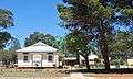 Public School
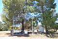 Ovals
Ovals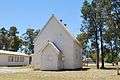 Uniting Church
Notes and references
| Wikimedia Commons has media related to Matong. |
- 1 2 Australian Bureau of Statistics (25 October 2007). "Matong (State Suburb)". 2006 Census QuickStats. Retrieved 27 October 2009.
| Preceding station | NSW Branch lines | Following station | ||
|---|---|---|---|---|
towards Hay | Hay Line | towards Junee |
This article is issued from
Wikipedia.
The text is licensed under Creative Commons - Attribution - Sharealike.
Additional terms may apply for the media files.