Lotbinière Regional County Municipality
| Lotbinière | |
|---|---|
| Regional county municipality | |
 | |
| Coordinates: 46°31′N 71°36′W / 46.517°N 71.600°WCoordinates: 46°31′N 71°36′W / 46.517°N 71.600°W[1] | |
| Country |
|
| Province |
|
| Region | Chaudière-Appalaches |
| Effective | January 1, 1982 |
| County seat | Sainte-Croix |
| Government[2] | |
| • Type | Prefecture |
| • Prefect | Maurice Sénécal |
| Area[2][3][4] | |
| • Total | 1,687.00 km2 (651.35 sq mi) |
| • Land | 1,661.99 km2 (641.70 sq mi) |
| Population (2011)[3] | |
| • Total | 29,617 |
| • Density | 17.8/km2 (46/sq mi) |
| • Pop 2006-2011 |
|
| • Dwellings | 13,321 |
| Time zone | UTC−5 (EST) |
| • Summer (DST) | UTC−4 (EDT) |
| Area code(s) | 418 and 581 |
| Website |
www |
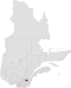
Lotbinière is a regional county municipality in the Chaudière-Appalaches region of Quebec. It is an almost exclusively rural RCM, with no village with a population above 4,000. As of the Canada 2011 Census, the RCM had a population of 29,617. Its seat is in Sainte-Croix.
Subdivisions
There are 18 subdivisions within the RCM:[2]
|
|
|
|
Demographics
Language
Mother tongue language from Canada 2006 Census
| Language | Population | Pct (%) |
|---|---|---|
| French only | 26,290 | 98.17% |
| English only | 145 | 0.54% |
| Both English and French | 60 | 0.22% |
| Other languages | 285 | 1.07% |
Transportation
Access Routes
Highways and numbered routes that run through the municipality, including external routes that start or finish at the county border:[5]
See also
References
- ↑ Reference number 141061 of the Commission de toponymie du Québec (in French)
- 1 2 3 Ministère des Affaires municipales, des Régions et de l'Occupation du territoire: Lotbinière Regional County Municipality
- 1 2 "(Code 2433) Census Profile". 2011 census. Statistics Canada. 2012.
- ↑ 2006 Statistics Canada Community Profile: Lotbinière Regional County Municipality, Quebec
- ↑ Official Transport Quebec Road Map
External links
- (in French) Lotbinière Regional County website
Adjacent Counties & Equivalent Territories | |
|---|---|
| Regional county municipalities and equivalent territories | |
|---|---|
| Municipalities | |
This article is issued from
Wikipedia.
The text is licensed under Creative Commons - Attribution - Sharealike.
Additional terms may apply for the media files.