Saint-Lambert-de-Lauzon, Quebec
| Saint-Lambert-de-Lauzon | |
|---|---|
| Municipality | |
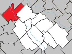 Location within La Nouvelle-Beauce RCM. | |
 Saint-Lambert-de-Lauzon Location in southern Quebec. | |
| Coordinates: 46°35′N 71°12′W / 46.583°N 71.200°WCoordinates: 46°35′N 71°12′W / 46.583°N 71.200°W[1] | |
| Country |
|
| Province |
|
| Region | Chaudière-Appalaches |
| RCM | La Nouvelle-Beauce |
| Constituted | July 1, 1855 |
| Government[2] | |
| • Mayor | Olivier Dumais |
| • Federal riding | Lévis—Lotbinière |
| • Prov. riding | Beauce-Nord |
| Area[2][3] | |
| • Total | 109.50 km2 (42.28 sq mi) |
| • Land | 107.13 km2 (41.36 sq mi) |
| Population (2011)[3] | |
| • Total | 6,177 |
| • Density | 57.7/km2 (149/sq mi) |
| • Pop 2006-2011 |
|
| • Dwellings | 2,480 |
| Time zone | UTC−5 (EST) |
| • Summer (DST) | UTC−4 (EDT) |
| Postal code(s) | G0S 2W0 |
| Area code(s) | 418 and 581 |
| Highways |
|
| Website |
www.municipalite.saint- lambert-de-lauzon.qc.ca |
Saint-Lambert-de-Lauzon is a municipality in La Nouvelle-Beauce Regional County Municipality in Quebec, Canada. It is part of the Chaudière-Appalaches region and the population is 6,177 as of the Canada 2011 Census. Prior to June 22, 2013 it was a parish municipality.[4]
It is named after Pierre Lambert, a land surveyor who planned neighbouring Lévis. Lauzon refers to the seigneurie of Lauzon, the first to be established on the south shore of the Saint Lawrence River in 1636.
References
- ↑ Reference number 418082 of the Commission de toponymie du Québec (in French)
- 1 2 Geographic code 26070 in the official Répertoire des municipalités (in French)
- 1 2 "(Code 2426070) Census Profile". 2011 census. Statistics Canada. 2012.
- ↑ "Modifications aux municipalités du Québec" (PDF). Institut de la statistique du Québec. 2013. ISSN 1715-6408.
Places adjacent to Saint-Lambert-de-Lauzon, Quebec | ||||||||||
|---|---|---|---|---|---|---|---|---|---|---|
| ||||||||||
| Cities & Towns | |
|---|---|
| Municipalities | |
| Parishes | |
| |
This article is issued from
Wikipedia.
The text is licensed under Creative Commons - Attribution - Sharealike.
Additional terms may apply for the media files.