Beauce-Sartigan Regional County Municipality
| Beauce-Sartigan | |
|---|---|
| Regional county municipality | |
 | |
| Coordinates: 45°58′N 70°39′W / 45.967°N 70.650°WCoordinates: 45°58′N 70°39′W / 45.967°N 70.650°W[1] | |
| Country |
|
| Province |
|
| Region | Chaudière-Appalaches |
| Effective | January 1, 1982 |
| County seat | Saint-Georges |
| Communities |
List
|
| Government[2] | |
| • Type | Prefecture |
| • Prefect | Luc Lemieux |
| Area[2][3] | |
| • Total | 1,977.00 km2 (763.32 sq mi) |
| • Land | 1,954.08 km2 (754.47 sq mi) |
| Population (2011)[3] | |
| • Total | 50,962 |
| • Density | 26.1/km2 (68/sq mi) |
| • Pop 2006-2011 |
|
| • Dwellings | 23,410 |
| Time zone | UTC−5 (EST) |
| • Summer (DST) | UTC−4 (EDT) |
| Area code(s) | 418 and 581 |
| Website |
www.mrc beaucesartigan.com |
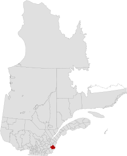
Beauce-Sartigan is a regional county municipality in the Chaudière-Appalaches region of Quebec, Canada. The county seat is Saint-Georges.[2]
The Chaudière River flows through it. It shares its eastern border with Maine, United States.
The name of the RCM is linked to the historical region of which it is part, Beauce. Sartigan is a distortion of Mechatigan (or Msakkikhan), the name given to the Chaudière River by the native Abenakis.
Subdivisions
There are 16 subdivisions within the RCM:[2]
|
|
|
|
|
Demographics
(Statistics Canada, 2006)
- Population change (2001-2006): 3.6%
- Dwellings: 21,867
- National rank in terms of population: 117
- Provincial rank in terms of population: 31
People
- 99.3% White
- 0.4% Aboriginal
- 0.3% Visible Minority
Transportation
Access Routes
Highways and numbered routes that run through the municipality, including external routes that start or finish at the county border:[4]
Attractions
- Centre d'art de Saint-Georges (Saint-Georges)
- Centre Marie-Fitzbach (Saint-Georges)
- Magasin général Honoré Grégoire (Saint-Honoré-de-Shenley)
- Musée d'autos antiques Victor-Bélanger (Saint-Côme–Linière)
- Pont couvert Perreault (1928) (Notre-Dame-des-Pins)
- Saint-Georges Airport (Saint-Georges)
- Saint-Paul-de-Cumberland Church (1847) (Saint-Simon-les-Mines)
- Village miniature Baillargeon (Saint-Georges)
See also
References
Adjacent Counties & Equivalent Territories | ||||||||||
|---|---|---|---|---|---|---|---|---|---|---|
| ||||||||||
| Regional county municipalities and equivalent territories | |
|---|---|
| Municipalities | |
This article is issued from
Wikipedia.
The text is licensed under Creative Commons - Attribution - Sharealike.
Additional terms may apply for the media files.