Sainte-Agathe-de-Lotbinière
| Sainte-Agathe-de-Lotbinière | |
|---|---|
| Municipality | |
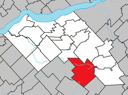 Location within Lotbinière RCM. | |
 Sainte-Agathe-de-Lotbinière Location in southern Quebec. | |
| Coordinates: 46°23′N 71°25′W / 46.383°N 71.417°WCoordinates: 46°23′N 71°25′W / 46.383°N 71.417°W[1] | |
| Country |
|
| Province |
|
| Region | Chaudière-Appalaches |
| RCM | Lotbinière |
| Constituted | February 3, 1999 |
| Government[2] | |
| • Mayor | Gilbert Breton |
| • Federal riding |
Lotbinière— Chutes-de-la-Chaudière |
| • Prov. riding | Lotbinière-Frontenac |
| Area[2][3] | |
| • Total | 166.70 km2 (64.36 sq mi) |
| • Land | 166.16 km2 (64.15 sq mi) |
| Population (2011)[3] | |
| • Total | 1,145 |
| • Pop 2006-2011 |
|
| • Dwellings | 494 |
| Time zone | UTC−5 (EST) |
| • Summer (DST) | UTC−4 (EDT) |
| Postal code(s) | G0S 2A0 |
| Area code(s) | 418 and 581 |
| Highways |
|
| Website |
www |
Sainte-Agathe-de-Lotbinière is a municipality in the Municipalité régionale de comté de Lotbinière in Quebec, Canada. Part of the Chaudière-Appalaches region, it had a population of 833 as of 2009. This town is also known for La Ferme Laitière Du Village Run by Luc Poirier. This Highly Profitable farm that earns approximately 52 046 962 dollars per year (according to a report from 2008) is very well known for its interesting process with new born calves
Although the new constitution dates from 1743, following the amalgamation of the village and parish of Sainte-Agathe, the territory was opened to colonizers in 1830. Sainte-Agathe-de-Lotbinière's early development was linked to the construction of the chemins Craig and Gosford in the mid-19th century.
It is named after Agatha of Sicily, who died as a martyr in 251.
References
- Commission de toponymie du Québec
- Ministère des Affaires municipales, des Régions et de l'Occupation du territoire
Places adjacent to Sainte-Agathe-de-Lotbinière | ||||||||||
|---|---|---|---|---|---|---|---|---|---|---|
| ||||||||||
| Municipalities | |
|---|---|
| Parishes | |
| Villages | |
| |