Bécancour Regional County Municipality
| Bécancour | |
|---|---|
| Regional county municipality | |
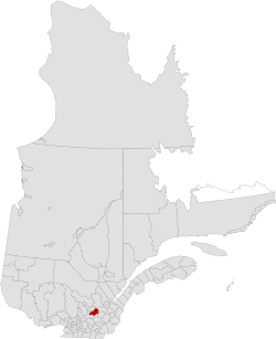 Location in province of Quebec. | |
| Coordinates: 46°19′N 72°11′W / 46.317°N 72.183°WCoordinates: 46°19′N 72°11′W / 46.317°N 72.183°W[1] | |
| Country |
|
| Province |
|
| Region | Centre-du-Québec |
| Effective | January 1, 1982 |
| County seat | Bécancour |
| Government[2] | |
| • Type | Prefecture |
| • Prefect | Poste vacant |
| Area[2][3] | |
| • Total | 1,231.30 km2 (475.41 sq mi) |
| • Land | 1,144.67 km2 (441.96 sq mi) |
| Population (2011)[3] | |
| • Total | 20,081 |
| • Density | 17.5/km2 (45/sq mi) |
| • Pop 2006-2011 |
|
| • Dwellings | 9,513 |
| Time zone | UTC−5 (EST) |
| • Summer (DST) | UTC−4 (EDT) |
| Area code(s) | 819 |
Bécancour is a regional county municipality in the Centre-du-Québec region of Quebec, Canada. Its seat is Bécancour.[2]
Subdivisions
There are 12 subdivisions and one native reserve within the RCM:[2]
|
|
|
|
Demographics
Mother tongue language from Canada 2006 Census
| Language | Population | Pct (%) |
|---|---|---|
| French only | 18080 | 97.70% |
| English only | 105 | 0.57% |
| Both English and French | 20 | 0.11% |
| Other languages | 300 | 1.62% |
Transportation
Access Routes
Highways and numbered routes that run through the municipality, including external routes that start or finish at the county border:[4]
See also
References
External links
Adjacent Counties & Equivalent Territories | |
|---|---|
| Regional county municipalities and equivalent territories | |
|---|---|
| Municipalities | |
This article is issued from
Wikipedia.
The text is licensed under Creative Commons - Attribution - Sharealike.
Additional terms may apply for the media files.