Saint-Gilles, Quebec
| Saint-Gilles | |
|---|---|
| Parish municipality | |
 Location within Lotbinière RCM. | |
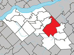
 Saint-Gilles Location in southern Quebec. | |
| Coordinates: 46°31′N 71°22′W / 46.517°N 71.367°WCoordinates: 46°31′N 71°22′W / 46.517°N 71.367°W[1] | |
| Country |
|
| Province |
|
| Region | Chaudière-Appalaches |
| RCM | Lotbinière |
| Constituted | July 1, 1855 |
| Government[2] | |
| • Mayor | Robert Samson |
| • Federal riding |
Lotbinière— Chutes-de-la-Chaudière |
| • Prov. riding | Lotbinière-Frontenac |
| Area[2][3] | |
| • Total | 180.80 km2 (69.81 sq mi) |
| • Land | 177.36 km2 (68.48 sq mi) |
| Population (2011)[3] | |
| • Total | 2,138 |
| • Density | 12.1/km2 (31/sq mi) |
| • Pop 2006-2011 |
|
| • Dwellings | 997 |
| Time zone | UTC−5 (EST) |
| • Summer (DST) | UTC−4 (EDT) |
| Postal code(s) | G0S 2P0 |
| Area code(s) | 418 and 581 |
| Highways |
|
| Website |
www |
Saint-Gilles is a parish municipality in the Lotbinière Regional County Municipality in the Chaudière-Appalaches region of Quebec, Canada. Its population was 2,138 as of the Canada 2011 Census. It is named after the seigneurie of Saint-Gilles, of which it was part.
References
Places adjacent to Saint-Gilles, Quebec | |
|---|---|
| Municipalities | |
|---|---|
| Parishes | |
| Villages | |
| |
This article is issued from
Wikipedia.
The text is licensed under Creative Commons - Attribution - Sharealike.
Additional terms may apply for the media files.