Lopik
| Lopik | |||
|---|---|---|---|
| Municipality | |||
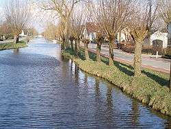 Canal through Polsbroek | |||
| |||
.svg.png) Location in Utrecht | |||
| Coordinates: 51°58′N 4°57′E / 51.967°N 4.950°ECoordinates: 51°58′N 4°57′E / 51.967°N 4.950°E | |||
| Country | Netherlands | ||
| Province | Utrecht | ||
| Government[1] | |||
| • Body | Municipal council | ||
| • Mayor | Laurens de Graaf (CDA) | ||
| Area[2] | |||
| • Total | 78.98 km2 (30.49 sq mi) | ||
| • Land | 75.75 km2 (29.25 sq mi) | ||
| • Water | 3.23 km2 (1.25 sq mi) | ||
| Elevation[3] | 0 m (0 ft) | ||
| Population (August 2017)[4] | |||
| • Total | 14,324 | ||
| • Density | 189/km2 (490/sq mi) | ||
| Time zone | UTC+1 (CET) | ||
| • Summer (DST) | UTC+2 (CEST) | ||
| Postcode | 3405–3415 | ||
| Area code | 0182, 030, 0348 | ||
| Website |
www | ||


Lopik (![]()
History
Lopik lies within the Lopikerwaard region, which used to be occupied by swamps and forests until the area was cultivated in the eleventh century. Lopik was first mentioned as "Lobeke" in 1155 CE. Most of the population settled along the canals that were used for transport and drainage (and which are still used for the latter purpose). It was not until after World War II that villages in the area were expanded beyond the original ribbons of buildings, and Lopik remains a well-known example of a linear settlement within the Netherlands.
In the Netherlands, "Lopik" is often used as a reference to the broadcasting facilities located in the eastern part of the municipality and in neighbouring IJsselstein. These include the Gerbrandy Tower, a structure that is the tallest structure in the Netherlands, and the world's largest Christmas tree during the period around Christmas.
Location and transport
The entire municipality lies within the Dutch Green Heart and has a rural character. The two main access roads are the N210 and N204 provincial roads, which connect the area with major cities that include Rotterdam and Utrecht.
Public transport in the region primarily consists of bus connections, which are mainly carried out by Syntus. The nearest railway stations are in Gouda and Woerden.
Population centres
The municipality of Lopik consists of the following cities, towns, villages and/or districts: Benschop, Cabauw, Jaarsveld, Lopik, Lopikerkapel, Polsbroek, Polsbroekerdam, Uitweg, Willige Langerak, and Zevender.
Topography

Notable residents
- Ton Strien (born 1958), politician
References
- ↑ "Burgemeester en Wethouders" [Mayor and aldermen] (in Dutch). Gemeente Lopik. Retrieved 7 April 2014.
- ↑ "Kerncijfers wijken en buurten" [Key figures for neighbourhoods]. CBS Statline (in Dutch). CBS. 2 July 2013. Retrieved 12 March 2014.
- ↑ "Postcodetool for 3411CH". Actueel Hoogtebestand Nederland (in Dutch). Het Waterschapshuis. Archived from the original on 21 September 2013. Retrieved 7 April 2014.
- ↑ "Bevolkingsontwikkeling; regio per maand" [Population growth; regions per month]. CBS Statline (in Dutch). CBS. 27 October 2017. Retrieved 27 October 2017.
External links

- Official website
Places adjacent to Lopik | ||||||||||
|---|---|---|---|---|---|---|---|---|---|---|
| ||||||||||
Municipalities of Utrecht | ||
|---|---|---|
 | ||
| ||
| Authority control |
|---|