De Ronde Venen
| De Ronde Venen | |||
|---|---|---|---|
| Municipality | |||
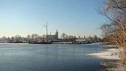 Vinkeveen town centre | |||
| |||
.png) Location in Utrecht | |||
| Coordinates: 52°12′N 4°52′E / 52.200°N 4.867°ECoordinates: 52°12′N 4°52′E / 52.200°N 4.867°E | |||
| Country | Netherlands | ||
| Province | Utrecht | ||
| Established | 1 January 1989 | ||
| Government[1] | |||
| • Body | Municipal council | ||
| • Mayor | Maarten Divendal (PvdA) | ||
| Area[2] | |||
| • Total | 116.98 km2 (45.17 sq mi) | ||
| • Land | 100.77 km2 (38.91 sq mi) | ||
| • Water | 16.21 km2 (6.26 sq mi) | ||
| Elevation[3] | −2 m (−7 ft) | ||
| Population (August 2017)[4] | |||
| • Total | 43,304 | ||
| • Density | 430/km2 (1,100/sq mi) | ||
| Time zone | UTC+1 (CET) | ||
| • Summer (DST) | UTC+2 (CEST) | ||
| Postcode | Parts of 1300, 1400 and 3600 ranges | ||
| Area code | 0294, 0297 | ||
| Website |
www | ||


De Ronde Venen (![]()
Population centres
The municipality of De Ronde Venen consists of the villages Abcoude, Amstelhoek, De Hoef, Baambrugge, Mijdrecht, Vinkeveen, Waverveen, and Wilnis, and a number of hamlets, such as Aan de Zuwe, Achterbos, and Stokkelaarsbrug.
Topography
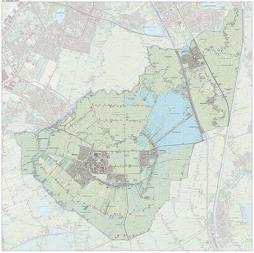
Dutch Topographic map of the municipality of De Ronde Venen, June 2015
References
- ↑ "Maarten Divendal" (in Dutch). Gemeente De Ronde Venen. Archived from the original on 5 April 2014. Retrieved 5 April 2014.
- ↑ "Kerncijfers wijken en buurten" [Key figures for neighbourhoods]. CBS Statline (in Dutch). CBS. 2 July 2013. Retrieved 12 March 2014.
- ↑ "Postcodetool for 3641AL". Actueel Hoogtebestand Nederland (in Dutch). Het Waterschapshuis. Retrieved 5 April 2014.
- ↑ "Bevolkingsontwikkeling; regio per maand" [Population growth; regions per month]. CBS Statline (in Dutch). CBS. 27 October 2017. Retrieved 27 October 2017.
External links

- Official website
Places adjacent to De Ronde Venen | ||||||||||
|---|---|---|---|---|---|---|---|---|---|---|
| ||||||||||
Municipalities of Utrecht | ||
|---|---|---|
 | ||
| ||
| Authority control |
|---|
This article is issued from
Wikipedia.
The text is licensed under Creative Commons - Attribution - Sharealike.
Additional terms may apply for the media files.