Jaarsveld
| Jaarsveld | |
|---|---|
| Town | |
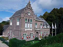 Polderhuis | |
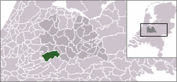 | |
 The town (darkgreen) and the statistical district (lightgreen) of Jaarsveld in the municipality of Lopik. | |
| Coordinates: 51°58′0″N 4°59′0″E / 51.96667°N 4.98333°ECoordinates: 51°58′0″N 4°59′0″E / 51.96667°N 4.98333°E | |
| Country | Netherlands |
| Province | Utrecht |
| Municipality | Lopik |
| Population (2001) | |
| • Total | 248 |
| Time zone | UTC+1 (CET) |
| • Summer (DST) | UTC+2 (CEST) |
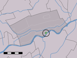
Jaarsveld is a town in the Dutch province of Utrecht. It is a part of the municipality of Lopik, and lies about 7 km southwest of IJsselstein.
In 2001, the town of Jaarsveld had 248 inhabitants. The built-up area of the town was 0.07 km², and contained 83 residences.[1] The wider statistical district has about 330 inhabitants.[2]
Jaarsveld used to be a separate municipality, covering a large part of the current municipality of Lopik south of the Lopiker Wetering and Enge IJssel rivers. It merged with the municipality of Lopik in 1943. A large part of the village of Lopik is actually built in the former municipality of Jaarsveld.
During the middleage until the early 20th century Jaarsveld was a vrije en hoge heerlijkheid [3] owned by the van Arkels, Egmonds, Orange-Nassau, van Voorst tot Voorst and de Witts from Dordrecht. As a free a high fief, Jaarsveld was an independent of the provinces Holland or Utrecht, like the larger Barony of IJsselstein to the east.
References
- ↑ Statistics Netherlands (CBS), Bevolkingskernen in Nederland 2001 . Statistics are for the continuous built-up area.
- ↑ Statistics Netherlands (CBS), Gemeente Op Maat 2004: Lopik .
- ↑ Hedendaagsche historie, of tegenwoordige staat van alle volkeren, Bd. XVII, 7, Isaak Tirion, Amsterdam 1748, p. 569 Google Booksearch
External links
- J. Kuyper, Gemeente Atlas van Nederland, 1865-1870, "Jaarsveld". Map of the former municipality in 1868.