Lopikerkapel
| Lopikerkapel | |
|---|---|
| Town | |
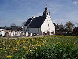 Church | |
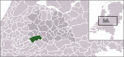 | |
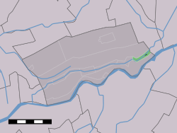 The town centre (darkgreen) and the statistical district (lightgreen) of Lopikerkapel in the municipality of Lopik. | |
| Coordinates: 51°59′31″N 5°2′50″E / 51.99194°N 5.04722°ECoordinates: 51°59′31″N 5°2′50″E / 51.99194°N 5.04722°E | |
| Country | Netherlands |
| Province | Utrecht |
| Municipality | Lopik |
| Population (2004) | |
| • Total | 640 |
| Time zone | UTC+1 (CET) |
| • Summer (DST) | UTC+2 (CEST) |
Lopikerkapel is a town in the Dutch province of Utrecht. It is a part of the municipality of Lopik, and lies about 3 km south of IJsselstein. The village has a very small town centre, with a church, but mostly consists of a ribbon of farms on both sides of the Enge IJssel river. The name Lopikerkapel means "Lopik's chapel".
In 2001, the town centre of Lopikerkapel had 145 inhabitants. The built-up area of the town was 0.03 km², and contained 47 residences.[1] The wider statistical area of Lopikerkapel, also covering the ribbon of farms, has a population of around 640.[2]
References
| Wikimedia Commons has media related to Lopikerkapel. |
This article is issued from
Wikipedia.
The text is licensed under Creative Commons - Attribution - Sharealike.
Additional terms may apply for the media files.