Bunnik
| Bunnik | |||
|---|---|---|---|
| Municipality | |||
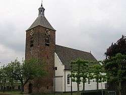 Church in Bunnik | |||
| |||
.svg.png) Location in Utrecht | |||
| Coordinates: 52°3′N 5°14′E / 52.050°N 5.233°ECoordinates: 52°3′N 5°14′E / 52.050°N 5.233°E | |||
| Country | Netherlands | ||
| Province | Utrecht | ||
| Government[1] | |||
| • Body | Municipal council | ||
| • Mayor | Roland van Schelven (acting) (D66) | ||
| Area[2] | |||
| • Total | 37.57 km2 (14.51 sq mi) | ||
| • Land | 36.95 km2 (14.27 sq mi) | ||
| • Water | 0.62 km2 (0.24 sq mi) | ||
| Elevation[3] | 3 m (10 ft) | ||
| Population (August 2017)[4] | |||
| • Total | 15,190 | ||
| • Density | 411/km2 (1,060/sq mi) | ||
| Demonym(s) | Bunniker(s) | ||
| Time zone | UTC+1 (CET) | ||
| • Summer (DST) | UTC+2 (CEST) | ||
| Postcode | 3980–3985 | ||
| Area code | 030 | ||
| Website |
www | ||


Bunnik (![]()
Chief interests of Bunnik are its surrounding nature, consisting mainly of forests and farmlands. Additionally, Bunnik, hosts the oldest Youth Hostel in the Netherlands. The major European construction and services company Royal BAM Group has its headquarters in Bunnik.
Population centres
The municipality of Bunnik consists of the following cities, towns, villages and/or districts: Bunnik, Odijk, Werkhoven.
Topography
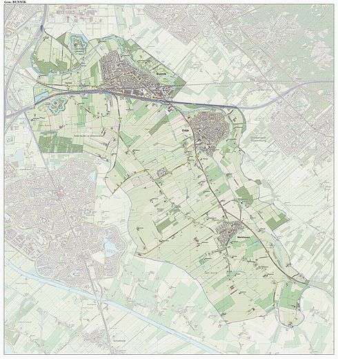
Dutch Topographic map of the municipality of Bunnik, June 2015.
Transportation
References
- ↑ "Burgermeester" [Mayor] (in Dutch). Gemeente Bunnik. Retrieved 4 April 2014.
- ↑ "Kerncijfers wijken en buurten" [Key figures for neighbourhoods]. CBS Statline (in Dutch). CBS. 2 July 2013. Retrieved 12 March 2014.
- ↑ "Postcodetool for 3984NC". Actueel Hoogtebestand Nederland (in Dutch). Het Waterschapshuis. Retrieved 4 April 2014.
- ↑ "Bevolkingsontwikkeling; regio per maand" [Population growth; regions per month]. CBS Statline (in Dutch). CBS. 27 October 2017. Retrieved 27 October 2017.
External links
| Wikivoyage has a travel guide for Bunnik. |

- Official website
Places adjacent to Bunnik | |
|---|---|
Municipalities of Utrecht | ||
|---|---|---|
 | ||
| ||