De Bilt
| De Bilt | |||
|---|---|---|---|
| Municipality | |||
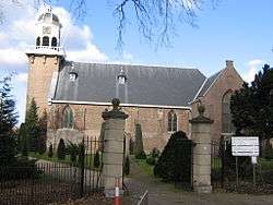 Church in De Bilt | |||
| |||
.svg.png) Location in Utrecht | |||
| Coordinates: 52°7′N 5°12′E / 52.117°N 5.200°ECoordinates: 52°7′N 5°12′E / 52.117°N 5.200°E | |||
| Country | Netherlands | ||
| Province | Utrecht | ||
| Government[1] | |||
| • Body | Municipal council | ||
| • Mayor | Sjoerd Potters (VVD) | ||
| Area[2] | |||
| • Total | 67.13 km2 (25.92 sq mi) | ||
| • Land | 66.30 km2 (25.60 sq mi) | ||
| • Water | 0.83 km2 (0.32 sq mi) | ||
| Elevation[3] | 4 m (13 ft) | ||
| Population (August 2017)[4] | |||
| • Total | 42,815 | ||
| • Density | 646/km2 (1,670/sq mi) | ||
| Demonym(s) | Biltenaar(s) | ||
| Time zone | UTC+1 (CET) | ||
| • Summer (DST) | UTC+2 (CEST) | ||
| Postcode | 3615, 3720–3732, 3737–3739 | ||
| Area code | 030, 0346 | ||
| Website |
www | ||

De Bilt (Dutch pronunciation: [də ˈbɪlt] (![]()
It is the ancestral home and namesake for the prominent Vanderbilt family of the United States.
Population centres
The municipality of De Bilt consists of the following cities, towns, villages and/or districts: Bilthoven, De Bilt, Groenekan, Hollandsche Rading, Maartensdijk, Westbroek.
Topography
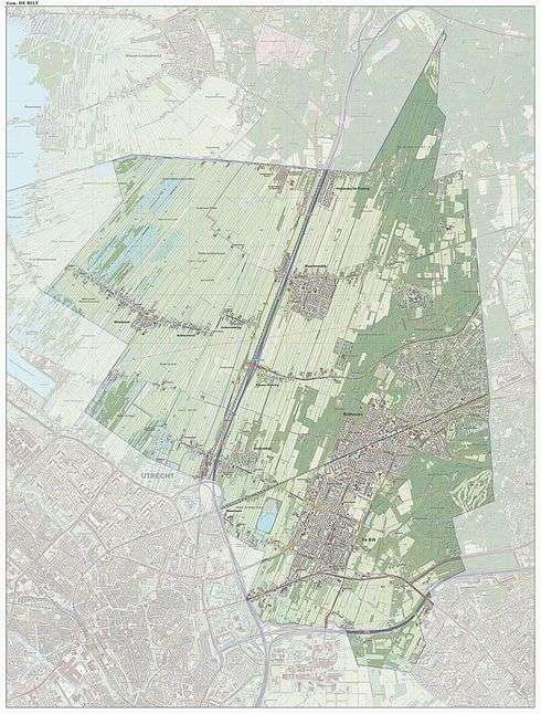
Dutch Topographic map of the municipality of De Bilt, June 2015
References
- ↑ "Burgemeester S.C.C.M. Potters" (in Dutch). Gemeente De Bilt. Retrieved 9 April 2017.
- ↑ "Kerncijfers wijken en buurten" [Key figures for neighbourhoods]. CBS Statline (in Dutch). CBS. 2 July 2013. Retrieved 12 March 2014.
- ↑ "Postcodetool for 3721AB". Actueel Hoogtebestand Nederland (in Dutch). Het Waterschapshuis. Retrieved 5 April 2014.
- ↑ "Bevolkingsontwikkeling; regio per maand" [Population growth; regions per month]. CBS Statline (in Dutch). CBS. 27 October 2017. Retrieved 27 October 2017.
External links

- Official Website
Places adjacent to De Bilt | ||||||||||
|---|---|---|---|---|---|---|---|---|---|---|
| ||||||||||
Municipalities of Utrecht | ||
|---|---|---|
 | ||
| ||
| Authority control |
|---|
This article is issued from
Wikipedia.
The text is licensed under Creative Commons - Attribution - Sharealike.
Additional terms may apply for the media files.