Stichtse Vecht
| Stichtse Vecht | |||
|---|---|---|---|
| Municipality | |||
|
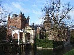
River through Maarssen | |||
| |||
.png) Location in Utrecht | |||
| Coordinates: 52°9′N 5°2′E / 52.150°N 5.033°ECoordinates: 52°9′N 5°2′E / 52.150°N 5.033°E | |||
| Country | Netherlands | ||
| Province | Utrecht | ||
| Established | 1 January 2011[1] | ||
| Government[2] | |||
| • Body | Municipal council | ||
| • Mayor | Marc Witteman (PvdA) | ||
| Area[3] | |||
| • Total | 106.82 km2 (41.24 sq mi) | ||
| • Land | 96.62 km2 (37.31 sq mi) | ||
| • Water | 10.20 km2 (3.94 sq mi) | ||
| Elevation[4] | 1 m (3 ft) | ||
| Population (August 2017)[5] | |||
| • Total | 64,385 | ||
| • Density | 666/km2 (1,720/sq mi) | ||
| Time zone | UTC+1 (CET) | ||
| • Summer (DST) | UTC+2 (CEST) | ||
| Postcode | 1393, 3600–3612, 3620–3622, 3626–3634 | ||
| Area code | 0294, 0346 | ||
| Website |
www | ||

Stichtse Vecht is a municipality of the Netherlands and lies in the northwestern part of the province of Utrecht.
The municipality has about 63,000 inhabitants and covers an area of about 107 km² (41 sq mi).
Stichtse Vecht has been newly formed by a merger of the municipalities of Breukelen (in the west), Maarssen (in the east) and Loenen (in the north) on 1 January 2011.[6]
Geography
Stichtse Vecht is situated north of the city of Utrecht, in an area called the Vechtstreek. It is located around sea level and mostly a rural area with lots of pastures.
Within its boundaries lay the Maarsseveense Plassen, which are recreational lakes. Northeast it borders the Loosdrechtse Plassen, also recreational lakes, which lay in neighbouring municipality of Wijdemeren.
The Amsterdam–Rhine Canal and the river Vecht crosses the municipality from south to north.
History
The municipality contains many stately homes (buitenplaatsen) and several castles, like Nijenrode Castle, Slot Zuylen and Huis te Mijnden.
Transportation
The A2 motorway crosses the municipality from south to north.
There are two railway stations:
Population centers

|
Former municipality of Breukelen:
|
Former municipality of Loenen:
|
Former municipality of Maarssen:
|
Politics
Municipal council
The municipal council consists of the following parties:[7]
| Political party | Seats |
| VVD | 8 |
| CDA | 5 |
| Maarssen2000 | 4 |
| D66 | 3 |
| PvdA | 3 |
| GroenLinks | 2 |
| ChristenUnie-SGP | 2 |
| Streekbelangen | 2 |
| Het Vechtse Verbond | 2 |
| Breukelen Beweegt | 1 |
| Maarssen Natuurlijk | 1 |
| Total | 33 |
Executive board
VVD, CDA, D66, ChristenUnie-SGP, Streekbelangen and Het Vechtse Verbond have formed a coalition. Together they have 22 seats. Members of the executive board are:[8]
- Marc Witteman (CDA)
- Pieter de Groene (D66)
- Gera Helling-Zeisseink (CDA)
- Vital van der Horst (Streekbelangen)
- Piet Ploeg (VVD)
- Jaap Verkroost (CDA)
- Klaas Wiersema (VVD)
Notable people
- Penney de Jager, dancer and choreographer
References
- ↑ "Gemeentelijke indeling op 1 januari 2011" [Municipal divisions on 1 January 2011]. cbs.nl (in Dutch). CBS. Retrieved 9 April 2014.
- ↑ "Collegeleden" [Board members] (in Dutch). Gemeente Stichtse Vecht. Retrieved 9 April 2014.
- ↑ "Kerncijfers wijken en buurten" [Key figures for neighbourhoods]. CBS Statline (in Dutch). CBS. 2 July 2013. Retrieved 12 March 2014.
- ↑ "Postcodetool for 3601GR". Actueel Hoogtebestand Nederland (in Dutch). Het Waterschapshuis. Retrieved 9 April 2014.
- ↑ "Bevolkingsontwikkeling; regio per maand" [Population growth; regions per month]. CBS Statline (in Dutch). CBS. 27 October 2017. Retrieved 27 October 2017.
- ↑ (in Dutch) Herindelingsprocedure Vecht- en Plassengebied Archived 2011-09-27 at the Wayback Machine. (municipal reorganization), Province of Utrecht website
- ↑ (in Dutch) Municipal council, Municipality of Stichtse Vecht website
- ↑ (in Dutch) Executive board, Municipality of Stichtse Vecht website
External links

- (in Dutch) Official website


