Nieuwegein
| Nieuwegein | |||
|---|---|---|---|
| Municipality | |||
 Canal through Nieuwegein | |||
| |||
.svg.png) Location in Utrecht | |||
| Coordinates: 52°2′N 5°5′E / 52.033°N 5.083°ECoordinates: 52°2′N 5°5′E / 52.033°N 5.083°E | |||
| Country | Netherlands | ||
| Province | Utrecht | ||
| Established | 1 July 1971 | ||
| Government[1] | |||
| • Body | Municipal council | ||
| • Mayor | Frans Backhuijs (VVD) | ||
| Area[2] | |||
| • Total | 25.65 km2 (9.90 sq mi) | ||
| • Land | 23.66 km2 (9.14 sq mi) | ||
| • Water | 1.99 km2 (0.77 sq mi) | ||
| Elevation[3] | 1 m (3 ft) | ||
| Population (August 2017)[4] | |||
| • Total | 62,235 | ||
| • Density | 2,630/km2 (6,800/sq mi) | ||
| Demonym(s) | Nieuwegeiner | ||
| Time zone | UTC+1 (CET) | ||
| • Summer (DST) | UTC+2 (CEST) | ||
| Postcode | 3430–3439 | ||
| Area code | 030 | ||
| Website |
www | ||


Nieuwegein [ˌniʋəˈɣɛi̯n] (![]()
Nieuwegein was founded on 1 July 1971 as a planned city, following the merger of the former municipalities of Jutphaas and Vreeswijk. The new town was built for the expanding population of the city of Utrecht, and grew rapidly during the decades following its foundation.
Nieuwegein is surrounded by three motorways (Dutch: autosnelweg), the A2 to the west, the A12 to the north and the A27 to the east.
Nieuwegein is connected to Utrecht and IJsselstein by the Sneltram (light rail) line. There is a pedestrian ferry across the river Lek to Vianen. Three canals flow through Nieuwegein: the Amsterdam-Rhine Canal, the Lek River and the Merwede Canal. There are also a few sports clubs in Nieuwegein, such as: KV Koveni, SV Geinoord, VSV Vreeswijk and JSV Nieuwegein.
Several national sports federations are housed in Nieuwegein, including the NeVoBo (volleyball), KNZB (swimming) and NBb (basketball).
There are three main secondary schools in the city, including the Anna van Rijn College, Oosterlicht College and the Cals College.
Topography

Dutch Topographic map of Nieuwegein and neighboring IJsselstein, as of March 2014.
Gallery
 Nieuwegein, hospital
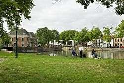
 Nieuwegein, drawbridge
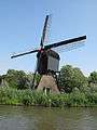 Nieuwegein, windmill
Twin towns
References
- ↑ "Burgemeester Frans Backhuijs" [Mayor Frans Backhuijs] (in Dutch). Gemeente Nieuwegein. Retrieved 8 April 2014.
- ↑ "Kerncijfers wijken en buurten" [Key figures for neighbourhoods]. CBS Statline (in Dutch). CBS. 2 July 2013. Retrieved 12 March 2014.
- ↑ "Postcodetool for 3431LZ". Actueel Hoogtebestand Nederland (in Dutch). Het Waterschapshuis. Retrieved 8 April 2014.
- ↑ "Bevolkingsontwikkeling; regio per maand" [Population growth; regions per month]. CBS Statline (in Dutch). CBS. 27 October 2017. Retrieved 27 October 2017.
External links

- Official website
Places adjacent to Nieuwegein | ||||||||||
|---|---|---|---|---|---|---|---|---|---|---|
| ||||||||||
Municipalities of Utrecht | ||
|---|---|---|
 | ||
| ||