Point Udall (Guam)
Coordinates: 13°26′51.2″N 144°37′5.5″E / 13.447556°N 144.618194°E
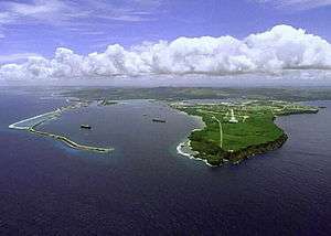
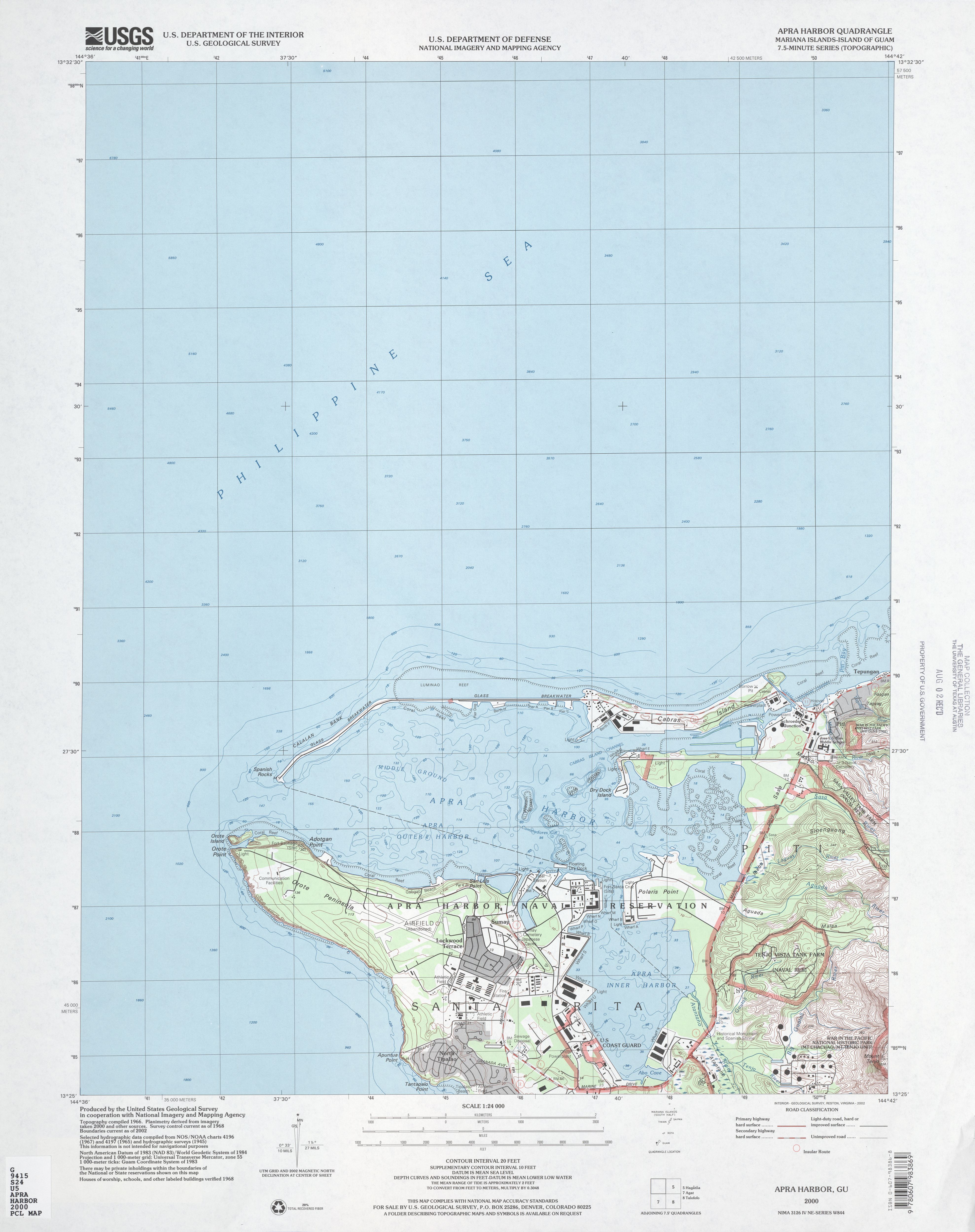
Point Udall, also called Orote Point, is the westernmost point (by travel, not longitude), in the territorial United States, located on the Orote Peninsula of Guam. It lies at the mouth of Apra Harbor, on the end of Orote Peninsula, opposite the Glass Breakwater of Cabras Island which forms the northern coast of the harbor.
Naming
The point is named for former Arizona congressman Morris "Mo" Udall. It was called "Orote Point" until it was renamed "Point Udall" in May 1987. Earlier that month, H.R. 2434, tables by U.S. Congressman Denny Smith of Oregon, proposed renaming the point "to honor the service and accomplishments of Morris Udall."[1] While the proposed resolution was referred to the House Subcommittee on Insular and International Affairs,[1] the name was officially designated as Point Udall by Governor of Guam Joseph Franklin Ada later that month.
In 1968, the easternmost point in the United States, Point Udall, Virgin Islands, had been named for Udall's brother, Stewart.[2] In a 1987 statement in regards to H.R. 2434, Congressman Smith and Guam's nonvoting congressional delegate Ben Blaz explained that "America's day would begin and end at a Point Udall."[1] When Mo Udall died in 1998, President Bill Clinton issued a statement saying in part "It is fitting that the easternmost point of the United States, in the Virgin Islands, and the westernmost point, in Guam, are both named 'Udall Point.' The Sun will never set on the legacy of Mo Udall."[3] This was also noted in the Congressional Record by Rep. George Miller of California.[4]
History
Point Udall was the site of Orote Field airbase during World War II. It was built by Japan during their occupation of the island from December 10, 1941 to July 21, 1944. Beginning in May 1944 and continued during the second Battle of Guam, the airfield was attacked from the air and American troops established their beachhead on either side of the Orote Peninsula on July 21 in order to seize the airfield and the deep water harbor nearby. The airfield was recaptured by July 30.[5]
Many sources still call it Orote Point, such as the US Military's Orote Point Lanes bowling alley.[6]
See also
References
- 1 2 3 Bill text and articles from the University of Arizona
- ↑ Tolchin, Martin; Binder, David (1989-02-17). "The Pillars of Udall". The New York Times. Retrieved 2018-10-12.
- ↑ Weekly compilation of Presidential documents, 1998
- ↑ Congressional Record
- ↑ "Pacific Wrecks".
- ↑ MWR bowling alley site
- Bendure, G. & Friary, N. (1988) Micronesia:A travel survival kit. South Yarra, VIC: Lonely Planet.
- Maps: