Civil parishes in Cumbria

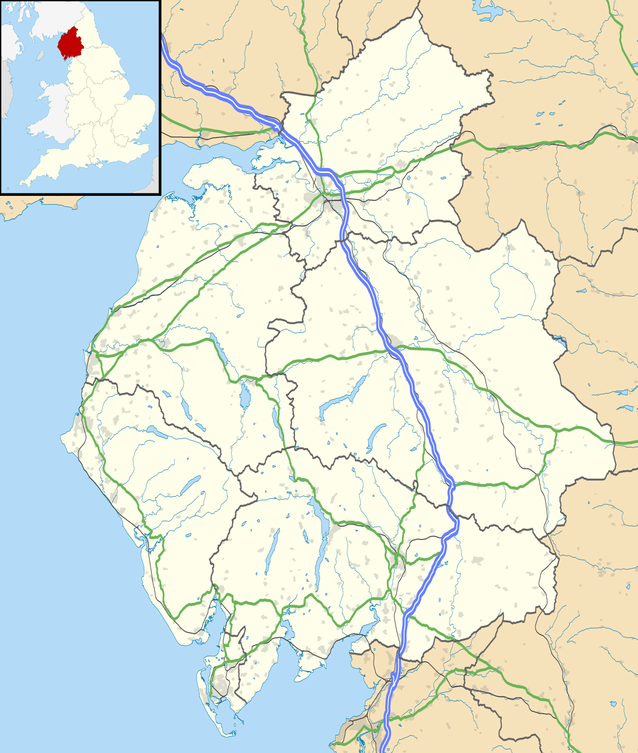
A map of Cumbria, showing the districts: (1) Barrow-in-Furness; (2) South Lakeland; (3) Copeland; (4) Allerdale; (5) Eden; and (6) Carlisle.

A civil parish in England is the lowest unit of local government. There are 284 civil parishes in the ceremonial county of Cumbria, with most of the county being parished, and Allerdale, Copeland, Eden and South Lakeland being entirely parished. At the 2001 census, there were 359,692 people living in those 284 parishes, accounting for 73.8 per cent of the county's population.

The extent of modern Civil parishes are largely geographically based on historic Church of England parish boundaries, which were ecclesiastical divisions that had acquired civil administration powers managed by the Vestry committee.[1]

History

The Highways Act 1555 made parishes responsible for the upkeep of roads. Every adult inhabitant of the parish was obliged to work four days a year on the roads, providing their own tools, carts and horses; the work was overseen by an unpaid local appointee, the Surveyor of Highways.[2]

The poor were looked after by the monasteries, until their dissolution. In 1572, magistrates were given power to 'survey the poor' and impose taxes for their relief. This system was made more formal by the Poor Law Act 1601, which made parishes responsible for administering the Poor Law; overseers were appointed to charge a rate to support the poor of the parish.[3] The 19th century saw an increase in the responsibility of parishes, although the Poor Law powers were transferred to Poor Law Unions.[4] The Public Health Act 1872 grouped parishes into Rural Sanitary Districts, based on the Poor Law Unions; these subsequently formed the basis for Rural Districts.[5]

Parishes were run by vestries, meeting annually to appoint officials, and were generally identical to ecclesiastical parishes,[6] although some townships in large parishes administered the Poor Law themselves; under the Divided Parishes and Poor Law Amendment Act 1882, all extra-parochial areas and townships that levied a separate rate became independent civil parishes.[7]

Civil parishes in their modern sense date from the Local Government Act 1894, which abolished vestries; established elected parish councils in all rural parishes with more than 300 electors; grouped rural parishes into Rural Districts; and aligned parish boundaries with county and borough boundaries.[7] Urban civil parishes continued to exist, and were generally coterminous with the Urban District, Municipal Borough or County Borough in which they were situated; many large towns contained a number of parishes, and these were usually merged into one. Parish councils were not formed in urban areas, and the only function of the parish was to elect guardians to Poor Law Unions; with the abolition of the Poor Law system in 1930 the parishes had only a nominal existence.[8]

The Local Government Act 1972 retained civil parishes in rural areas, and many former Urban Districts and Municipal Boroughs that were being abolished, were replaced by new successor parishes; urban areas that were considered too large to be single parishes became unparished areas.[9]

The current position

Recent governments have encouraged the formation of town and parish councils in unparished areas, and the Local Government and Rating Act 1997 gave local residents the right to demand the creation of a new civil parish.[10]

A parish council can become a town council unilaterally, simply by resolution;[9] and a civil parish can also gain city status, but only if that is granted by the Crown.[9] The chairman of a town or city council is called a mayor.[9] The Local Government and Public Involvement in Health Act 2007 introduced alternative names: a parish council can now choose to be called a community; village; or neighbourhood council.[11]

List of civil parishes and unparished areas

Image Name Status Population District Former local authority Refs
Above DerwentCivil parish1,207AllerdaleCockermouth
Rural District
[12]
[13]
AiktonCivil parish480AllerdaleWigton
Rural District
[14]
[13]
AllhallowsCivil parish548AllerdaleWigton
Rural District
[14]
[13]
AllonbyCivil parish462AllerdaleWigton
Rural District
[14]
[13]
AspatriaTown2,718AllerdaleWigton
Rural District
[14]
[13]
BassenthwaiteCivil parish412AllerdaleCockermouth
Rural District
[12]
[13]
Bewaldeth and SnittlegarthCivil parish40AllerdaleCockermouth
Rural District
[12]
[13]
Blennerhasset and TorpenhowCivil parish437AllerdaleWigton
Rural District
[14]
[13]
BlindbothelCivil parish148AllerdaleCockermouth
Rural District
[12]
[13]
BlindcrakeCivil parish287AllerdaleCockermouth
Rural District
[12]
[13]
BoltonsCivil parish585AllerdaleWigton
Rural District
[14]
[13]
BorrowdaleCivil parish438AllerdaleCockermouth
Rural District
[12]
[13]
Bothel and ThreaplandCivil parish438AllerdaleCockermouth
Rural District
[12]
[13]
BownessCivil parish1,221AllerdaleWigton
Rural District
[14]
[13]
BridekirkCivil parish636AllerdaleCockermouth
Rural District
[12]
[13]
BrighamCivil parish1,065AllerdaleCockermouth
Rural District
[12]
[13]
BromfieldCivil parish530AllerdaleWigton
Rural District
[14]
[13]
BroughtonCommunity1,727AllerdaleCockermouth
Rural District
[12]
[13]
Broughton MoorCivil parish726AllerdaleCockermouth
Rural District
[12]
[13]
ButtermereCivil parish127AllerdaleCockermouth
Rural District
[12]
[13]
CaldbeckCivil parish714AllerdaleWigton
Rural District
[14]
[13]
CamertonCivil parish172AllerdaleCockermouth
Rural District
[12]
[13]
CockermouthTown7,877AllerdaleCockermouth
Urban District
[15]
[13]
CrosscanonbyCivil parish1,054AllerdaleCockermouth
Rural District
[12]
[13]
DeanCivil parish1,077AllerdaleCockermouth
Rural District
[12]
[13]
DearhamCivil parish2,028AllerdaleCockermouth
Rural District
[12]
[13]
DundrawCivil parish167AllerdaleWigton
Rural District
[14]
[13]
EmbletonCivil parish297AllerdaleCockermouth
Rural District
[12]
[13]
GilcruxCivil parish303AllerdaleCockermouth
Rural District
[12]
[13]
Great CliftonCivil parish1,101AllerdaleCockermouth
Rural District
[12]
[13]
GreysouthenCivil parish508AllerdaleCockermouth
Rural District
[12]
[13]
Hayton and MealoCivil parish229AllerdaleWigton
Rural District
[14]
[13]
Holme AbbeyCivil parish776AllerdaleWigton
Rural District
[14]
[13]
Holme East WaverCivil parish306AllerdaleWigton
Rural District
[14]
[13]
Holme LowCivil parish373AllerdaleWigton
Rural District
[14]
[13]
Holme St CuthbertCivil parish421AllerdaleWigton
Rural District
[14]
[13]
Ireby and UldaleCivil parish428AllerdaleWigton
Rural District
[14]
[13]
KeswickTown4,984AllerdaleKeswick
Urban District
[16]
[13]
KirkbamptonCivil parish471AllerdaleWigton
Rural District
[14]
[13]
KirkbrideCivil parish519AllerdaleWigton
Rural District
[14]
[13]
Little CliftonCivil parish391AllerdaleCockermouth
Rural District
[12]
[13]
LortonCivil parish250AllerdaleCockermouth
Rural District
[12]
[13]
LoweswaterCivil parish209AllerdaleCockermouth
Rural District
[12]
[13]
MaryportTown11,275AllerdaleMaryport Urban District[17]
[13]
Oughterside and AllerbyCivil parish626AllerdaleCockermouth
Rural District
[12]
[13]
PapcastleCivil parish406AllerdaleCockermouth
Rural District
[12]
[13]
PlumblandCivil parish367AllerdaleCockermouth
Rural District
[12]
[13]
SeatonCivil parish4,861AllerdaleCockermouth
Rural District
[12]
[13]
SeberghamCivil parish361AllerdaleWigton
Rural District
[14]
[13]
SetmurthyCivil parish108AllerdaleCockermouth
Rural District
[12]
[13]
Silloth-on-SolwayTown2,932AllerdaleWigton
Rural District
[14]
[13]
Lands common to Holme Abbey, Holme Low and Holme St CuthbertCommon lands0AllerdaleWigton
Rural District
[14]
[13]
[18]
St John's Castlerigg and WythburnCivil parish407AllerdaleCockermouth
Rural District
[12]
[13]
ThursbyCivil parish1,185AllerdaleWigton
Rural District
[14]
[13]
UnderskiddawCivil parish282AllerdaleCockermouth
Rural District
[12]
[13]
WavertonCivil parish326AllerdaleWigton
Rural District
[14]
[13]
WestnewtonCivil parish247AllerdaleWigton
Rural District
[14]
[13]
WestwardCivil parish814AllerdaleWigton
Rural District
[14]
[13]
WigtonTown5,360AllerdaleWigton
Rural District
[14]
[13]
WinscalesCivil parish186AllerdaleCockermouth
Rural District
[12]
[13]
WoodsideCivil parish516AllerdaleWigton
Rural District
[14]
[13]
WorkingtonTown24,295AllerdaleWorkington
Municipal Borough
[19]
[13]
WythopCivil parish51AllerdaleCockermouth
Rural District
[12]
[13]
Barrow-in-FurnessUnparished area59,181Barrow-in-FurnessBarrow in Furness
County Borough
[20]
[21]
Askam and IrelethCivil parish3,632Barrow-in-FurnessDalton in Furness Urban District[22]
[23]
Dalton Town with NewtonTown8,394Barrow-in-FurnessDalton in Furness Urban District[22]
[23]
Lindal and MartonCivil parish773Barrow-in-FurnessDalton in Furness Urban District[22]
[23]
ArthuretCivil parish2,434CarlisleBorder
Rural District
[24]
[25]
AskertonCivil parish162CarlisleBorder
Rural District
[24]
[25]
BeaumontCivil parish447CarlisleBorder
Rural District
[24]
[25]
BewcastleCivil parish411CarlisleBorder
Rural District
[24]
[25]
BramptonCivil parish4,361CarlisleBorder
Rural District
[24]
[25]
Burgh by SandsCivil parish1,143CarlisleBorder
Rural District
[24]
[25]
BurtholmeCivil parish184CarlisleBorder
Rural District
[24]
[25]
CarlattonCivil parish29CarlisleBorder
Rural District
[24]
[25]
CarlisleUnparished area68,735CarlisleCarlisle
County Borough
[26]
[27]
Castle CarrockCivil parish309CarlisleBorder
Rural District
[24]
[25]
CummersdaleCivil parish486CarlisleBorder
Rural District
[24]
[25]
CumrewCivil parish85CarlisleBorder
Rural District
[24]
[25]
CumwhittonCivil parish293CarlisleBorder
Rural District
[24]
[25]
DalstonCivil parish2,643CarlisleBorder
Rural District
[24]
[25]
FarlamCivil parish590CarlisleBorder
Rural District
[24]
[25]
HaytonCivil parish2,180CarlisleBorder
Rural District
[24]
[25]
HethersgillCivil parish382CarlisleBorder
Rural District
[24]
[25]
IrthingtonCivil parish712CarlisleBorder
Rural District
[24]
[25]
KingmoorCivil parish407CarlisleBorder
Rural District
[24]
[25]
KingwaterCivil parish164CarlisleBorder
Rural District
[24]
[25]
KirkandrewsCivil parish447CarlisleBorder
Rural District
[24]
[25]
Kirklinton MiddleCivil parish369CarlisleBorder
Rural District
[24]
[25]
MidgeholmeCivil parish67CarlisleBorder
Rural District
[24]
[25]
Nether DentonCivil parish318CarlisleBorder
Rural District
[24]
[25]
NicholforestCivil parish386CarlisleBorder
Rural District
[24]
[25]
OrtonCivil parish383CarlisleBorder
Rural District
[24]
[25]
RockcliffeCivil parish733CarlisleBorder
Rural District
[24]
[25]
ScalebyCivil parish349CarlisleBorder
Rural District
[24]
[25]
SolportCivil parish168CarlisleBorder
Rural District
[24]
[25]
St Cuthbert WithoutCivil parish2,043CarlisleBorder
Rural District
[24]
[25]
Stanwix RuralCivil parish3,043CarlisleBorder
Rural District
[24]
[25]
StapletonCivil parish221CarlisleBorder
Rural District
[24]
[25]
Upper DentonCivil parish92CarlisleBorder
Rural District
[24]
[25]
WaltonCivil parish278CarlisleBorder
Rural District
[24]
[25]
WaterheadCivil parish124CarlisleBorder
Rural District
[24]
[25]
WestlintonCivil parish359CarlisleBorder
Rural District
[24]
[25]
WetheralCivil parish5,203CarlisleBorder
Rural District
[24]
[25]
Arlecdon and FrizingtonCivil parish3,678CopelandEnnerdale
Rural District
[28]
[29]
BeckermetCivil parish2,310CopelandEnnerdale
Rural District
[28]
[29]
[30]
BootleCivil parish745CopelandMillom
Rural District
[31]
[29]
Cleator MoorTown6,939CopelandEnnerdale
Rural District
[28]
[29]
DistingtonCivil parish2,247CopelandEnnerdale
Rural District
[28]
[29]
Drigg and CarletonCivil parish450CopelandMillom
Rural District
[31]
[29]
EgremontTown7,444CopelandEnnerdale
Rural District
[28]
[29]
Ennerdale and KinnisideCivil parish240CopelandEnnerdale
Rural District
[28]
[29]
EskdaleCivil parish264CopelandMillom
Rural District
[31]
[29]
GosforthCivil parish1,230CopelandEnnerdale
Rural District
[28]
[29]
HaileCivil parish237CopelandEnnerdale
Rural District
[28]
[29]
Irton with SantonCivil parish373CopelandMillom
Rural District
[31]
[29]
LamplughCivil parish763CopelandEnnerdale
Rural District
[28]
[29]
LowcaCivil parish773CopelandEnnerdale
Rural District
[28]
[29]
Lowside QuarterCivil parish379CopelandEnnerdale
Rural District
[28]
[29]
MillomTown7,132CopelandMillom
Rural District
[31]
[29]
Millom WithoutCivil parish1,638CopelandMillom
Rural District
[31]
[29]
MoresbyCivil parish1,280CopelandEnnerdale
Rural District
[28]
[29]
MuncasterCivil parish335CopelandMillom
Rural District
[31]
[29]
PartonCivil parish924CopelandEnnerdale
Rural District
[28]
[29]
PonsonbyCivil parish92CopelandEnnerdale
Rural District
[28]
[29]
SeascaleCivil parish1,747CopelandMillom
Rural District
[31]
[29]
St BeesCivil parish1,717CopelandEnnerdale
Rural District
[28]
[29]
UlphaCivil parish159CopelandMillom
Rural District
[31]
[29]
WaberthwaiteCivil parish274CopelandMillom
Rural District
[31]
[29]
WasdaleCivil parish79CopelandEnnerdale
Rural District
[28]
[29]
WeddicarCivil parish442CopelandEnnerdale
Rural District
[28]
[29]
WhichamCivil parish395CopelandMillom
Rural District
[31]
[29]
WhitehavenTown25,032CopelandWhitehaven
Municipal Borough
[32]
[33][34]
AinstableCivil parish532EdenPenrith
Rural District
[35]
[36]
Alston MoorCivil parish2,156EdenAlston with Garrigill
Rural District
[37]
[36]
Appleby-in-WestmorlandTown2,862EdenAppleby
Municipal Borough
[38]
[36]
AsbyCivil parish280EdenNorth Westmorland
Rural District
[39]
[36]
AskhamCivil parish360EdenNorth Westmorland
Rural District
[39]
[36]
BamptonCivil parish283EdenNorth Westmorland
Rural District
[39]
[36]
BartonCivil parish232EdenNorth Westmorland
Rural District
[39]
[36]
BoltonCivil parish416EdenNorth Westmorland
Rural District
[39]
[36]
BroughCivil parish680EdenNorth Westmorland
Rural District
[39]
[36]
Brough SowerbyCivil parish127EdenNorth Westmorland
Rural District
[39]
[36]
BroughamCivil parish279EdenNorth Westmorland
Rural District
[39]
[36]
Castle SowerbyCivil parish337EdenPenrith
Rural District
[35]
[36]
CatterlenCivil parish471EdenPenrith
Rural District
[35]
[36]
CliburnCivil parish204EdenNorth Westmorland
Rural District
[39]
[36]
CliftonCivil parish461EdenNorth Westmorland
Rural District
[39]
[36]
ColbyCivil parish120EdenNorth Westmorland
Rural District
[39]
[36]
CrackenthorpeCivil parish77EdenNorth Westmorland
Rural District
[39]
[36]
Crosby GarrettCivil parish112EdenNorth Westmorland
Rural District
[39]
[36]
Crosby RavensworthCivil parish538EdenNorth Westmorland
Rural District
[39]
[36]
CulgaithCivil parish721EdenPenrith
Rural District
[35]
[36]
DacreCivil parish1,326EdenPenrith
Rural District
[35]
[36]
DuftonCivil parish169EdenNorth Westmorland
Rural District
[39]
[36]
GlassonbyCivil parish314EdenPenrith
Rural District
[35]
[36]
Great SalkeldCivil parish445EdenPenrith
Rural District
[35]
[36]
Great StricklandCivil parish246EdenNorth Westmorland
Rural District
[39]
[36]
GreystokeCivil parish733EdenPenrith
Rural District
[35]
[36]
HartleyCivil parish133EdenNorth Westmorland
Rural District
[39]
[36]
HelbeckCivil parish19EdenNorth Westmorland
Rural District
[39]
[36]
HesketCivil parish2,363EdenPenrith
Rural District
[35]
[36]
HoffCivil parish189EdenNorth Westmorland
Rural District
[39]
[36]
HunsonbyCivil parish383EdenPenrith
Rural District
[35]
[36]
HuttonCivil parish326EdenPenrith
Rural District
[35]
[36]
KaberCivil parish89EdenNorth Westmorland
Rural District
[39]
[36]
King's MeaburnCivil parish105EdenNorth Westmorland
Rural District
[39]
[36]
Kirkby StephenCivil parish1,832EdenNorth Westmorland
Rural District
[39]
[36]
Kirkby ThoreCivil parish731EdenNorth Westmorland
Rural District
[39]
[36]
KirkoswaldCivil parish870EdenPenrith
Rural District
[35]
[36]
LangwathbyCivil parish748EdenPenrith
Rural District
[35]
[36]
LazonbyCivil parish980EdenPenrith
Rural District
[35]
[36]
Little StricklandCivil parish66EdenNorth Westmorland
Rural District
[39]
[36]
Long MartonCivil parish704EdenNorth Westmorland
Rural District
[39]
[36]
LowtherCivil parish402EdenNorth Westmorland
Rural District
[39]
[36]
MallerstangCivil parish87EdenNorth Westmorland
Rural District
[39]
[36]
MartindaleCivil parish49EdenNorth Westmorland
Rural District
[39]
[36]
MatterdaleCivil parish526EdenPenrith
Rural District
[35]
[36]
MilburnCivil parish171EdenNorth Westmorland
Rural District
[39]
[36]
MorlandCivil parish380EdenNorth Westmorland
Rural District
[39]
[36]
MungrisdaleCivil parish284EdenPenrith
Rural District
[35]
[36]
MurtonCivil parish330EdenNorth Westmorland
Rural District
[39]
[36]
MusgraveCivil parish152EdenNorth Westmorland
Rural District
[39]
[36]
NatebyCivil parish110EdenNorth Westmorland
Rural District
[39]
[36]
NewbigginCivil parish96EdenNorth Westmorland
Rural District
[39]
[36]
NewbyCivil parish164EdenNorth Westmorland
Rural District
[39]
[36]
OrmsideCivil parish133EdenNorth Westmorland
Rural District
[39]
[36]
OrtonCivil parish594EdenNorth Westmorland
Rural District
[39]
[36]
OusbyCivil parish362EdenPenrith
Rural District
[35]
[36]
PatterdaleCivil parish460EdenLakes
Urban District
[40]
[36]
PenrithTown14,756EdenPenrith Urban District[41]
[42]
RavenstonedaleCivil parish570EdenNorth Westmorland
Rural District
[39]
[36]
ShapCivil parish1,221EdenNorth Westmorland
Rural District
[39]
[36]
Shap RuralCivil parish119EdenNorth Westmorland
Rural District
[39]
[36]
SkeltonCivil parish1,059EdenPenrith
Rural District
[35]
[36]
SleagillCivil parish100EdenNorth Westmorland
Rural District
[39]
[36]
Sockbridge and TirrilCivil parish397EdenNorth Westmorland
Rural District
[39]
[36]
SoulbyCivil parish186EdenNorth Westmorland
Rural District
[39]
[36]
StainmoreCivil parish253EdenNorth Westmorland
Rural District
[39]
[36]
TebayCivil parish728EdenNorth Westmorland
Rural District
[39]
[36]
Temple SowerbyCivil parish333EdenNorth Westmorland
Rural District
[39]
[36]
ThrelkeldCivil parish454EdenPenrith
Rural District
[35]
[36]
ThrimbyCivil parish30EdenNorth Westmorland
Rural District
[39]
[36]
WaitbyCivil parish60EdenNorth Westmorland
Rural District
[39]
[36]
WarcopCivil parish491EdenNorth Westmorland
Rural District
[39]
[36]
WhartonCivil parish31EdenNorth Westmorland
Rural District
[39]
[36]
WintonCivil parish213EdenNorth Westmorland
Rural District
[39]
[36]
Yanwath and Eamont BridgeCivil parish457EdenNorth Westmorland
Rural District
[39]
[36]
AldinghamCivil parish1,187South LakelandNorth Lonsdale
Rural District
[43]
[44]
AngertonCivil parish14South LakelandNorth Lonsdale
Rural District
[43]
[44]
ArnsideCivil parish2,301South LakelandSouth Westmorland
Rural District
[45]
[44]
BarbonCivil parish263South LakelandSouth Westmorland
Rural District
[45]
[44]
BeethamCivil parish1,724South LakelandSouth Westmorland
Rural District
[45]
[44]
Blawith and SubberthwaiteCivil parish189South LakelandNorth Lonsdale
Rural District
[43]
[44]
Broughton EastCivil parish173South LakelandNorth Lonsdale
Rural District
[43]
[44]
Broughton WestCivil parish954South LakelandNorth Lonsdale
Rural District
[43]
[44]
Burton-in-KendalCivil parish1,411South LakelandSouth Westmorland
Rural District
[45]
[44]
Cartmel FellCivil parish309South LakelandNorth Lonsdale
Rural District
[43]
[44]
CastertonCivil parish500South LakelandSouth Westmorland
Rural District
[45]
[44]
ClaifeCivil parish392South LakelandNorth Lonsdale
Rural District
[43]
[44]
ColtonCivil parish765South LakelandNorth Lonsdale
Rural District
[43]
[44]
ConistonCivil parish1,058South LakelandNorth Lonsdale
Rural District
[43]
[44]
CrookCivil parish340South LakelandSouth Westmorland
Rural District
[45]
[44]
Crosthwaite and LythCivil parish562South LakelandSouth Westmorland
Rural District
[45]
[44]
DentCivil parish675South LakelandSedbergh
Rural District
[46]
[44]
DockerCivil parish55South LakelandSouth Westmorland
Rural District
[45]
[44]
Dunnerdale with SeathwaiteCivil parish129South LakelandNorth Lonsdale
Rural District
[43]
[44]
Egton with NewlandCivil parish898South LakelandNorth Lonsdale
Rural District
[43]
[44]
Fawcett ForestCivil parish23South LakelandSouth Westmorland
Rural District
[45]
[44]
FirbankCivil parish97South LakelandSouth Westmorland
Rural District
[45]
[44]
GarsdaleCivil parish202South LakelandSedbergh
Rural District
[46]
[44]
Grange-over-SandsTown4,042South LakelandGrange Urban District[47]
[44]
GrayriggCivil parish223South LakelandSouth Westmorland
Rural District
[45]
[44]
HaverthwaiteCivil parish728South LakelandNorth Lonsdale
Rural District
[43]
[44]
HawksheadCivil parish589South LakelandNorth Lonsdale
Rural District
[43]
[44]
HelsingtonCivil parish288South LakelandSouth Westmorland
Rural District
[45]
[44]
HevershamCivil parish647South LakelandSouth Westmorland
Rural District
[45]
[44]
HincasterCivil parish195South LakelandSouth Westmorland
Rural District
[45]
[44]
HolmeCivil parish1,167South LakelandSouth Westmorland
Rural District
[45]
[44]
HugillCivil parish416South LakelandSouth Westmorland
Rural District
[45]
[44]
Hutton RoofCivil parish193South LakelandSouth Westmorland
Rural District
[45]
[44]
KendalTown27,505South LakelandKendal
Municipal Borough
[48]
[44]
KentmereCivil parish95South LakelandSouth Westmorland
Rural District
[45]
[44]
KillingtonCivil parish152South LakelandSouth Westmorland
Rural District
[45]
[44]
Kirkby IrelethCivil parish1,247South LakelandNorth Lonsdale
Rural District
[43]
[44]
Kirkby LonsdaleTown1,771South LakelandSouth Westmorland
Rural District
[45]
[44]
LakesCivil parish5,127South LakelandLakes Urban District[40]
[44]
LambriggCivil parish90South LakelandSouth Westmorland
Rural District
[45]
[44]
LevensCivil parish1,007South LakelandSouth Westmorland
Rural District
[45]
[44]
LongsleddaleCivil parish73South LakelandSouth Westmorland
Rural District
[45]
[44]
Lower AllithwaiteCivil parish1,758South LakelandNorth Lonsdale
Rural District
[43]
[44]
Lower HolkerCivil parish1,808South LakelandNorth Lonsdale
Rural District
[43]
[44]
LowickCivil parish224South LakelandNorth Lonsdale
Rural District
[43]
[44]
LuptonCivil parish165South LakelandSouth Westmorland
Rural District
[45]
[44]
ManserghCivil parish141South LakelandSouth Westmorland
Rural District
[45]
[44]
MansriggsCivil parish42South LakelandNorth Lonsdale
Rural District
[43]
[44]
MiddletonCivil parish109South LakelandSouth Westmorland
Rural District
[45]
[44]
MilnthorpeCivil parish2,106South LakelandSouth Westmorland
Rural District
[45]
[44]
NatlandCivil parish747South LakelandSouth Westmorland
Rural District
[45]
[44]
Nether StaveleyCivil parish677South LakelandSouth Westmorland
Rural District
[45]
[44]
New HuttonCivil parish313South LakelandSouth Westmorland
Rural District
[45]
[44]
Old Hutton and HolmescalesCivil parish357South LakelandSouth Westmorland
Rural District
[45]
[44]
OsmotherleyCivil parish234South LakelandNorth Lonsdale
Rural District
[43]
[44]
Over StaveleyCivil parish516South LakelandSouth Westmorland
Rural District
[45]
[44]
PenningtonCivil parish1,794South LakelandNorth Lonsdale
Rural District
[43]
[44]
Preston PatrickCivil parish438South LakelandSouth Westmorland
Rural District
[45]
[44]
Preston RichardCivil parish1,307South LakelandSouth Westmorland
Rural District
[45]
[44]
SatterthwaiteCivil parish257South LakelandNorth Lonsdale
Rural District
[43]
[44]
SedberghCivil parish2,705South LakelandSedbergh
Rural District
[46]
[44]
SedgwickCivil parish380South LakelandSouth Westmorland
Rural District
[45]
[44]
Skelsmergh and ScalthwaiteriggCivil parish374South LakelandSouth Westmorland
Rural District
[45]
[44][49]
SkelwithCivil parish185South LakelandNorth Lonsdale
Rural District
[43]
[44]
StaintonCivil parish301South LakelandSouth Westmorland
Rural District
[45]
[44]
Staveley-in-CartmelCivil parish428South LakelandNorth Lonsdale
Rural District
[43]
[44]
Strickland KetelCivil parish1,093South LakelandSouth Westmorland
Rural District
[45]
[44]
Strickland RogerCivil parish544South LakelandSouth Westmorland
Rural District
[45]
[44]
TorverCivil parish135South LakelandNorth Lonsdale
Rural District
[43]
[44]
UlverstonTown11,524South LakelandUlverston
Urban District
[50]
[44]
Underbarrow and BradleyfieldCivil parish351South LakelandSouth Westmorland
Rural District
[45]
[44]
Upper AllithwaiteCivil parish824South LakelandNorth Lonsdale
Rural District
[43]
[44]
UrswickCivil parish1,467South LakelandNorth Lonsdale
Rural District
[43]
[44]
WhinfellCivil parish152South LakelandSouth Westmorland
Rural District
[45]
[44]
Whitwell and SelsideCivil parish198South LakelandSouth Westmorland
Rural District
[45]
[44]
WindermereTown8,245South LakelandWindermere Urban District[51]
[44]
Witherslack, Meathop and UlphaCivil parish625South LakelandSouth Westmorland
Rural District
[45]
[44][52]

See also

References

  1. Angus Winchester, 2000, Discovering Parish Boundaries. Shire Publications. Princes Risborough, 96 pages ISBN 978-0-7478-0470-3
  2. RAC Foundation : What Went Wrong? British Highway Development Before Motorways Retrieved 22 August 2009
  3. The Victorian Web : The Poor Law : Introduction Retrieved 22 August 2009
  4. Staffordshire University : Poor Law Unions and Registration Districts Archived 2012-09-14 at Archive.is Retrieved 22 August 2009
  5. A Vision of Britain Through Time : Status Details for Rural Sanitary District Retrieved 22 August 2009
  6. Robert Tittler, The Reformation and the Towns in England, 1998, Oxford University Press, 395 pages, ISBN 978-0-19-820718-4
  7. 1 2 Modern British Surnames : Selected Events in the History of Civil Registration and Boundary Changes 1801-1996 Archived August 1, 2010, at the Wayback Machine. Retrieved 22 August 2009
  8. Alex MacMorran and T R Colquhoun Dill, The Local Government Act 1894 and the Subsequent Statutes Affecting Parish Councils, 1907, Butterworth and Co, London, 626 pages
  9. 1 2 3 4 Office of Public Sector Information : Local Government Act 1972 Archived 2012-12-05 at Archive.is Retrieved 22 August 2009
  10. Office of Public Sector Information : Local Government and Rating Act 1997 Archived 2012-08-05 at Archive.is Retrieved 22 August 2009
  11. Office of Public Sector Information : Local Government and Public Involvement in Health Act 2007 Archived 2012-08-05 at Archive.is Retrieved 22 August 2009
  12. 1 2 3 4 5 6 7 8 9 10 11 12 13 14 15 16 17 18 19 20 21 22 23 24 25 26 27 28 29 30 31 32 A Vision of Britain Through Time : Cockermouth Rural District Archived 2007-09-30 at the Wayback Machine. Retrieved 26 October 2010
  13. 1 2 3 4 5 6 7 8 9 10 11 12 13 14 15 16 17 18 19 20 21 22 23 24 25 26 27 28 29 30 31 32 33 34 35 36 37 38 39 40 41 42 43 44 45 46 47 48 49 50 51 52 53 54 55 56 57 58 59 60 61 62 63 Office for National Statistics : Census 2001 : Parish Headcounts : Allerdale Retrieved 26 October 2010
  14. 1 2 3 4 5 6 7 8 9 10 11 12 13 14 15 16 17 18 19 20 21 22 23 24 25 26 27 A Vision of Britain Through Time : Wigton Rural District Archived 2007-10-01 at the Wayback Machine. Retrieved 26 October 2010
  15. A Vision of Britain Through Time : Cockermouth Urban District Retrieved 26 October 2010
  16. A Vision of Britain Through Time : Keswick Urban District Retrieved 26 October 2010
  17. A Vision of Britain Through Time : Maryport Urban District Retrieved 26 October 2010
  18. A Vision of Britain Through Time : Lands common to Holme Abbey; Holme Low; and Holme St Cuthbert civil parishes Retrieved 26 October 2010
  19. A Vision of Britain Through Time : Workington Municipal Borough Retrieved 26 October 2010
  20. A Vision of Britain Through Time : Barrow in Furness County Borough Retrieved 26 October 2010
  21. Office for National Statistics : Census 2001 : Table KS01 : Usual Resident Population Barrow Island; Central; Hawcoat; Hindpool; Newbarns; Parkside; Ormsgill; Risedale; Roosecote; Walney North; and Walney South wards. Retrieved 26 October 2010
  22. 1 2 3 A Vision of Britain Through Time : Dalton in Furness Urban District Retrieved 26 October 2010
  23. 1 2 3 Office for National Statistics : Census 2001 : Parish Headcounts : Barrow in Furness Retrieved 26 October 2010
  24. 1 2 3 4 5 6 7 8 9 10 11 12 13 14 15 16 17 18 19 20 21 22 23 24 25 26 27 28 29 30 31 32 33 34 35 36 A Vision of Britain Through Time : Border Rural District Archived September 30, 2007, at the Wayback Machine. Retrieved 26 October 2010
  25. 1 2 3 4 5 6 7 8 9 10 11 12 13 14 15 16 17 18 19 20 21 22 23 24 25 26 27 28 29 30 31 32 33 34 35 36 Office for National Statistics : Census 2001 : Parish Headcounts : Carlisle Retrieved 26 October 2010
  26. A Vision of Britain Through Time : Carlisle County Borough Retrieved 26 October 2010
  27. Office for National Statistics : Census 2001 : Table KS01 : Usual Resident Population Belah; Belle Vue; Botcherby; Castle; Currock; Denton Holme; Harraby; Morton; St Aidans; Stanwix Urban (part); Upperby; and Yewdale wards. Retrieved 26 October 2010
  28. 1 2 3 4 5 6 7 8 9 10 11 12 13 14 15 16 17 A Vision of Britain Through Time : Ennerdale Rural District Archived 2007-03-11 at the Wayback Machine. Retrieved 26 October 2010
  29. 1 2 3 4 5 6 7 8 9 10 11 12 13 14 15 16 17 18 19 20 21 22 23 24 25 26 27 28 Office for National Statistics : Census 2001 : Parish Headcounts : Copeland Archived 2016-03-03 at the Wayback Machine. Retrieved 26 October 2010
  30. Capper, Tim; Shaw, Stephanie. "Community Governance Review: Egremont, Beckermet, Haile, Lowside Quarter, Ponsonby" (PDF). Copeland Borough Council. Retrieved 24 June 2011.
  31. 1 2 3 4 5 6 7 8 9 10 11 A Vision of Britain Through Time : Millom Rural District Archived 2011-09-02 at the Wayback Machine. Retrieved 26 October 2010
  32. A Vision of Britain Through Time : Whitehaven Municipal Borough Retrieved 26 October 2010
  33. Office for National Statistics : Census 2001 : Table KS01 : Usual Resident Population Bransty; Harbour; Hensingham; Hillcrest; Kells; Mirehouse; and Sandwith (part) wards. Retrieved 26 October 2010
  34. "The Copeland Borough Council (Reorganisation of Community Governance) Order 2014" (PDF). Copeland Borough Council. Retrieved 3 March 2018.
  35. 1 2 3 4 5 6 7 8 9 10 11 12 13 14 15 16 17 18 19 A Vision of Britain Through Time : Penrith Rural District Archived 2011-06-28 at the Wayback Machine. Retrieved 26 October 2010
  36. 1 2 3 4 5 6 7 8 9 10 11 12 13 14 15 16 17 18 19 20 21 22 23 24 25 26 27 28 29 30 31 32 33 34 35 36 37 38 39 40 41 42 43 44 45 46 47 48 49 50 51 52 53 54 55 56 57 58 59 60 61 62 63 64 65 66 67 68 69 70 71 72 73 74 Office for National Statistics : Census 2001 : Parish Headcounts : Eden Retrieved 26 October 2010
  37. A Vision of Britain Through Time : Alston with Garrigill Rural District Archived 2011-06-28 at the Wayback Machine. Retrieved 26 October 2010
  38. A Vision of Britain Through Time : Appleby Municipal Borough Archived 2011-06-28 at the Wayback Machine. Retrieved 26 October 2010
  39. 1 2 3 4 5 6 7 8 9 10 11 12 13 14 15 16 17 18 19 20 21 22 23 24 25 26 27 28 29 30 31 32 33 34 35 36 37 38 39 40 41 42 43 44 45 46 47 48 49 50 51 52 A Vision of Britain Through Time : North Westmorland Rural District Archived 2011-05-14 at the Wayback Machine.
  40. 1 2 A Vision of Britain Through Time : Lakes Urban District Archived 2007-10-01 at the Wayback Machine. Retrieved 26 October 2010
  41. A Vision of Britain Through Time : Penrith Urban District Archived 2011-06-28 at the Wayback Machine. Retrieved 26 October 2010
  42. Office for National Statistics : Census 2001 : Table KS01 : Usual Resident Population Penrith Carleton; Penrith East; Penrith North; Penrith Pategill; Penrith South; and Penrith West wards. Retrieved 26 October 2010
  43. 1 2 3 4 5 6 7 8 9 10 11 12 13 14 15 16 17 18 19 20 21 22 23 24 25 26 A Vision of Britain Through Time : North Lonsdale Rural District Archived 2011-05-14 at the Wayback Machine. Retrieved 26 October 2010
  44. 1 2 3 4 5 6 7 8 9 10 11 12 13 14 15 16 17 18 19 20 21 22 23 24 25 26 27 28 29 30 31 32 33 34 35 36 37 38 39 40 41 42 43 44 45 46 47 48 49 50 51 52 53 54 55 56 57 58 59 60 61 62 63 64 65 66 67 68 69 70 71 72 73 74 75 76 77 Office for National Statistics: Census 2001 : Parish Headcounts : South Lakeland Archived 2014-12-05 at the Wayback Machine. Retrieved 26 October 2010
  45. 1 2 3 4 5 6 7 8 9 10 11 12 13 14 15 16 17 18 19 20 21 22 23 24 25 26 27 28 29 30 31 32 33 34 35 36 37 38 39 40 41 42 43 A Vision of Britain Through Time : South Westmorland Rural District Archived 2007-10-01 at the Wayback Machine. Retrieved 26 October 2010
  46. 1 2 3 A Vision of Britain Through Time : Sedbergh Rural District Retrieved 26 October 2010
  47. A Vision of Britain Through Time : Grange Urban District Retrieved 26 October 2010
  48. A Vision of Britain Through Time : Kendal Municipal Borough Retrieved 26 October 2010
  49. "Skelsmergh and Scalthwaiterigg". ONS. Retrieved 3 March 2018.
  50. A Vision of Britain Through Time : Ulverston Urban District Retrieved 26 October 2010
  51. A Vision of Britain Through Time : Windermere Urban District Retrieved 26 October 2010
  52. "Witherslack, Meathop and Ulpha". ONS. Retrieved 3 March 2018.
This article is issued from Wikipedia. The text is licensed under Creative Commons - Attribution - Sharealike. Additional terms may apply for the media files.